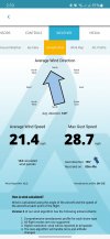
The logs contain instantaneous values for the drone's pitch, roll, "xspeed" ( North/South ) and "yspeed" ( East/West ).
The speeds are ground speeds but I am wondering if, over the duration of any given flight log, the reported speeds for each reported angle of tilt ( pitch and roll ) were averaged ( sum/ number-of-instances-of-that-angle ) would you end up with a crude but reasonably accurate mapping of angle of tilt to airspeed? I.e over the whole journey would the averaging canel out wind speed? And, if this was done for each flight log of that drone would it improve the accuracy of the mapping.
The arithmetic would be carried out by a computer program, I am not considering doing it by 'hand' lol.


