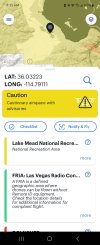
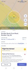
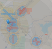
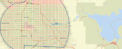
Attached are four screenshots from four different sources regarding the same location. A FRIA (RC Plane Field) is located near Lake Mead in Nevada, not far from Hoover Dam. (Flying near the dam is strictly prohibited.) Notice the color of the airspace around the FRIA. The screenshots from AutoPylot and Air Aware are pretty much in agreement that this FRIA lies within an area that has restrictions. However, when you view the screenshot from the FAA’s site (faa.maps.arcgis.com) the airspace appears as Class G with no restrictions. (The page title is Visualize it: See FAA UAS Data on a Map) The FRIA is the little blue square on the right of the image to the left of the restricted airspace. In the recent past, flying along the shore of Lake Mead has always been prohibited. (It’s funny how boats aren’t considered a threat, but drones are)
I am bringing this up to illustrate the difference between different sources. The FAA’s site should be the most accurate and authoritative source. The local CBO submitted the FRIA request on August 4, 2024, and it was granted for four years. The DJI FlySafe database shows the area with a 500m altitude limit and no other airspace restrictions.
So, who would you trust if you wanted to fly here? How are we supposed to follow the rules when the sources disagree?


