DJI Mavic, Air and Mini Drones
Friendly, Helpful & Knowledgeable Community
Join Us Now

Alternative waypoint mapping

but, yes...to be able to create waypoints on a bigger screen would be a big help.

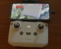
I did find a kind of weird way to accomplish that. Pretty sure it only works on Android, have not tried IOS. I configured TEAMVIEWER on my MAC as remote control for my Samsung S22 ULTRA and was able to use the S22 full screen on my 32" monitor using the mouse. There was some slight lag but not terrible. Of course I am NOT using the RC2 controller but the RCN2 with my phone and tablet.
 
I used an Apple Ipad with phone with my old Mini2.....I wonder if one could connect to the mini4 with a controller without screen, and access DJI Fly through an Ipad, and lay out the route on that...then if dji could come out with an update that would allow one to transfer it to the RC2 controller, even using a cord...that would be great...being able to see the geography more clearly and not create waypoints by accident would be helpful.....I find that when I am checking all the waypoint parameters, that I inadvertently create a few extras at the end accidently....easy enough to delete, but unless I do catch them....who knows where the trip might end
 
I used an Apple Ipad with phone with my old Mini2.....I wonder if one could connect to the mini4 with a controller without screen, and access DJI Fly through an Ipad, and lay out the route on that...then if dji could come out with an update that would allow one to transfer it to the RC2 controller, even using a cord...that would be great...being able to see the geography more clearly and not create waypoints by accident would be helpful.....I find that when I am checking all the waypoint parameters, that I inadvertently create a few extras at the end accidently....easy enough to delete, but unless I do catch them....who knows where the trip might end
If you are asking if the RC-N2 (NOT RC-N1) controller (without screen) will work with waypoints on an iPad, then yes. That's why I sold off my RC2 for an RC-N2. I really dislike the RC2 for a LOT of reasons including the tiny screen. lousy res and bad 76yr old eyes. I much preferred to use the iPad mini or Samsung S22Ultra. Not quite as convenient.
 
I’ve been having a great time flying waypoint missions on my mini Pro 4. I mainly fly through some rocky formations near home. While the flying part is a lot of fun, planning waypoints on the RC2 controller is very tedious because of the small screen.

Is there an alternative way to plan a mission on an IPad, Mac or even a PC?

Thanks everyone
Hello what about exporting to MINI4P a KMZ or CSV file provided by a mission build with Litchi? how to proceed? thank you
 
I use Litchi with my Air 2S. It works fine and the program is very intuitive. However, Sometimes the videos are rather jerky. This is due to the fact that sometimes the drone loses contact with the RC for just a second and the drone quickly tries to catch up to the instructions coming from the RC. On my Mini 4 Pro, however, the instructions are built into the drone and don’t require a constant signal from the RC. I, too, would like to see some method of pre-programming flights on a larger screen.
 
  • Like
Reactions: MARK (LI)
There is a new site called Waypoint Map that works only with drones that have Waypoints feature built-in; so the Mavic 3 Pro, the Mini 4 Pro, and the Air 3. I think this is exactly what you are looking for. I think it should work on any internet browser.
Yes that site does look good, but the program looks to be set up for mapping. I've tried setting up a Mission and when you finish setting Waypoints there are a whole lot of Waypoints added to criss cross for mapping. Anybody know how to use it for flying and filming?
 
Yes that site does look good, but the program looks to be set up for mapping. I've tried setting up a Mission and when you finish setting Waypoints there are a whole lot of Waypoints added to criss cross for mapping. Anybody know how to use it for flying and filming?
I cannot remember exactly, but I believe there is a simple option to turn that off or on, and if enabled, there are even more features such as how far apart the intermediate waypoints should be etc. However, some features are paid as far as I remember, so I’m not sure if that toggle to disable the intermediate waypoints and only keep the ones you create yourself is available in the free version.
 
I cannot remember exactly, but I believe there is a simple option to turn that off or on, and if enabled, there are even more features such as how far apart the intermediate waypoints should be etc. However, some features are paid as far as I remember, so I’m not sure if that toggle to disable the intermediate waypoints and only keep the ones you create yourself is available in the free version.
Thanks for the reply, it makes sense that there would be such an option. I don't have a problem with paying for the premium option if it does what I want. Maybe I should just bite the bullet , subscribe for a month and have a paddle around. Thanks again.
 

DJI Drone Deals

New Threads

Forum statistics

Threads
134,660
Messages
1,597,275
Members
163,144
Latest member
flo1710
Want to Remove this Ad? Simply login or create a free account