

Appreciate the thought buy no weeds.Was the drone as high as you were before it took off from the launch pad?.....
Maybe there was some weed it got tangled in near by when it hit the roof.

You are using an out of date browser. It may not display this or other websites correctly.
You should upgrade or use an alternative browser.
You should upgrade or use an alternative browser.
Bad day to fly. Waypoints...... Never again.
- Thread starter SmilingOgre
- Start date
rodolpholemos
Member
- Joined
- Apr 29, 2017
- Messages
- 15
- Reactions
- 4
- Age
- 45
I have a Mavic Air 2 and by watching tutorial videos about waypoints, something occurred to me: if I set a mission and save it on my tasks list, then I go to another location far from the previous mission saved, then I accidentally choose that mission with far waypoints in my tasks list. What happens then? The drone will tell me the task can’t be done, or the drone will try to get to the distant first waypoint of the mission?
lol, great question. OooPs, there goes my drone!I have a Mavic Air 2 and by watching tutorial videos about waypoints, something occurred to me: if I set a mission and save it on my tasks list, then I go to another location far from the previous mission saved, then I accidentally choose that mission with far waypoints in my tasks list. What happens then? The drone will tell me the task can’t be done, or the drone will try to get to the distant first waypoint of the mission?
I have a Mavic Air 2 and by watching tutorial videos about waypoints, something occurred to me: if I set a mission and save it on my tasks list, then I go to another location far from the previous mission saved, then I accidentally choose that mission with far waypoints in my tasks list. What happens then? The drone will tell me the task can’t be done, or the drone will try to get to the distant first waypoint of the mission?
Waypoint missions are not currently possible on the MA2. Additionally, because the SDK has not yet been released, none of the third-party apps like Litchi and Dronelink support the MA2. Waypoint missions for the Mini are currently supported by Dronelink so there’s no reason to think they won’t also be supported for the MA2 at some point in the future.

rodolpholemos
Member
- Joined
- Apr 29, 2017
- Messages
- 15
- Reactions
- 4
- Age
- 45
Waypoints are within Hyperlapse mode and they can be set only flying to each point and adding them to a list (it’s not possible to make a mission at home to put it in motion later in litchi, for example. I know that). Now it’s possible to add up to 45 waypoints. Then you can make a Hyperlapse Waypoint Mission using one battery, record the points to a list; bring the drone back and change to a full battery; then choose your previously waypoints list to circle through them making a Hyperlapse. And here is my question: if you choose a waypoint list that was recorded in a far place from where you are, DJI Fly will warn you about that or it’ll send the drone seeking the first waypoint no matter how far it is?Waypoint missions are not currently possible on the MA2. Additionally, because the SDK has not yet been released, none of the third-party apps like Litchi and Dronelink support the MA2. Waypoint missions for the Mini are currently supported by Dronelink so there’s no reason to think they won’t also be supported for the MA2 at some point in the future.
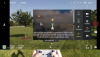
In this video, something about waypoints in Mavic Air 2 is explained:
Attachments
baddog
Well-Known Member
I use the same setup, works well. Just keep in mind, that Google Earth images may NOT reflect current obstacles such as trees, wires, light poles, etc.... These images can be up to 3 years old.@skunky1 "How do you mirror them on your computer?"
I'm not sure of the context that the word "mirror" is being used, but I suppose "mirroring" is looking at an enlarged representation of the phone's screen. Is the "mirroring" done at home? I would imagine that is done with a streaming app or hardware attachment like Chromecast or FireTV stick.
Regardless of the context, I don't "mirror" my missions. I DESIGN my missions on the computer. With Litchi it's easy and it's not done in a rush in the field while you're drone is burning juice, sitting on the launch pad while in idle. How to do it?...There are four app components (apps) plus a computer involved: 1) Litchi app. 2) Virtual Litchi Mission App. 3) Google Earth Pro app (VLM and Google earth are installed on your computer).
Once you have all the components, go to flylitchi.com . Then go to "mission hub" in the menu. Make sure you're signed in before you start designing your mission. Once you have it down, save the mission. Then you can go to "open", select that mission to make sure it's populated. Then you can "export" the mission eithe KLM or VLM. If you don't have the Virtual Litchi Mission app you'll only be able to export KLM. KLM will open Google Earth so you see what your mission looks like. VLM will allow you to actually fly the mission virtually. If you do that and see any corrections needed, go back to the mission hub and make any edits in the mission and then save it again with the changes. Rinse and repeat until you get it right. If you've signed in on the Litchi app on your phone you can check the missions to make sure the one you've worked on is in your phone. Once you're in the field all you have to do is dial up Litchi, load the mission and press "start' when you're ready for it to go. The basics of Litchi are described in the free tutorials found here: Litchi course and other stuff
and as hard evidence proves every day.... all the planing in the world doesn't stop bad software from ruining your day. Ask anyone that has flown a Boeing in the last 10 years.Sorry for your bad experience. A smooth flight begins with a lot of careful flight planning.
This is one advantage of the smart controller it has a HDMI and USB port so you can attach any size screen and mouse which makes plotting waypoints much clearer and easier.How do you mirror them on your computer?
So, I watch videos, read tutorials. Go for a flight and manually set four waypoints. I land. I take off again. Retrieve mission and hit go. Holy x#$%!!! The thing takes off like a bat out of hell and bounces off the neighbor's roof. Couldn't stop it in time. Landed the drone and replaced two beat up propellers. Noted a dent and crack in the top front cowling. Fire the drone back up. It goes through normal initialization routine to include gimbal but the gimbal settles limp off to one side. Thought I'd try to calibrate the gimbal but there is no longer a camera icon in the general settings menu. Contacted DJI, they are sending a return label.
I was hoping for a smooth flight but got a race to the ruins.
My very first crash was using litchi and setting up a waypoint mission. My mistake was I moved one waypoint from a 700 foot elevation to a much lower spot without noticing the altitude now was the average of two waypoints not 700 and of course my P2 crashed into trees.
I now am much more cautious and use LVM to verify all flights. I also set my first waypoint above or near my takeoff so the bird goe up above all danger then proceeds with the mission. Same with the last waypoint. That being said I never use the Goapp only Litchi and I have done some pretty scarry missions planned thousands of mile away and not a problem. Caution and diligence is the key
LA 2020
Well-Known Member
I use Litchi App exclusively now because you can program things without being connected to the drone which saves a lot of battery and you're not in as big a hurry so you make fewer mistakes. I find waypoints very easy to set up but you have to check altitudes, speeds, direction, etc at each waypoint before takeoffOne thing i have found is that its really easy to make a mistake with Way Points. Add one , delete Two. its tricky.
I mirror them now on my computer so I can see what is really happening and that was a game changer.
Phantomrain.org
Gear to fly your Mavic in the Rain
Jan Smith
Active Member
So, I watch videos, read tutorials. Go for a flight and manually set four waypoints. I land. I take off again. Retrieve mission and hit go. Holy x#$%!!! The thing takes off like a bat out of hell and bounces off the neighbor's roof. Couldn't stop it in time. Landed the drone and replaced two beat up propellers. Noted a dent and crack in the top front cowling. Fire the drone back up. It goes through normal initialization routine to include gimbal but the gimbal settles limp off to one side. Thought I'd try to calibrate the gimbal but there is no longer a camera icon in the general settings menu. Contacted DJI, they are sending a return label.
I hope you get that label. When I called them after damaging my MA2, they said they would send a label, but it never showed up. After nearly a week and 5 phone calls, no label ever came (they said they would e-mail it each time). They verified my e-mail address, and nothing was in my junk/spam folder. I wound up paying UPS to send it in, and now a replacement is on the way.
Chas2379
Well-Known Member
- Joined
- Jan 28, 2019
- Messages
- 55
- Reactions
- 27
I use Mission Hub when at home and I know exactly where I will be flying. Even then when in the field I have to adjust the first and last waypoint to coincide to my take off spot. I travel to remote locations which I have no mission programed. On my tablet I use draw to draw the path of the mission and let Litchi fill in the waypoints. I can then change the alt, speed, gimble pitch and heading. After the aircraft is fired up I change the first and last waypoint for takeoff and landing. Once the aircraft is on the mission flight I can pause the mission and change gimble pitch and heading. I just did a mission around some towers that were located remotely at 8500 FT alt. The path was several circles around the towers. I paused the mission and rotated the aircraft 90 degrees to face the towers. The aircraft maintained that look and orbited around the towers. I also slowly adjusted the pitch to get better views.
Mavic 2 Pro, there is no Mavic Pro 2.Wow! I apologize. I left out the fun fact that it is a Mavic pro 2. Don't get old. The brains ooze out your ears.
StinkiePants
Well-Known Member
I had similar thing happen the first time I used waypoints - flew right into my house trying to get to waypoint 1. I now go to waypoint 1 manually before starting the mission (after double checking speeds and altitudes on all waypoints). Lessons learned. Glad nobody was injured! ") Like many others here I now exclusively use Litchi for waypoint missions.
Like many others here I now exclusively use Litchi for waypoint missions.
Like many others here I now exclusively use Litchi for waypoint missions.ajkm
Well-Known Member
- Joined
- Jul 20, 2019
- Messages
- 251
- Reactions
- 153
- Age
- 66
It truly is as well as academic per my perspective. I'm going to send it into DJI for repair. They will make a billing decision. I will pay per their decision to get it back. From everything I've read here, DJI does not negotiate. Every dispute I've read about has been ignored by DJI.This is all little more than guesswork without the flight data.
I have devised my own plan. I just purchased and Air 2 with refresh. When the Mavic 2 is repaired I will purchase a refresh policy for it. This way I can keep one bird in the air while the other bird is in for service. Seems crazy, but it's the way it's working out.
Of course VLM is available for PC. You can find the downlad from this thread: VLM download thread and link
Litchi has a beta out for the MM and should have a real version out soon. They're waiting for the SDK for the MA2's but that shouldn't be too long down the road.
Thanks for the link and info kind sir.
itsneedtokno
I'm chillin, appreciate it though.
Very interesting. You'll have to walk me through "yaw error caused by launch point" can't wrap my head around that. The launch point was an area with trees to sides and rear maybe 20' - 25' lateral distance. There was also a maybe 15' overhead obstruction. Launch was manual if I remember correctly. Air craft hovered after launch @ approx 3' vertical. The drone was launched from a round orange launch pad. Activated mission and drone moved to first way point being maybe 5' away staying at about 3'. Second way point was about 15' away from the first, still at about 3' vertical. Third way point was supposed to be straight up for about 120'. It was almost as if the drone skipped the assent and combined it with the course to the 4th way point also 120' altitude and maybe 400' distance. It was during this angular assent that the drone met the neighbors roof. No indication of obstacle avoidance during this segment.
Hope that helps. Best I got.
A short explanation of compass function, calibration and errors.
BACKGROUND The aircraft compass is often misunderstood, both in terms of function and purpose, but it is important to understand what the compass measures, why, and what happens to that information. At the most basic level the purpose of the compass is to measure the earth’s magnetic field in...
 mavicpilots.com
I recommend reading this, about Yaw errors and more
I have Dronelink also and it works well with the MM.For waypoints I find there is nothing better or safer than Dronelink. You can simulate the mission planned on your pc within Dronelink and then upload it to google earth and refine it, and refine it, before you fly so 'belt & braces'. Bit of a learning curve but great series of tutorials and very powerful and versatile.
Great read. Explains a lot. Interesting how our drones track and compute heading.A short explanation of compass function, calibration and errors.
BACKGROUND The aircraft compass is often misunderstood, both in terms of function and purpose, but it is important to understand what the compass measures, why, and what happens to that information. At the most basic level the purpose of the compass is to measure the earth’s magnetic field in...
I recommend reading this, about Yaw errors and more
Similar threads
- Replies
- 8
- Views
- 3K
- Replies
- 13
- Views
- 917
- Replies
- 13
- Views
- 2K
- Replies
- 17
- Views
- 5K


DJI Drone Deals
New Threads
-
 Last Week's Most Popular Topics (January 31, 2026)
- Started by msinger
- Replies: 0
-
 How to Protect and Extend the Life of your Equipment in 2026 (By Timothy Brazzel)
- Started by The Droning Company
- Replies: 1
-

-
Navigating the Invisible (By Chris 'The Drone Geek' Fravel)
- Started by The Droning Company
- Replies: 0
-
Forum statistics
