I am a new Mavic Air 2 owner and I started uploading my flight data to AirData. I find it really interesting to look at and play the flight back.
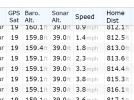
I noted that there are two altitude measures, barometric and sonar. The sonar altitude doesn't seem to make any sense. Googling seems to indicate this is related to height over water. Is it a case where sonar alt is only relevant when flying over water?
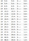
Here is a snapshot of one of my logs. I have no problems flying so there doesn't appear to be anything wrong.
Thanks!


