DJI Mavic, Air and Mini Drones
Friendly, Helpful & Knowledgeable Community
Join Us Now

Controller and maps

Max Headroom

Well-Known Member
Joined
Aug 18, 2024
Messages
405
Reactions
330
Location
England.
I have been playing with the new Mini 3 (not pro) tonight and I cannot get the Wi-Fi problem in the video below to work, I have set up the hotspot and the controller seems to connect, but the map has no details about flying restrictions and I have to zoom in from a full map of the world not my area does anyone here know what i may be doing wrong.

Thanks in advance.

To view this content we will need your consent to set third party cookies.
For more detailed information, see our cookies page.
 
I have also tried this but have found after I click on Europe as country as UK is not listed it only lists a few regions in the UK so I cannot choose mine if I choose a different one the map works fine with all no fly restrictions showing.


To select a country/region in the DJI Fly app, navigate to the "Before You Fly" section. This will automatically detect your location and provide information about local regulations, including GEO zones and potential restrictions. Before flying, verify your location is correct and understand any local rules and restrictions.


Here's a more detailed breakdown:


1. Launch the DJI Fly app: Open the app and navigate to the "Before You Fly" section.
2. Location Detection and Verification: The app will attempt to automatically detect your current location. Double-check that the displayed location is accurate.
3. Regional Information: The app will then display relevant information about your location, including local flying rules and regulations.
 
Last edited:
I have also tried this but have found after I click on Europe as country as mine is not listed it only lists a few regions in the UK so I cannot choose mine if I choose a different one the map works fine with all no fly restrictions showing.


To select a country/region in the DJI Fly app, navigate to the "Before You Fly" section. This will automatically detect your location and provide information about local regulations, including GEO zones and potential restrictions. Before flying, verify your location is correct and understand any local rules and restrictions.


Here's a more detailed breakdown:


1. Launch the DJI Fly app: Open the app and navigate to the "Before You Fly" section.
2. Location Detection and Verification: The app will attempt to automatically detect your current location. Double-check that the displayed location is accurate.
3. Regional Information: The app will then display relevant information about your location, including local flying rules and regulations.
I don't think you're doing anything wrong - this strikes me as being one of DJI's famous firmware fluff jobs... prepare for an update to the latest update in short order.
 
  • Like
Reactions: Max Headroom
I have also tried this but have found after I click on Europe as country as UK is not listed it only lists a few regions in the UK so I cannot choose mine if I choose a different one the map works fine with all no fly restrictions showing.

Thanks, Felix.
I have edited my earlier post to clarify. (see above)

I have an app on my phone that allows me to track no-fly zones, can I ignore the map on the controller and use that when out and about?
 
Last edited:
  • Like
Reactions: Felix le Chat
Thanks Felix.
I have edited my earlier post to clarify.

I have a app on my phone that allows me to track no fly zones can I ignore the map on the controller and use that when out and about?
I always do the same. Before I head anywhere: I'll scout the area with the Drone Assist app (no account required). The FLY app geozone map is pretty much redundant (for the moment). The only use it ever had to begin with was to stop the drone taking off in red or blue zones without permission.

Another good, completely current and accurate on-line resource to have a browser shortcut to is the NATS map.

*Addendum*
Be wary of Altitude Angel and Drone Assist map advisories - you'll find that a lot of their 'no fly' zones can be unlocked... for a fee... sneaky bastards.
 
That's the one I have on my phone ;)
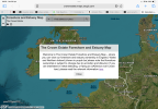
If you ever go anywhere near coastal or estuary areas, might I suggest a browser link to the Crown Foreshore & Estuary map... at-a-glance confirmation that any chosen TOAL spot is within this jurisdiction, which gives blanket permission for any drone launch from Crown Estate controlled coastal areas... regardless of local authority bye-laws.
 
I have had a quick look on my phone and part of the coast near me is coloured purple what does that mean?
 

DJI Drone Deals

New Threads

Forum statistics

Threads
136,561
Messages
1,618,805
Members
165,198
Latest member
erickidde
Want to Remove this Ad? Simply login or create a free account