DJI Mavic, Air and Mini Drones
Friendly, Helpful & Knowledgeable Community
Join Us Now

Custom Unlock Help

PapaBob

Member
Joined
Feb 25, 2019
Messages
22
Reactions
10
I got LAANC authorization for flight this weekend in Class D airspace. I have a smart controller and will not have internet access. I have prior experience with custom unlock at DJI FlySafe but it has been a while and there is a new system. I entered my personal data, got a verification email, and my prior licenses appear. However, part 2 (unlock details) is giving me heartburn. I entered that I am flying in the US and the address of the flight. I then selected polygon to correspond with the LAANC approval. There I get stuck. It won't let me enter date and time or name the license. I can enter the altitude and reasons for request. If I try to submit, then I get required field errors. I spent some time on this without success. I called DJI but the rep couldn't help. I have an email into FlySafe. I must be doing something wrong. Any help would be appreciated.

---Bob
 
Problem solved. I set four points and FlySafe drew a polygon on the screen. It appeared to be a complete polygon, I but I neglected to click on the home point to close the base of the polygon (5 clicks for a four point polygon). In retrospect it seems like a nimnutz mistake but I thought I would post in case anyone had a similar issue. Note: I did get a quick and helpful response from DJI.
 
  • Like
Reactions: db4476
Problem solved. I set four points and FlySafe drew a polygon on the screen. It appeared to be a complete polygon, I but I neglected to click on the home point to close the base of the polygon (5 clicks for a four point polygon). In retrospect it seems like a nimnutz mistake but I thought I would post in case anyone had a similar issue. Note: I did get a quick and helpful response from DJI.
Those minor details bite you in the arse sometimes. Glad you solved the issue.

Cheers!
 
I just did my first custom unlock. No LAANC issues to worry about, as I'm in Papua New Guinea. However, after the custom unlock is approved and imported into the controller, is there anything else I need to do?

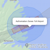
Also, the custom unlock is inside a blue authorization zone, My thought is that I should be good for the whole area, right?

Backstory - Aerial survey for an uncontrolled airstrip in the boonies. The strip is red, with a blue authorization zone around it. I went ahead and submitted for the blue zone, then realized that some of what I needed to shoot was in the red, so I submitted for a custom zone just incorporating the red and a bit of blue (purple on the image).
My thought is that the whole area should be covered. Am I good, or do I need to do another custom, incorporating everything?

Screen Shot 2022-04-21 at 13.06.41.png
 
I have never requested an unlock in a restricted area but often fly blue zones with limited elevation.
If you fly a DJI drone then you may have run into issues with geofencing, and not knowing how to turn it off.

In this guide, we’ll walk you through how to identify whether where you want to fly is in airspace that requires unlocking, the two different types of geofencing DJI uses, and what to do to unlock each one of them.

Here’s our YouTube video, but if you’d prefer to read through this guide, please scroll below:


How to Unlock DJI Geofencing Using the GEO System

Watch this video on YouTube

Is Your Mission Located in a Geofenced Area?​

Start by using DJI’s Fly Safe Geo Map to see whether the area in which you want to fly is located in a geofenced “zone” that will require unlocking.

To do this, enter the address of the location where you want to fly in the search box in the top left of the interactive map that appears on the Geo Map page, and then click on the area to populate the geofencing zones in the location where you want to fly.

Quick note: Make sure to check off the “Warning Zones” and “Enhanced Warning Zones” boxes below the map to make sure all of the geofencing information relevant to your mission will be included in your search.

dji-geofencing_1.png

Color Coding​

Once you input the location where you want to fly, you’ll notice color-coding indicating the different kinds of geofencing zones that cover the area (these colors correspond with the “DJI GEO Zones” you see listed horizontally below the map in the screenshot above).

Red zones indicate restricted areas, which require a Custom Unlock. We’ll walk you through how to request a Custom Unlock in the next section.

Gray zones indicate areas with altitude restrictions and are usually found near airport runways. Due to safety reasons, these restrictions cannot be turned off.

Blue zones indicate areas where flying is risky but up to the discretion of the pilot, and may be flown after completing a Self Unlock. We’ll walk you through how to perform a Self Unlock in the next section.
 

DJI Drone Deals

New Threads

Forum statistics

Threads
134,575
Messages
1,596,443
Members
163,076
Latest member
thelelans
Want to Remove this Ad? Simply login or create a free account