When I was waiting for my drone a few years back, I read and appreciated many of the posts here. Now that I have my own (happy so far) crash story, I figured I would share.
WARNING: This is not overly dramatic or exciting. The drone was found immediately. I'm posting an airdata link for anyone who is curious.
I got a drone (Mavic Air 1) after seeing one in use while hiking in New Hampshire. I like taking photos and the possibility to get some unique shots appealed to me. Unfortunately I have not been traveling as much and so have not used it much of late.
(LESSON 1: Don't forget all the stuff you spent so much time learning!)
Before going on the trip, I fired up the drone to make sure everything was updated and ship shape. I renewed my FAA registration, checked that I had the new apps for registering flights (I live within controlled airspace so used to have a lot of conversations with the local tower), and made sure I remembered how everything worked. Oh, and charged all the batteries.
Plan A was a flight during a hike to Zealand Falls in the White Mountains. Previously this whole area had been off limits, but the maps I had seemed to indicate it was open now. Unfortunately, they have a 1/4 mile "no land" zone around the hut at the falls. I got some good stuff farther down though. No issues.
(LESSON 2: Just because one flight goes OK doesn't mean the next one will!)
Plan B was a flight over Jackson Falls, which is in the town of Jackson NH. No flight restrictions and easily accessible. I fired up the drone and starting flitting about. I was not planning a short flight so turned on Sport Mode to get places a little more quickly. While I was above tree level that was fine...
I descended to ~10 feet over the creek and flew the drone back toward me, still in Sport Mode. There was nothing in the way, I had line of sight, no problem. I thought it would be cool to fly it past me at speed, so I did.
(LESSON 3: "It would be cool" often leads to uncool things.)
Unfortunately, not too far beyond me the other way was part of the falls themselves, rising up ~4 feet. It was a close call so I figured it would be good to get some height.
Note, the smart thing to do here would be to STOP THE DRONE. But I was just turning around and the drone was at speed, so this became a reflex decision instead of a reasoned one.
Everything would have been fine...if I had not gone down instead of up. Rusty at the controls, I just went the wrong way on the stick. I corrected but it was too late.
Fortunately the drone hit the top ledge rather than the face of the falls. Unfortunately, that meant it bounced toward the water.
Assuming it had gone into the drink, I put the controls down and started looking for it. Extremely luckily for me, it had come to rest upside down just at the edge of the water, in a small puddle. A few minutes later I had crossed over and retrieved it. I immediately powered everything down, dried it off, and let it sit for a week (well, 6 days).
I fired it up briefly today and everything seemed to work, at least at low altitude. Hopefully that remains the case!
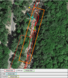
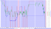
Flight data, including a picture of where the crash took place, below.


