As a new vendor on MavicPilots, we are pleased to announce the release of DroneViewer and DroneViewer Pro for your Mavic Pro.
DroneViewer displays your DJI drone videos in a whole new way! While your movie is playing you can see your drone’s position on a Google Map. You can geotag key positions in the video and jump back to them instantly. You can click on your route in the Map View to jump immediately to that point in the movie. You can export portions of your videos to separate clips, or export just a single geotagged frame. DroneViewer has multiple views including graphs of your drone’s speed, altitude, distance, and bearing. Imperial and metric units are supported. We supply a 60-page User's Manual with the software. Best of all DroneViewer runs on both Mac and Windows computers and is compatible with the Mavic Pro, Phantom 4 series, Phantom 3, and Phantom 2 with FlyTrex Core 2 data logger.

Version 1.0.1 has the following updates:
New Features:
Please visit our website to download the software and learn more about DroneViewer.
Thanks,
John
Website: DroneViewer
FAA Part 107 UAS Pilot
DroneViewer displays your DJI drone videos in a whole new way! While your movie is playing you can see your drone’s position on a Google Map. You can geotag key positions in the video and jump back to them instantly. You can click on your route in the Map View to jump immediately to that point in the movie. You can export portions of your videos to separate clips, or export just a single geotagged frame. DroneViewer has multiple views including graphs of your drone’s speed, altitude, distance, and bearing. Imperial and metric units are supported. We supply a 60-page User's Manual with the software. Best of all DroneViewer runs on both Mac and Windows computers and is compatible with the Mavic Pro, Phantom 4 series, Phantom 3, and Phantom 2 with FlyTrex Core 2 data logger.
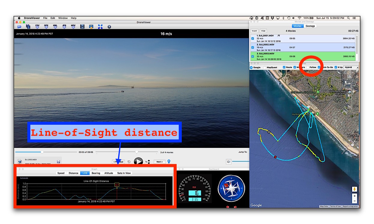
Screenshot of DroneViewer showing current location of drone (red dot) and geotags at key points in the video. Current speed and other statistics are shown in the dashboard and graphs. Line-Of-Sight distances from geotags are shown in the Movies and Geotags window. This was taken near the oil islands of Long Beach, CA.
Version 1.0.1 has the following updates:
New Features:
- Added compatibility with Phantom 4 Pro v2, which embeds its GPS data inside the movie file itself. Note that Video Caption must be enabled in the Go App for this to occur. Earlier Phantom 4 Pro drones (and possibly Inspire2 drones), which also store their SRT data in the movies, may work as well although I haven’t tested them.
- Fixed bug in which consecutive movies recorded at significantly different times would not update the cursor correctly.
- Fixed bug in which SRT data points stored at greater than 1 Hz were not loaded properly.
Please visit our website to download the software and learn more about DroneViewer.
Thanks,
John
Website: DroneViewer
FAA Part 107 UAS Pilot