


That's where the ability to select and read the log file of Go4 would allow compatibility with other DJI device.Sadly, yes. For some reason, the Mavic Pro's SRT file contains no navigation data.
There are command lines tools to convert (decode) the log file into CSV format; maybe their authors would agree for its use in relation with your software. There are also some on Github. At basic you would need a very limited conversion as you are interested only with basic flight info GPS position + altitude versus time.
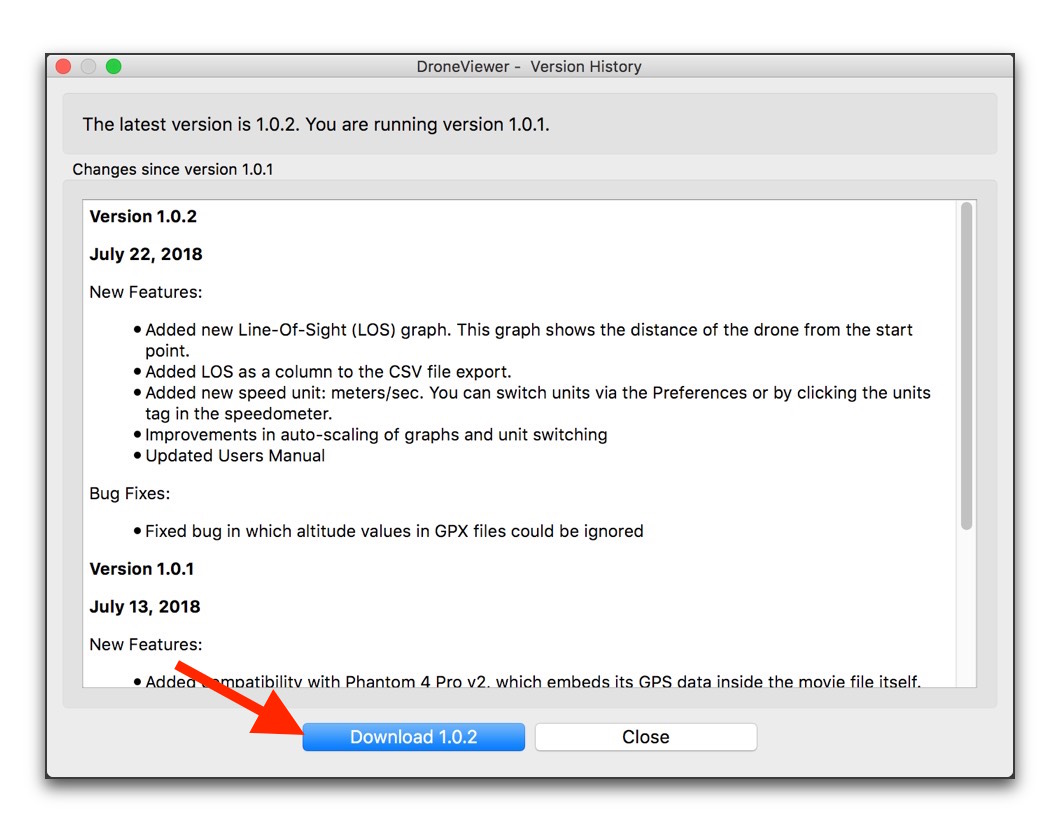
Let's hope in a future version
")


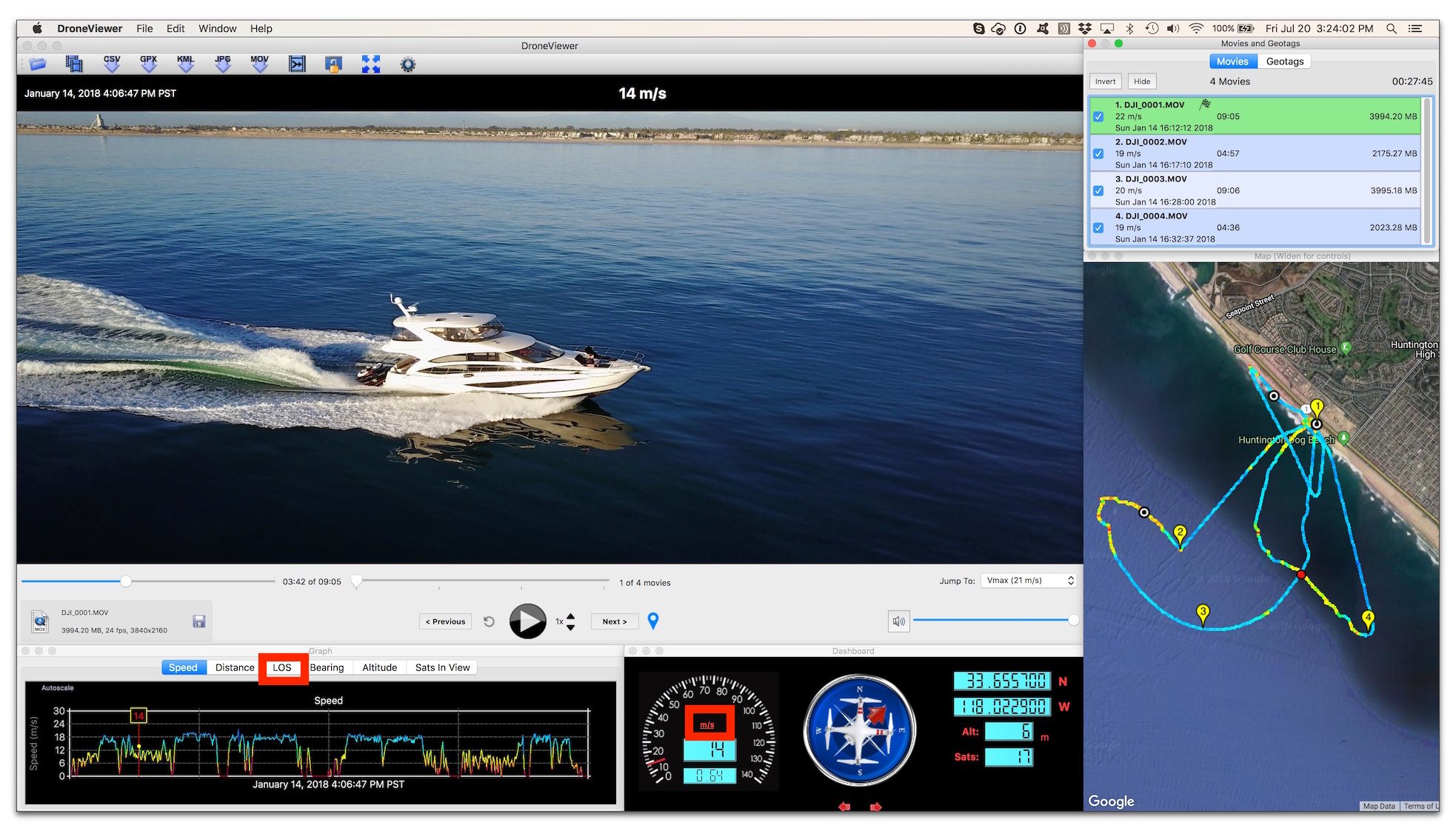
") Yes the drone location may be slightly off due to two factors (1) GPS nav accuracy due to satellite dispersion and # of satellites in view and (2) the fact that DJI arbitrarily rounds off precision in their SRT lat/lon logging. Number 2 is the bigger issue (and also the one that could be easily fixed by DJI).
Yes the drone location may be slightly off due to two factors (1) GPS nav accuracy due to satellite dispersion and # of satellites in view and (2) the fact that DJI arbitrarily rounds off precision in their SRT lat/lon logging. Number 2 is the bigger issue (and also the one that could be easily fixed by DJI).


