Hi Guys,
Hope you're all well.
I've an Air2s and a client has reached out to me asking me to capture some aerial photography for them - standard stuff no problems.
He said:
I know you can get the GPS coordinates of the photo and I've seen before them in Lightroom I'm guessing this is what he means. I can ask him but just wanted to be sure I wasn't asking something daft i should know
Any thoughts / guidance would be great
Thanks Ro
Hope you're all well.
I've an Air2s and a client has reached out to me asking me to capture some aerial photography for them - standard stuff no problems.
He said:
- The images will be used to generate photomontages showing a proposed extension to an existing industrial development.
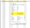
- Are you able to provide the data showing the geolocation of the captured photography as we would need this when inputting our model to the captured photography?
I know you can get the GPS coordinates of the photo and I've seen before them in Lightroom I'm guessing this is what he means. I can ask him but just wanted to be sure I wasn't asking something daft i should know
Any thoughts / guidance would be great
Thanks Ro
Last edited:


