- Joined
- Oct 17, 2020
- Messages
- 1,213
- Reactions
- 893
- Age
- 43
- Location
- Grand Rapids, MI
- Site
- karlblessing.com
Starting out tried different routes :
1) Using a web script to create a path exporting to Litchi. Saving it in the Litchi hub, and running the waypoint, which I still had to process in some way.
2) Then tried using DreonDeploy trial unfortunately I could never get the app to actually execute the flight, so had to use method #1 then upload those results for processing in Drone Deploy
3) Doing #1 then loading into WebODM for processing
4) Current method is now using DroneLink which works with the Air 2S without issues (though seems like it turns off auto-landing so have to be careful descending slowly or you can smack the ground hard), did the planning in DroneLink able to chain 2+ map plans into a single execution, and loading the results into WebODM
Results so far from doing one run with a 80%+ or better overlap with the gimbal pointed straight down (-90°), then two runs separated by 20° flight direction, with gimbal set at -65°. Meaning first run flight direction is 0° , first angled run at 350° direction, and second angled run at 10°.
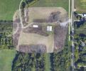
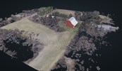
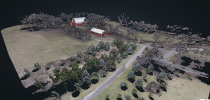
First try being at a park south of here with a barn, didn't quite get the unseen parts.
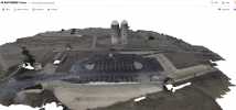
Then tried something taller without obstruction sort of a silo. First time was only 100ft up, but missed a lot of the top of the structure so re-ran it about 150 (silo max height around 75ft)
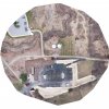
Then tried something a little more urban
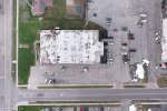
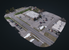
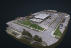
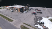
Getting there. Trying to think of what may be some good 3D applications to remove or flatten some of the elements. My 3D experience is quite a few years out of date, last used Bryce3D and briefly Rhino3d in college. But at least the orthomosaic is coming out good with some settings tweaks.
1) Using a web script to create a path exporting to Litchi. Saving it in the Litchi hub, and running the waypoint, which I still had to process in some way.
2) Then tried using DreonDeploy trial unfortunately I could never get the app to actually execute the flight, so had to use method #1 then upload those results for processing in Drone Deploy
3) Doing #1 then loading into WebODM for processing
4) Current method is now using DroneLink which works with the Air 2S without issues (though seems like it turns off auto-landing so have to be careful descending slowly or you can smack the ground hard), did the planning in DroneLink able to chain 2+ map plans into a single execution, and loading the results into WebODM
Results so far from doing one run with a 80%+ or better overlap with the gimbal pointed straight down (-90°), then two runs separated by 20° flight direction, with gimbal set at -65°. Meaning first run flight direction is 0° , first angled run at 350° direction, and second angled run at 10°.
First try being at a park south of here with a barn, didn't quite get the unseen parts.


Then tried something taller without obstruction sort of a silo. First time was only 100ft up, but missed a lot of the top of the structure so re-ran it about 150 (silo max height around 75ft)


Then tried something a little more urban


Getting there. Trying to think of what may be some good 3D applications to remove or flatten some of the elements. My 3D experience is quite a few years out of date, last used Bryce3D and briefly Rhino3d in college. But at least the orthomosaic is coming out good with some settings tweaks.


