

No, I am sorry I do not have authorative doc on that. This was the figure given to me during a visit to Yellowstone NP, Arches, Painted Desert and Petrified NPs. Each place I inquired and each time I was told of 2000. So, without solid doc, I must assume. It would make sense though, to help keep the fixed/rotary wingers out as well. If you find solid doc, please post as well. Many thanks.

You are using an out of date browser. It may not display this or other websites correctly.
You should upgrade or use an alternative browser.
You should upgrade or use an alternative browser.
Grand Canyon
- Thread starter Jearim08
- Start date
No, I am sorry I do not have authorative doc on that. This was the figure given to me during a visit to Yellowstone NP, Arches, Painted Desert and Petrified NPs. Each place I inquired and each time I was told of 2000. So, without solid doc, I must assume. It would make sense though, to help keep the fixed/rotary wingers out as well. If you find solid doc, please post as well. Many thanks.
OK - well it's really the other way around. In the absence of such a rule, which would been incorporated on sectionals, there is no AGL restriction. I suspect that they are referring, inaccurately, to the circular that I linked to above.
Could be, personally, I been extremely hesitant to even fly near a NP for fear of having taken the wrong way then tying everything up in some sort of litigation. I greatly appreciate and respect the yourpoints of view, I still stand by the NPS flyer I posted that it is permissible in some NPs, which ones, don’t know, as I still intend to avoid.OK - well it's really the other way around. In the absence of such a rule, which would been incorporated on sectionals, there is no AGL restriction. I suspect that they are referring, inaccurately, to the circular that I linked to above.
- Joined
- Oct 10, 2018
- Messages
- 30
- Reactions
- 16
- Age
- 43
Thanks for letting me know sounds goog and looks nice and stunning viewThat's a nice place to fly, but note that Red Rock Canyon is on BLM land run by Southern Nevada Conservancy, a non-profit organization. It's not a National Park.
Bigbird48
Well-Known Member
yes it doesOutside the park is no longer the Grand Canyon, is it?
Do not think that taking off outside the park allows you to fly over the canyon.
yes it does
Aside from the airspace issue, which arguably doesn't apply to recreational flight, you would clearly be beyond VLOS if you actually flew to the edge of the canyon, which would make the flight illegal.
ReadyKilowatt
Well-Known Member
- Joined
- Feb 1, 2017
- Messages
- 111
- Reactions
- 63
- Age
- 57
You can fly over a designated wilderness area but cannot takeoff or land, nor can you operate/pilot from the wilderness area. This is because wilderness areas are off limits for motorized vehicles. So if there's a road running through a wilderness area you can find a shoulder big enough to safely pull off, fly your mission and that's it. I'd also be pretty carful about flying around animals since you aren't supposed to be "harassing" the wildlife either (although most animals seem to ignore drones).
https://www.wilderness.net/NWPS/documents/FS/FS_Wilderness_Regulations.pdf
Sec. 261.16 National Forest Wilderness.
The following are prohibited in a National Forest Wilderness:
(a) Possessing or using a motor vehicle, motorboat or motorized equipment except as authorized by Federal Law or regulation.
(b) Possessing or using a hang glider or bicycle.
(c) Landing of aircraft, or dropping or picking up of any material, supplies, or person by means of aircraft, including a helicopter.
[42 FR 2957, Jan. 14, 1977, as amended at 42 FR 35959, July 13, 1977; 50
FR 16231, Apr. 25, 1985]
You can fly over a designated wilderness area but cannot takeoff or land, nor can you operate/pilot from the wilderness area. This is because wilderness areas are off limits for motorized vehicles. So if there's a road running through a wilderness area you can find a shoulder big enough to safely pull off, fly your mission and that's it. I'd also be pretty carful about flying around animals since you aren't supposed to be "harassing" the wildlife either (although most animals seem to ignore drones).
https://www.wilderness.net/NWPS/documents/FS/FS_Wilderness_Regulations.pdf
Sec. 261.16 National Forest Wilderness.
The following are prohibited in a National Forest Wilderness:
(a) Possessing or using a motor vehicle, motorboat or motorized equipment except as authorized by Federal Law or regulation.
(b) Possessing or using a hang glider or bicycle.
(c) Landing of aircraft, or dropping or picking up of any material, supplies, or person by means of aircraft, including a helicopter.
[42 FR 2957, Jan. 14, 1977, as amended at 42 FR 35959, July 13, 1977; 50
FR 16231, Apr. 25, 1985]
All true, but the Grand Canyon is not National Forest - different regulations apply there.

AMann
Well-Known Member
All true, but the Grand Canyon is not National Forest - different regulations apply there.
Most of it is National Park, but some parts of the north rim upstream towards Lee’s Ferry are BLM with some State and some private inholdings (ranches and patented uranium mine claims, etc.). The Kaibab NF does not extend to the rim, it is bordered by National Park land there. The south rim is National Park and Navajoland.
ReadyKilowatt
Well-Known Member
- Joined
- Feb 1, 2017
- Messages
- 111
- Reactions
- 63
- Age
- 57
All true, but the Grand Canyon is not National Forest - different regulations apply there.
Right. But there was some tangent about flying in designated wilderness areas.
A couple of thoughts...first of all, there are amazing places to photograph the canyon without flying over it. I'll attach of couple of my shots below - taken by hand.
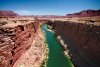
Then, a little north of the canyon is Navajo Bridge (Image 8967-Small is taken from the center of the bridge looking north)...it crosses the Colorado outside of the park and provides EXCELLENT access to the river and canyon formations. Not as wide as the canyon, obviously, but a great place to fly from. Plus, if you cross the bridge towards the west and make the first right after the bridge, the road will wind you down all the way to a small beach on the Colorado river...and you can fly from there as well. Really awesome location.


Then, a little north of the canyon is Navajo Bridge (Image 8967-Small is taken from the center of the bridge looking north)...it crosses the Colorado outside of the park and provides EXCELLENT access to the river and canyon formations. Not as wide as the canyon, obviously, but a great place to fly from. Plus, if you cross the bridge towards the west and make the first right after the bridge, the road will wind you down all the way to a small beach on the Colorado river...and you can fly from there as well. Really awesome location.
Attachments
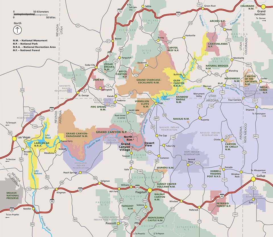
Can you tell where I can get this kind of maps ? ThanksIt's a National Park, so takeoff and landing is prohibited without authorization from the NPS, and most of the main section is a flight-free zone for all aircraft.
View attachment 51769
AMann
Well-Known Member
Dragon2650
Active Member
- Joined
- Jun 6, 2018
- Messages
- 34
- Reactions
- 17
- Age
- 67
Yes. There are some state parks on the SW corner of the lake, but I had no problems.Can I fly in Lake tahoe?
Davzone
Well-Known Member
- Joined
- Mar 24, 2017
- Messages
- 57
- Reactions
- 27
- Age
- 36
There are parts that are not part of the NPS, and look great.
Parts of route 89A is not part of any NPS,NF,NRA. South side is wide open, North is wonderful view of the Marble Canyon with a straight road for miles.
Check these coordinates: 36 42' 2"N, 111 56' 52"W Not precisely here, but that's the long straight part of 89A that's not part of any park and its wide open.
Also check Airmap for NFZ boundaries, the parks are included nicely.
Also route 89 has 2 blocks that are quite big, that are not part of any park. Not as nice as 89A.
People still fly everywhere. I was there in september and popular spots in both yosemite and grand canyon had multiple people flying from the top of the mountains(Glacier Point,Half Dome), or at the horseshoe bend. In the 10 days I've spent there I've seen 0 park rangers, not alone anybody saying anything to these people, even though there were No Drone Zone signs posted at every location.
- Joined
- Oct 10, 2018
- Messages
- 30
- Reactions
- 16
- Age
- 43
Thanks to share your experience that's good to knowThere are parts that are not part of the NPS, and look great.
Parts of route 89A is not part of any NPS,NF,NRA. South side is wide open, North is wonderful view of the Marble Canyon with a straight road for miles.
Check these coordinates: 36 42' 2"N, 111 56' 52"W Not precisely here, but that's the long straight part of 89A that's not part of any park and its wide open.
Also check Airmap for NFZ boundaries, the parks are included nicely.
Also route 89 has 2 blocks that are quite big, that are not part of any park. Not as nice as 89A.
People still fly everywhere. I was there in september and popular spots in both yosemite and grand canyon had multiple people flying from the top of the mountains(Glacier Point,Half Dome), or at the horseshoe bend. In the 10 days I've spent there I've seen 0 park rangers, not alone anybody saying anything to these people, even though there were No Drone Zone signs posted at every location.
OCsurfer411
Well-Known Member
- Joined
- Nov 8, 2016
- Messages
- 77
- Reactions
- 38
- Age
- 55
BTW, I tried taking off just outside the park entrance to Grand Canyon, which is a good couple of miles away. Trust me, at keeping it under 400' AGL, you can't see anything of the Canyon except a small slit on the horizon. Not worth it.
I've heard of people flying in from outside the park, but as others have said, it's a No Fly Zone below 14,500'
It's too bad too, it would be some AMAZING drone footage. I wish they'd have like a drone week or something where we could fly and film there. Alas. No.
I've heard of people flying in from outside the park, but as others have said, it's a No Fly Zone below 14,500'
It's too bad too, it would be some AMAZING drone footage. I wish they'd have like a drone week or something where we could fly and film there. Alas. No.
Bigbird48
Well-Known Member
AMann
Well-Known Member
where do you find its a NFZ,
https://www.faa.gov/about/office_or...nyon_overflights/documentation/SFRA_trail.pdf
Similar threads
- Replies
- 1
- Views
- 868
- Replies
- 5
- Views
- 1K
- Replies
- 1
- Views
- 322
- Replies
- 2
- Views
- 443
- Replies
- 8
- Views
- 1K


