DJI Mavic, Air and Mini Drones
Friendly, Helpful & Knowledgeable Community
Join Us Now

How to download sphere panorama photo to PC

Now I have been using the dji stitched pano in the device (low rez) version and it works.(seen up top) I use topaz gigapixel to make it 6000x6000 when finished and this solves the low rez issue. BUT...
I have found in using photoshop to stitch all 26 together is gives a mish-mash of a pano with pieces missing. I have tried all the different options from auto to spherical and several of the others. None of them stitch all 26 together into one seamless image. If I do the 9 image pano it works ok but the 26 leaves 4 images out and is just not right... If anyone is using photoshop on the 26 images and it gives you the full rectangular pano (flat) like the dji low rez version could you share your setting and process?
Do you rename the images?
do you rename them to process in a different order?
or does it just work for you and not me?
:)
Seriously, PS is not a reliable tool for 360 panoramas. Not worth the hassle and effort.
 
Next I will try out to upload ONLY the 26 photos and see if and what kind of panaroma Google photos creates. Then I will upload a DJI-fly-created panorama and upload one of the 26 shots from that as well, to see if this confirms my theory of that additional photo being the trigger for Google to create a 360 degree version of the flat file.

Did some experiments with Google Photos and DJI Fly 360 degree panoramas:

- Uploading only the DJI Fly stiched panaroma will show as flat
- If additionally you take ONE normal picture from the same position as the 360 degree sphere, and upload that picture, Google photos will turn the flat DJI stitched flat picture into a 360 degree panorama!
- Above two steps can be done with auto-upload from your phone, the only thing you have to do after taking a 360 degree picture with the drone is take another normal one from the same position (this one can later be deleted in Google Photos
- Google Photos WILL NOT create a panorama if you upload the 26 DNG files there, which is unfortunate, as it would have been an easy way to get a HQ pano
- Even adding one JPG to these does not change anything

I will try uploading 26 JPGs next time, maybe with the lower resolution Google Photos will create a pano, which would still be much better than the one from DJI Fly, but I doubt it.
 
Uploading only the DJI Fly stiched panaroma will show as flat
This hasn't been my experience. I have been downloading the 360 sphere from the MA2 to the Fly app and then sharing it to Google Photos. I also tried uploading an archived 360 sphere on my PC to another Google Photos account via the web browser and I was able to view by click and dragging the sphere around. Either method allowed me to view by using the mouse (PC), touch and drag (phone) or use the internal accelerometer to view by moving the phone around. Not sure why it's not working for you.
 
Another way to get the tiny planet is to copy the flat sphere pano either from the SD card or to a PC. Open the latest Gimp Software(a free photo editing software that is IMO comparable to Photoshop). Open the flat pano in Gimp, go to filters on top menu... select Map ... select Little Planet. It creates it for you automatically. No editing or stitching multiple pics together.

Open source ... a beautiful thing!
Thanks for the info. My Mavic 2 Zoom showed a sphere when I downloaded it to my smart controller, but the file ended up being a flat sphere pano. Per your recommendation, I downloaded Gimp (~250 Mb) and followed your instructions. Gimp took the original 9.8 Mb .jpg file and then created a 33 Mb .xcf file. I then exported it back to a JPEG file that was 1.1 Mb. Attached is my 1st sphere photo of my neighborhood.
 

Attachments

  • Sphere1.jpeg
    Sphere1.jpeg
    1.1 MB · Views: 28
Last edited:
Thanks for the info. The drone showed a sphere when I downloaded it to my smart controller, but the file ended up being a flat sphere pano. Per your recommendation, I downloaded Gimp (~250 Mb) and followed your instructions. Gimp took the original 9.8 Mb .jpg file and then created a 33 Mb .xcf file. I then exported it back to a JPEG file that was 1.1 Mb. Attached is my 1st sphere photo of my neighborhood.
So how do you get this displayed as a 360 degree pano? All I see is a tiny planet picture, but I can't "fly into it"?
 
Now I have been using the dji stitched pano in the device (low rez) version and it works.(seen up top) I use topaz gigapixel to make it 6000x6000 when finished and this solves the low rez issue. BUT...
I have found in using photoshop to stitch all 26 together is gives a mish-mash of a pano with pieces missing. I have tried all the different options from auto to spherical and several of the others. None of them stitch all 26 together into one seamless image. If I do the 9 image pano it works ok but the 26 leaves 4 images out and is just not right... If anyone is using photoshop on the 26 images and it gives you the full rectangular pano (flat) like the dji low rez version could you share your setting and process?
Do you rename the images?
do you rename them to process in a different order?
or does it just work for you and not me?
:)
Hey, I'm facing the same problem here :((
I delete the flat image that DJI Fly APP provides and then I only have the 26 DNG's file.
I'm trying to create the tiny planet with Photoshop but after align all the files it seems like yours :(((
Seems like is missing some photos. ****!
Does someone have any solution for that?
 
Now I have been using the dji stitched pano in the device (low rez) version and it works.(seen up top) I use topaz gigapixel to make it 6000x6000 when finished and this solves the low rez issue. BUT...
I have found in using photoshop to stitch all 26 together is gives a mish-mash of a pano with pieces missing. I have tried all the different options from auto to spherical and several of the others. None of them stitch all 26 together into one seamless image. If I do the 9 image pano it works ok but the 26 leaves 4 images out and is just not right... If anyone is using photoshop on the 26 images and it gives you the full rectangular pano (flat) like the dji low rez version could you share your setting and process?
Do you rename the images?
do you rename them to process in a different order?
or does it just work for you and not me?
:)
Hey guys..looks like I have found a solution:

1) Simply drag your 26 DNG Files to photoshop home page - the page where you can see your recent works.
2) The 26 files will open with Camera RAW Options (see photo 1 attached)
3) Here you can edit them (exposure, saturation, shadows and etc) if you want. Then select all your DNG pressing Ctrl+A, right click in the first photo and Sync Settings. Press OK and all your 26 dng will have the same settings as the one you edited.
OBS: I did some lens corrections (see photo 2 attached)

4) Select all 26 dng files, right click and MERGE TO PANORAMA.
5) These are my options in this window (see photo 3 attached). MERGE. SAVE IT.
6) Now you can work on your FLAT 360 image. Go ahead, OPEN IT on Photoshop.
7) Make the image square going on IMAGE > IMAGE SIZE > Width HAS to be the same value as Height. (see photo 4 attatched). PRESS OK.
8) Flip Vertical your image (if you dont do that you will see your tiny planet from INSIDE. Weird o/)
9) go FILTER > DISTORT > POLAR COORDINATES.

I know it is not a perfect step by step but I hope it works.

REFERENCES:
 

Attachments

  • 1.JPG
    1.JPG
    135.4 KB · Views: 6
  • 2.JPG
    2.JPG
    138.9 KB · Views: 6
  • 3.JPG
    3.JPG
    65.4 KB · Views: 6
  • 4.JPG
    4.JPG
    105.9 KB · Views: 7
  • Like
Reactions: New England Droning
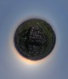
1) There is a (relatively) low resolution version of the sphere saved to the phone's memory by DJI Fly app.
2) Even so, the sphere's metadata is flawed. The photo is not recognized correctly by most of the panorama-aware apps (there are exceptions like RICOH THETA viewer). You need to update EXIF data - there are couple of ways: online sites, exiftool, edit360 app, etc. It's quite simple, but it must be done if you want to use it online. It was discussed here.
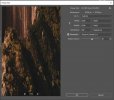
3) If you need more megapixels (and results are astonishing when we compare them to the Fly's output) you need to shoot panorama with RAW files (ie. DNG) and use extra software on your PC/Mac. I personally convert DNG to 16-bit TIF and then photos can be stitch in free, but slow Hugin or in excellent but expensive PTgui. PS. I convert DNG to TIF because I had serious problems with colors when I imported directly DNGs. The results have serious "wow" effect ;)

Cheers.
Hope you can help me out. As you will be able to tell I know little about this. I took some sphere, wide angle and the other, photos in jpg and raw thinking I would just have to download the finished product from my SD card to my laptop. Nooo. I get a whole mess of dng files with jpg in between and an Edge swoop for each pic (that doesnt seem to do anything). I gather that you can only see the actual final pics on my DJI phone app album. I have not been successful sharing them from there via email. So I take it I need a program to stitch them together. I would prefer a free stand alone program. Have you found one that is easy you like? Hope you can help, Thanks
 
You can upload to Skypixel, then share the link.
 
Lycus Tech Mavic Air 3 Case

DJI Drone Deals

New Threads

Forum statistics

Threads
130,597
Messages
1,554,232
Members
159,603
Latest member
refrigasketscanada