To All,
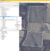
I created a KML & KMZ file in Google Earth Pro. This particular KML/KMZ file has 2 different polygon areas designated in Google Earth. Basically it is two potential solar fields, across the street from each other, (See Example Below). When I try to import this KML into DJI Pilot 2, on my RC Pro Enterprise controller, I get "Invlaid KML Format" error message. I want to import it as an "Area Map", but I did try all 3 types, same error.
Could this be, because the DJI Pilot 2 app does not support daisy chaining flight routes together? There is a feature in Dronelink, that supports this, so I will try it there next.
However, I can get this to work, if I import each polygon as a separate KML file in the Pilot 2 App.


