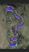
I've been hired to document a small residential road inside a subdivision for ongoing projects. We need to create the Base Line status of the road so any future damage will be well documented. The problems are:
Narrow Road
Need full width of road and 6' more in the frame and no more (high detail)
Road is curvy
Lots of elevation changes (up and down)
A Few trees come into play with a couple limbs handing out over the road
I finally decided to use Litchi to do this and below is a picture of the flight planning (86 different waypoints)


