DJI Mavic, Air and Mini Drones
Friendly, Helpful & Knowledgeable Community
Join Us Now

Lost Drone

tck444

Well-Known Member
Joined
Sep 13, 2018
Messages
375
Reactions
467
Age
61
Wondering if this data can be converted and loaded to an interactive map? It is the last log entry and hoping will include the final resting place?

All help welcome, Thanks in advance

#Sat Apr 17 12:23:49 PDT 2021
Is_HD=false
FPS_local=24
ApertureSize=560
Video_Resolution_Enum_Drone=-100
UUID_Drone=-100
CameraType=23
Source_File_Path=/storage/5988-8BAE/DJI/dji.go.v4/DJI_RECORD/2021_04_17_12_23_47.mp4
ProductType=38
FileID_Drone=-100
EndTimeMsec=0
Sync_Drone_Time=
CaptureDate=2021/04/17 12\:23\:49
Sync_Local_Time=
LocalFileName=2021_04_17_12_23_47
LocationString=
ImageDescription=
PixelYDimension_Drone=-100
File_Source_Type=1
FolderID_Drone=-100
PixelXDimension_Drone=-100
PositionGPSAlt=0.0
ShutterSpeed=1/100
ISO=0
PixelYDimension_Local=720
ExposureMode=1
FPS_Drone=-100
PixelXDimension_Local=1280
FrameJumpped=0
DeviceMaker=DJI
PositionGPSLng=-115.4176264032266
Version=1.0
WhiteBalance=0
Video_Type=0
StartTimeMsec=0
PositionGPSLat=36.14561090458677
PositionRelativeAlt=0.0
 
Wondering if this data can be converted and loaded to an interactive map?...

No ...

It is the last log entry and hoping will include the final resting place?

Don't know what kind of log you're referring to but what you've included isn't from a proper flight log ... looks more like exif info.

If you want assistance it's better that you describe what craft you had & what happened ... & then attach the proper log from that flight here in a new post.

Go here & read up on how to retrieve the mobile device .TXT log from the screen device you flew with --> Mavic Flight Log Retrieval and Analysis Guide (read under section 3.)
 
Thanks, After further research, I found a map on the DJI App
 
Wondering if this data can be converted and loaded to an interactive map? It is the last log entry and hoping will include the final resting place?
There's location data in there.
But it's the location where you shot a photo.
As mentioned, if you want help, post recorded flight data, which will help identify the cause of your flight incident and where the drone might have ended up..


ps here's where you took a photo (but it probably is not where the drone ended up
i-97NTFd5-X2.jpg
 
Thanks, After further research, I found a map on the DJI App
Just a tip .... you don't know what you are doing and if you want help, just post the data so people with expertise in analysing flight incidents can tell you a lot more than you're going to find out on your own.

Go to DJI Flight Log Viewer | Phantom Help
Follow the instructions there to upload your flight record from your phone or tablet.
That will give you a report of the flight.
Come back and post a link to the report it gives you even if the report looks empty.
Or .. just post the txt file here.

And give a description of what happened and what kind of drone you flew.
 
  • Like
Reactions: bigswifty
Further information attached.


Now that I have a general view of the area, is there a way to use location tracking from my phone to see in greater detail as I am searching?

Like, "You are here" on a map?
 

Attachments

  • DJIFlightRecord_2021-04-17_[12-17-37].txt
    282.2 KB · Views: 7
Last edited:
Further information attached.
Now that I have a general view of the area, is there a way to use location tracking from my phone to see in greater detail as I am searching?

Like, "You are here" on a map?
The recorded flight data shows you initiating RTH at 1:22 when the drone was 900 ft from the launch point.
RTH brought it back to a point 156 ft above the launch point and started autolanding.
But during the autodescent, you gave joystick inputs that moved teh drone further away from the launch point.
The data ends with the drone still 40 ft higher than the launch point and 380 ft to the southeast.
But it was not on the ground.

That photo location you gave earlier is 120 ft further south from where the data ended.

I'm not sure how you could trigger the camera if signal was lost, but the photo location was 36.14561° -115.41763°.
And the end of data location is 36.14594° -115.417633°

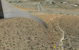
If the photo was triggered on the ground as the image metadata suggests, the drone should be 466 ft south-southeast of the launch point, just on the western side of the gully shown here.
i-ghjrjsb-XL.jpg
 
  • Like
Reactions: amstar
Following the gully southwards and looking around 20 ft to the west would probably be a good idea.
 
Thanks so Much !

Did you say, "Perhaps not on the ground?"
 
Thanks so Much !

Did you say, "Perhaps not on the ground?"
The image metadata suggests that the drone was at ground level when the photo was taken.
But we don't have flight data after the drone had descended to 40 ft to confirm that the photo was taken on that flight.
If it was, it's a reasonable assumption that the drone landed there.
 
The coordinates from that photo seems to be a reasonable continuation path from where the log stops recording ... I would definitely start the search from that photo position.

The log stops at 12:20:23 PDT ... but the photo is taken 12:23:49 PDT. Did you move away from the home point to another location during that time in between?

1618737360265.png
 
Last edited:
Thanks for all the replies.

Can I interact with any of these maps when searching? Get a sense of getting closer to the drone?

Any clue in the data as to why the drone went done?
 
Thanks for all the replies.

Can I interact with any of these maps when searching? Get a sense of getting closer to the drone?

Any clue in the data as to why the drone went done?
Borrow a handheld GPS or use a GPS waypoint app on your phone to find the location.
Or use Google Earth on your phone.

The drone came down because you initiated RTH.
But your joystick input put he drone off course toward the SE on the autodescent.

We haven't seen any data for what happened after signal was lost with the drone still 40 feet up, but it will have continued descending.
But you must have had signal to trigger the camera to take that picture and get the metadata from the image.

If you were able to trigger the camera, did you also have control to keep the drone going further SE after the data above ended?
Can you give any more information?
 
Thanks for all the help! I will try early in the morning.
In the FlyApp is "FIND MY DRONE." You have to go into the settings page to find it on main page. That would have possibly led you to the drone within a short time of it going down. I've never had to use it personally - so others will have to chime in as to actual value of trying to use it.

Good luck in your search.
 
Borrow a handheld GPS or use a GPS waypoint app on your phone to find the location.
Or use Google Earth on your phone.

The drone came down because you initiated RTH.
But your joystick input put he drone off course toward the SE on the autodescent.

We haven't seen any data for what happened after signal was lost with the drone still 40 feet up, but it will have continued descending.
But you must have had signal to trigger the camera to take that picture and get the metadata from the image.

If you were able to trigger the camera, did you also have control to keep the drone going further SE after the data above ended?
Can you give any more information?
Initially, I was trying to shoot a reveal as rising above the hill. Perhaps altitude too low after passing the hill created a loss of signal? (Just a guess). Also, a bit windy that morning and received one warning earlier in the day.

I looked this morning for a few hours without success. The terrain is desert and brushes so not great for searching by myself. Expanded the search area from "Lost Signal" but still no luck.

No cell service in the area to provide a live map or further clues. Chalk one up as a learning experience.

The area is near some well-traveled hiking trails so slight possibility it was found by someone?
 
I was there just a few months ago when we visited Las Vegas. The parking lot you took off from is to the right. Taken with my MA2. Good news is there aren't any trees it could've gotten stuck in. Good luck finding it.

PSX_20201209_165934[1].jpg
 
I recently lost my drone and was of course panicked. I found on the DJIGo4 app how to find my drone. Open the app
and on the main page you will see 3 horizontal lines on the top right. Click that, go to "Find My Drone". It will show you your relative position to the lost drone and you can walk right up to it. It will also let you ping your drone if you still have battery left.
 
Click that, go to "Find My Drone". It will show you your relative position to the lost drone and you can walk right up to it.
Find my drone is misleadingly named.
It's more like find where my drone was when it last had a signal connection to the controller.

That's fine if the drone was within signal range as it came down to the ground.
But it's no use if your drone was in flight and lost signal as it went further away or behind an obstacle that blocked signal.
 
Lycus Tech Mavic Air 3 Case

DJI Drone Deals

New Threads

Forum statistics

Threads
131,647
Messages
1,564,898
Members
160,513
Latest member
swaggyC