

Hello everyone, I have a problem with SC, the map blocks the yellow zone and it cannot be removed. It is apparently a minor problem, but it makes it difficult to see the map due to the yellow coating. DJI support has been telling me for months that an upcoming update will fix it ...
Is there any way to fix this problem? (I've already tried to ignore) I attach application update data and flight bases


The map does not work well, it is not able to load the satellite view either.

Is there any way to fix this problem? (I've already tried to ignore) I attach application update data and flight bases
The map does not work well, it is not able to load the satellite view either.
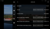
Attachments

Last edited:


