DJI Mavic, Air and Mini Drones
Friendly, Helpful & Knowledgeable Community
Join Us Now

Mavic 3 flyaway

AKAurora

Active Member
Joined
Jul 18, 2022
Messages
43
Reactions
29
Age
39
Location
Colorado
I went on a family trip to Telluride CO. I drove up to the base of Bridal Veil Falls and took my Mavic 3 off after waiting for about ~30 sec for it to update home point and get 12+ (I think 16) sat connections. Well, I started video and started to ascend from the auto hover altitude and took video going up the fall. I got to the top of the falls (I was back about 400 feet from them) and the drone started backing up with no input from me. After a momentary freakout, I tried to adjust altitude (btw, only 6mph winds, almost nothing to feel) and it started to drift in a half-moon shape circle before crashing and getting lost. During this, I was getting disconnection on video and random drops. I got video back just long enough to see it dive into the trees.
After about an hour of searching and there being no signal to connect to in order to use the "find my drone" I gave up. This was about 300 miles from home and a day trip (long drive back).
It's gone, and I can't figure out what happened. I thought maybe a signal jammer or something, but I'd assume it'd just hover or land if that was the case.

EDIT: DJI support came through and is sending me a new drone free of charge.
 
Last edited:
Here is the flight record.
 

Attachments

  • DJIFlightRecord_2022-07-16_[17-07-57].txt
    158.9 KB · Views: 78
So, what is your own analysis of the flight log details?
How good was your VLOS? Could you really see the drone sufficiently to make flight control decisions based on your vision? How close the ground was the drone when you lost connection?
What was your set RTH altitude?
 
So, what is your own analysis of the flight log details?
How good was your VLOS? Could you really see the drone sufficiently to make flight control decisions based on your vision? How close the ground was the drone when you lost connection?
What was your set RTH altitude?
It was literally directly above me, roughly 300 ft up to the top of the falls, I could see it the entire time until it crashed. I was able to hike to the area it crashed, but unable to locate. RTH was 200ft, but my plan was straight up, straight down, and maybe some panning. The drone was directly above me when the connections went wonky and it started drifting/listing hard and it just kind of flew away on me with 0 input.
 
I suspect various pilot errors and misjudgments. You were flying at up to 49 mph; either intentionally or because of windy conditions. I suspect that you did not have adequate VLOS to actually know what the drone was doing. Perhaps the non-direct route to the falls because of winds blowing the drone off course, or your were attempting to avoid obstructions. Losing signal when flying in mountains is dangerous.
In the end the drone was too close to the ground as indicated by the visual altitude of 13 feet and the drone crashed into something.
 
  • Haha
Reactions: Ex Coelis
The log shows it was over 500 from home point, so not directly overhead.
So, it's back to the strong wind at altitude. Wind can be extremely strong and variable over mountainous terrain.
If you had AirData you could upload the .txt file yourself to find out the wind aloft.
 
Do you have any low-resolution images cached on your device?
 
I suspect various pilot errors and misjudgments. You were flying at up to 49 mph; either intentionally or because of windy conditions. I suspect that you did not have adequate VLOS to actually know what the drone was doing. Perhaps the non-direct route to the falls because of winds blowing the drone off course, or your were attempting to avoid obstructions. Losing signal when flying in mountains is dangerous.
In the end the drone was too close to the ground as indicated by the visual altitude of 13 feet and the drone crashed into something.
There was 0 wind, I was in CINE mode (slow action, won't go that fast). I went straight up above me, started to pan left/right and that's when it went haywire. There was literally, at most, a 6mph wind. VLOS was directly above me (I was getting a video going up the falls, pan left and right at the top, come down). and I got up, and it started going backwards, than tilting (you can see the tilt on the logs) and just hit the trees on the other side of the river. I went straight up from where I took off (300ish feet up, easy VLOS) and didn't tell it to go forward or back, was literally panning. My stick inputs are after it started to take off on me (again, in logs). I panicked and was trying to get it back, but it was BVLOS at this point.
 
It was literally directly above me, roughly 300 ft up to the top of the falls, I could see it the entire time until it crashed. I was able to hike to the area it crashed, but unable to locate. RTH was 200ft, but my plan was straight up, straight down, and maybe some panning. The drone was directly above me when the connections went wonky and it started drifting/listing hard and it just kind of flew away on me with 0 input.

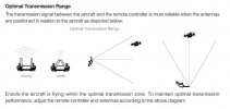
Depending on the antenna orientation of the controller flying directly above it might cause connection issues. Hope one of the log decoding experts will chime in. @sar104
 

Attachments

  • 195044as233xt8tppux2uc.jpg
    195044as233xt8tppux2uc.jpg
    51.4 KB · Views: 49
There was 0 wind, I was in CINE mode (slow action, won't go that fast). I went straight up above me, started to pan left/right and that's when it went haywire. There was literally, at most, a 6mph wind. VLOS was directly above me (I was getting a video going up the falls, pan left and right at the top, come down). and I got up, and it started going backwards, than tilting (you can see the tilt on the logs) and just hit the trees on the other side of the river. I went straight up from where I took off (300ish feet up, easy VLOS) and didn't tell it to go forward or back, was literally panning. My stick inputs are after it started to take off on me (again, in logs). I panicked and was trying to get it back, but it was BVLOS at this point.
I wasn't even near the top of the mountains, this particular valley and the top of the falls is still several hundred feet below the tops of the mountains. I get winds can change, but even the weather and everything had it at 6mph winds. And within 10 minutes I was near the crash site, or last known location, and 0 wind there. It was super odd in the fact that the controller and video was getting choppy/disconnecting during this whole process. Where it crashed was due to flyaway, not due to me flying it bvlos.
 
  • Like
Reactions: Gringorio
Depending on the antenna orientation of the controller flying directly above it might cause connection issues. Hope one of the log decoding experts will chime in. @sar104
I have the RCPro remote and had the antennas oriented straight out as the user manual states for flying directly above. Unless I did something horribly wrong, this may have just been a fluke/freak accident. I'm still not sure.
 
  • Like
Reactions: Gringorio
Just based on the log data you presented it looks like it got caught by a very strong wind at 45 sec into the flight and 380 feet ATL. That seems to be right over perhaps a pass where the wind would have been strong the drone was also facing away from the falls. That would have been an opportunity to quickly descent to a wind free level. The extreme tilt implies the drone attempting and failing to hold position in the wind. You don't have any winds aloft data.
 
I went on a family trip to Telluride CO. I drove up to the base of Bridal Veil Falls and took my Mavic 3 off after waiting for about ~30 sec for it to update home point and get 12+ (I think 16) sat connections. Well, I started video and started to ascend from the auto hover altitude and took video going up the fall. I got to the top of the falls (I was back about 400 feet from them) and the drone started backing up with no input from me. After a momentary freakout, I tried to adjust altitude (btw, only 6mph winds, almost nothing to feel) and it started to drift in a half-moon shape circle before crashing and getting lost. During this, I was getting disconnection on video and random drops. I got video back just long enough to see it dive into the trees.
After about an hour of searching and there being no signal to connect to in order to use the "find my drone" I gave up. This was about 300 miles from home and a day trip (long drive back).
It's gone, and I can't figure out what happened. I thought maybe a signal jammer or something, but I'd assume it'd just hover or land if that was the case.
Just seems like as you were going up to the fall, the drone lost signal and the low light warning came on , at some point RTH must have kicked in and maybe you panicked, and cancelled it , at that point without GPS signal it just drifted away with the winds of the falls .

If there was pilot error it was just cancelling the RTH , or what ever happened at that point.

Phantomrain.org
Gear to fly in the Rain. Land on the Water, and play with the falls.
 
Just based on the log data you presented it looks like it got caught by a very strong wind at 45 sec into the flight and 380 feet ATL. That seems to be right over perhaps a pass where the wind would have been strong the drone was also facing away from the falls. That would have been an opportunity to quickly descent to a wind free level. The extreme tilt implies the drone attempting and failing to hold position in the wind. You don't have any winds aloft data.
That's another thing, I was definitely facing the falls the entire time. It's so hard to explain, but I attempted to descend to no avail. It didn't even try. No high wind warnings appeared during the flight, either. It almost acted as though I lost a motor or the thing just wigged out. No tree movement up near where it was (I was watching it at first trying to recover it as it drifted backwards) and no wind near where it went down (about 100ft lower than where it started drifting).
 
Just seems like as you were going up to the fall, the drone lost signal and the low light warning came on , at some point RTH must have kicked in and maybe you panicked, and cancelled it , at that point without GPS signal it just drifted away with the winds of the falls .

If there was pilot error it was just cancelling the RTH , or what ever happened at that point.

Phantomrain.org
Gear to fly in the Rain. Land on the Water, and play with the falls.
The RTH was me pushing the button to try to get it to come home as it wasn't taking/responding to my input.
 
Just seems like as you were going up to the fall, the drone lost signal and the low light warning came on , at some point RTH must have kicked in and maybe you panicked, and cancelled it , at that point without GPS signal it just drifted away with the winds of the falls .

If there was pilot error it was just cancelling the RTH , or what ever happened at that point.

Phantomrain.org
Gear to fly in the Rain. Land on the Water, and play with the falls.
Low light warning kicked on at the end when it went into the trees, too.
 
Here's the notification log: nothing odd except the ambient light issue when VPS went off line. And the winds aloft were minimal as stated - less than 7 mph at 300 feet. The odd thing is the drone was descending when things went bonkers. If I had to guess, the drone got below tree line, RF was lost, Auto RTH happened sans VPS, and the rest is history.

Trees are just as good as rocks for blocking RF, sometimes better. And my SWAG for a moral: never fly the drone where you can't see it. But, those 45+ MPH speeds in Cine mode are suspicious - like perhaps the electronics went berserk midflight.
Capture.JPG
 
  • Like
Reactions: Jbizzle and Pile
Lycus Tech Mavic Air 3 Case

DJI Drone Deals

New Threads

Forum statistics

Threads
130,584
Messages
1,554,091
Members
159,585
Latest member
maniac2000