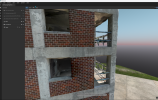
I finally had a chance to use the M3E's new slope and geometric shape planners.
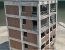
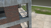
The slope produced an incredibly detailed facade of a building that could be easily used to inspect the building.
For a full building I would need 4 slope missions and a traditional nadir for the roof or I could manually adjust the last upper flight lines to angle the camera down more.
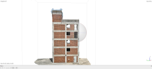
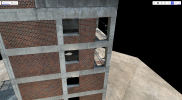
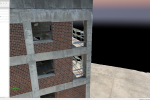
I next tried the geometric planner and it also made a very detailed model of the building and used 369 images.
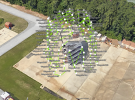
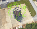
My final test will be Agisoft's Mission planner which has you make a low resolution model of the area of interest. Then Agisoft will make a flight plan that can avoid obstacles in the area of interest such as powerlines and other hazards.
Agisoft's flight plan interestingly enough will only need 260 images to fully cover the building as compared to Pilot 2's geometric planner needing 369. This is around 30% less images, so this will be a dramatic decrease in processing time, especially scaled to larger projects (If this ratio holds true for other structures).
I will post the result of the resulting models from the Pilot 2 geomtric planner vs Agisoft planner.
Agisoft Mission Planner
While oblique flights in the past have made some incredible models, these new flight modes ensure that the buildings sides are as good as the roof. You can now see under eaves and such and the GSD for the walls is equal to the roof.
The slope produced an incredibly detailed facade of a building that could be easily used to inspect the building.
For a full building I would need 4 slope missions and a traditional nadir for the roof or I could manually adjust the last upper flight lines to angle the camera down more.

I next tried the geometric planner and it also made a very detailed model of the building and used 369 images.
My final test will be Agisoft's Mission planner which has you make a low resolution model of the area of interest. Then Agisoft will make a flight plan that can avoid obstacles in the area of interest such as powerlines and other hazards.
Agisoft's flight plan interestingly enough will only need 260 images to fully cover the building as compared to Pilot 2's geometric planner needing 369. This is around 30% less images, so this will be a dramatic decrease in processing time, especially scaled to larger projects (If this ratio holds true for other structures).
I will post the result of the resulting models from the Pilot 2 geomtric planner vs Agisoft planner.
Agisoft Mission Planner


While oblique flights in the past have made some incredible models, these new flight modes ensure that the buildings sides are as good as the roof. You can now see under eaves and such and the GSD for the walls is equal to the roof.


