DJI Mavic, Air and Mini Drones
Friendly, Helpful & Knowledgeable Community
Join Us Now

Mini 2 sphere panorama image size low and not recognised in facebook

Chris.Eng

Member
Joined
Dec 31, 2020
Messages
5
Reactions
18
Age
48
Location
Norwich
I thoroughly enjoy taking Spherical panoramas with my MA2 and was happy to see the same function on my new Mini 2.
However, the final image in the DJI Fly app is only approx 1.4Mbytes (relatively low resolution 4096x2048) and does not seem to contain the necessary EXIf data for facebook to recognise as a spherical pano.
Even trying to share directly from the DJI fly app to facebook does not work. ( it works fine with the same app and my MA2)
Any ideas or is this just a bug at the moment?
( I have also tried saving as JPG+raw but just ended up with a folder full of the original images on the SD card and no way of stitching them on my mac)
 
  • Like
Reactions: Sub779
To get Facebook to recognize it, you'll have to re-attach the exif info that is missing (not sure why DJI can't just keep the exif data attached to the image?). There are super convoluted ways of using websites or programs to add in the info needed to the photos exif data.

OR, the easiest way I found was to use the Google Street View app on your phone. Essentially you import the photo to Street View app, save it back to your phone from the Street View app (which fixes the exif data), then upload to Facebook:
-In the Street View app, hit the + icon in the bottom right, and add your flat 360 photo that you got from the DJI app, that's saved on your phones camera roll. This will turn it into an interactive 360.
-Then hit the share button and "Share Privately", which allows you to then save it to your phone.
-Now upload that image saved from the Street View app to Facebook and it should work.
(You can always Publish them to the public, and they'll show up on street view and google earth which could be really cool for the world to see!)

As far as using the raw images, or individual images to stitch them on your mac... It definitely results in a much higher resolution image, but also involves a convoluted process of finding software to download to Mac that will do it for you. Seems there are great free ways to do it for PC, but limited on Mac. I didn't find many great options that were free that wouldn't leave a massive watermark on the image. I tried the trial version of the PTgui program which was great, but to remove the obnoxious watermarks it costs $157, which is silly. There are also tons of guides showing how to use Photoshop and Lightroom, but again I'm not willing to get caught up in a monthly subscription to those at the moment, and just resorted to using the lower res image from the DJI app. In all honestly, all my friends and family on Facebook will never notice any difference in a low res version and the high res version. I even asked a few people if they noticed much difference and they didn't. It seems I'm the only one that it's going to annoy, and the content of the image is way more important anyways. An aerial 360 is going to blow most friends/family away regardless of the resolution.

I hope others with more experience will care to share.

Good luck, let me know if you have any trouble or further questions. Post up your 360 here if you care to, would love to see it!
 
Last edited:
To get Facebook to recognize it, you'll have to re-attach the exif info that is missing (not sure why DJI can't just keep the exif data attached to the image?). There are super convoluted ways of using websites or programs to add in the info needed to the photos exif data.

OR, the easiest way I found was to use the Google Street View app on your phone. Essentially you import the photo to Street View app, save it back to your phone from the Street View app (which fixes the exif data), then upload to Facebook:
-In the Street View app, hit the + icon in the bottom right, and add your flat 360 photo that you got from the DJI app, that's saved on your phones camera roll. This will turn it into an interactive 360.
-Then hit the share button and "Share Privately", which allows you to then save it to your phone.
-Now upload that image saved from the Street View app to Facebook and it should work.
(You can always Publish them to the public, and they'll show up on street view and google earth which could be really cool for the world to see!)

As far as using the raw images, or individual images to stitch them on your mac... It definitely results in a much higher resolution image, but also involves a convoluted process of finding software to download to Mac that will do it for you. Seems there are great free ways to do it for PC, but limited on Mac. I didn't find many great options that were free that wouldn't leave a massive watermark on the image. I tried the trial version of the PTgui program which was great, but to remove the obnoxious watermarks it costs $157, which is silly. There are also tons of guides showing how to use Photoshop and Lightroom, but again I'm not willing to get caught up in a monthly subscription to those at the moment, and just resorted to using the lower res image from the DJI app. In all honestly, all my friends and family on Facebook will never notice any difference in a low res version and the high res version. I even asked a few people if they noticed much difference and they didn't. It seems I'm the only one that it's going to annoy, and the content of the image is way more important anyways. An aerial 360 is going to blow most friends/family away regardless of the resolution.

I hope others with more experience will care to share.

Good luck, let me know if you have any trouble or further questions. Post up your 360 here if you care to, would love to see it!
Thanks for the great answer on this!
agree that the options on Mac are very limited, I too tried ptgui trial and the hi res image from the raw files was astounding. It’s such a shame that the DJI software chooses to take this 50-60Mbyte image and reduce it down to only 1.4Mbyte.
at least on the MA2 it’s only reduced to around 10Mbyte and retains good detail.
 
I hadn't realized that DJI now uses the Fly app to compose Panos until I saw a YT clip about the new Attitude indicator. In M2, the stitching was done in firmware on board the AC and stored on the SD card.

Dumb idea to download and process, leaving results on app.
 
  • Like
Reactions: LogoQRcode.com
To get Facebook to recognize it, you'll have to re-attach the exif info that is missing (not sure why DJI can't just keep the exif data attached to the image?). There are super convoluted ways of using websites or programs to add in the info needed to the photos exif data.

OR, the easiest way I found was to use the Google Street View app on your phone. Essentially you import the photo to Street View app, save it back to your phone from the Street View app (which fixes the exif data), then upload to Facebook:
-In the Street View app, hit the + icon in the bottom right, and add your flat 360 photo that you got from the DJI app, that's saved on your phones camera roll. This will turn it into an interactive 360.
-Then hit the share button and "Share Privately", which allows you to then save it to your phone.
-Now upload that image saved from the Street View app to Facebook and it should work.
(You can always Publish them to the public, and they'll show up on street view and google earth which could be really cool for the world to see!)

As far as using the raw images, or individual images to stitch them on your mac... It definitely results in a much higher resolution image, but also involves a convoluted process of finding software to download to Mac that will do it for you. Seems there are great free ways to do it for PC, but limited on Mac. I didn't find many great options that were free that wouldn't leave a massive watermark on the image. I tried the trial version of the PTgui program which was great, but to remove the obnoxious watermarks it costs $157, which is silly. There are also tons of guides showing how to use Photoshop and Lightroom, but again I'm not willing to get caught up in a monthly subscription to those at the moment, and just resorted to using the lower res image from the DJI app. In all honestly, all my friends and family on Facebook will never notice any difference in a low res version and the high res version. I even asked a few people if they noticed much difference and they didn't. It seems I'm the only one that it's going to annoy, and the content of the image is way more important anyways. An aerial 360 is going to blow most friends/family away regardless of the resolution.

I hope others with more experience will care to share.

Good luck, let me know if you have any trouble or further questions. Post up your 360 here if you care to, would love to see it!

Thanks for the post, your suggestion for Google Street View worked a treat howeve the resolution is terrible.
Aew we able to use a bigger file rather than the tiny ~1mb file?
Or are we just waiting for DJI to release another update to 'hopefully' correct this issue...... fingers crossed.
 
Thanks for the post, your suggestion for Google Street View worked a treat howeve the resolution is terrible.
Aew we able to use a bigger file rather than the tiny ~1mb file?
Or are we just waiting for DJI to release another update to 'hopefully' correct this issue...... fingers crossed.
You bet! Yeah unfortunately to solve the low resolution issue it looks like you’d have to employ using a standalone program to stitch the individual photos. I won’t hold my breath with waiting for DJI to change that, but who knows. I forget the max file size for the Street View app, but I’m pretty sure you can drop much larger pics into it if you do stitch the individual photos.

If anyone knows of any good free or low cost options for Mac, I’m all ears!
 
Im interested to see answers on this. I experienced the same problem
I recommend on iOS an app called 'edit360' (made in japan, and similar app by the same author - meta360) - while we can do there some simple adjustments to the 'flat 360' photo, the extra benefit is that the app saves the photo with correct metadata. I tried with a success - I opened dji's broken sphere, and just saved it there. Voila, I have a 360 photo now.
 
  • Like
Reactions: Chris.Eng
I recommend on iOS an app called 'edit360' (made in japan, and similar app by the same author - meta360) - while we can do there some simple adjustments to the 'flat 360' photo, the extra benefit is that the app saves the photo with correct metadata. I tried with a success - I opened dji's broken sphere, and just saved it there. Voila, I have a 360 photo now.
Thanks for that info. I found both apps, but they do not offer a trial period. Can you confirm youre now able to post the sphere photo on FB or send to someone in messenger and they see it as the 360 view without the need of viewing apps?
 
I only ask because the app preview shows a very different style of 360 photo than i get with the drone.20210107_091403.jpg
 
Thanks for that info. I found both apps, but they do not offer a trial period. Can you confirm youre now able to post the sphere photo on FB or send to someone in messenger and they see it as the 360 view without the need of viewing apps?
Yes, it helped me to put correctly my spheres on Google Photos and FB (I use only 'edit360', I did not buy 'meta360'), but no luck with FB Messenger or eg. Whatsapp - but I believe they simply ignore 'sphere' photos.
 
  • Like
Reactions: Sub779
FYI The Panoramic mode on the Mini 2 will not save jpegs any larger than 3 megapixels in size. So the stitching from 3MP files isn't going to yield much more than roughly 9 megapixels total (with the overlap that it has).

So the only way to get it larger is to go into camera setting and turn on RAW+Jpeg, and use the DNG raw files as a source on a computer, since the DNG files are are the full 12 megapixel resolution.

Far as facebook goes, it won't recognize it as a 360 camera because it's not, you have to do the Exif modification as others have mentioned.
 
  • Like
Reactions: TheDude
Thanks for that info. I found both apps, but they do not offer a trial period. Can you confirm youre now able to post the sphere photo on FB or send to someone in messenger and they see it as the 360 view without the need of viewing apps?
BTW: I found a way to add correct exif metadata using free exiftool tool (available i.a. on windows/mac/linux/raspberry pi/etc). It should be easy for a computer savvy person.
 
Last edited:
Righto guys, i have another method for you. Its free and pretty much straight forward. Took me half a day to figure out.
Firstly, go to this website NadirPatch.com make panorama photo for facebook
Upload your sphere image, the website converts it. Then download the image and save it in your photos.
Then get the app photo exif editor, there you upload your converted photo, edit the make and model of the camera. Make is RICOH, model is RICOH THETA S, the save.
The picture is ready to send to FB. when you add it to facebook, be sure to press EDIT prior to posting the pic, you dont actually edit anything, for some reason pressing edit, then pressing DONE turns it into the 360 degree view
I've found only doing your first step, going to NadirPatch.com/exif and uploading/downloading the image gets it ready for FB, without having to do the second step you listed.

Seems Nadirpatch.com/exif is the only one not to degrade the image from the original, and I'll be using this from now on instead of the Google Street View app. Thanks!
 
Just tried the nadirpatch exif upload and download on my iPhone and it worked great and uploaded as 360 to facebook with minimal loss of quality.
I can understand DJI limiting the output resolution from the app for the mini 2 in order to protect the more expensive range of drones, but it’s very disappointing that my MA2 uses the same app and uploads 9Mbyte high res 360 panoramas directly to Facebook from the fly app.
 
Last edited:
  • Like
Reactions: Sub779
BTW: I found a way to add correct exif metadata using free exiftool tool (available i.a. on windows/mac/linux/raspberry pi/etc). It should be easy for a computer savvy person.
What command did you use?
 
What command did you use?
It's not the best place to discuss the code but in short (Windows version):

Code:
exiftool -overwrite_original -ProjectionType="equirectangular" -UsePanoramaViewer="True" -"PoseHeadingDegrees<$exif:GPSImgDirection" -"CroppedAreaImageWidthPixels<$ImageWidth" -"CroppedAreaImageHeightPixels<$ImageHeight" -"FullPanoWidthPixels<$ImageWidth" -"FullPanoHeightPixels<$ImageHeight" -CroppedAreaLeftPixels="0" -CroppedAreaTopPixels="0" your_filename.jpg
This adds correct data to jpgs.

For Linux/Mac you must replace double quotes by single quotes (so all variables starting with $ are correctly used by exiftool and not by shell)
 
  • Like
Reactions: SethB
To get Facebook to recognize it, you'll have to re-attach the exif info that is missing (not sure why DJI can't just keep the exif data attached to the image?). There are super convoluted ways of using websites or programs to add in the info needed to the photos exif data.

OR, the easiest way I found was to use the Google Street View app on your phone. Essentially you import the photo to Street View app, save it back to your phone from the Street View app (which fixes the exif data), then upload to Facebook:
-In the Street View app, hit the + icon in the bottom right, and add your flat 360 photo that you got from the DJI app, that's saved on your phones camera roll. This will turn it into an interactive 360.
-Then hit the share button and "Share Privately", which allows you to then save it to your phone.
-Now upload that image saved from the Street View app to Facebook and it should work.
(You can always Publish them to the public, and they'll show up on street view and google earth which could be really cool for the world to see!)

As far as using the raw images, or individual images to stitch them on your mac... It definitely results in a much higher resolution image, but also involves a convoluted process of finding software to download to Mac that will do it for you. Seems there are great free ways to do it for PC, but limited on Mac. I didn't find many great options that were free that wouldn't leave a massive watermark on the image. I tried the trial version of the PTgui program which was great, but to remove the obnoxious watermarks it costs $157, which is silly. There are also tons of guides showing how to use Photoshop and Lightroom, but again I'm not willing to get caught up in a monthly subscription to those at the moment, and just resorted to using the lower res image from the DJI app. In all honestly, all my friends and family on Facebook will never notice any difference in a low res version and the high res version. I even asked a few people if they noticed much difference and they didn't. It seems I'm the only one that it's going to annoy, and the content of the image is way more important anyways. An aerial 360 is going to blow most friends/family away regardless of the resolution.

I hope others with more experience will care to share.

Good luck, let me know if you have any trouble or further questions. Post up your 360 here if you care to, would love to see it!
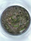
Thank you. As requested an example.Screenshot_20210120-123149.jpeg
 

DJI Drone Deals

New Threads

Forum statistics

Threads
134,568
Messages
1,596,346
Members
163,068
Latest member
Liger210
Want to Remove this Ad? Simply login or create a free account