First off it was my pilot error that caused the crash. I was flying low looking for a lost fixed wing airplane and I drove the Mav into a hill side, sideways.
I looked where it should be but no avail.
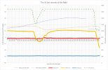
The csv files shows the last lat/lon and an altitude of about 12 feet. Is this AGL or measured from the take off point?
I was videoing when this happened and is there any chance that the video was saved on the controller/iPad?
No internet - rural area.
Thanks, this should be a simple case. Should be. Attached is the csv file.
Bill C


