DJI Mavic, Air and Mini Drones
Friendly, Helpful & Knowledgeable Community
Join Us Now

New NFZ?

LenSavage

Well-Known Member
Joined
Jan 21, 2019
Messages
249
Reactions
324
I have traveled from San Diego to fly and video my client's construction project in Beverly Hills a dozen times in the past few months - no advisories - free flight area.
Yesterday, my controller displayed 'in NFZ'. It doesn't show on Airmap or b4ufly, so what happened?

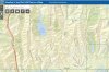
Location: 9982 Beverly Grove Dr, Beverly Hills, CA 90210 34.0967492,-118.427614

Progress:


So yesterday, I just walked around with the DSLR to get SOMETHING:


Thoughts?
 
I learned more than I ever wanted to know about geo zones recently and will no longer fly an op without checking Fly Safe...turns out there is an abandoned airfield in my area that does not show on Airmap or Kittyhawk...I spent an entire Saturday figuring that one out...
 
I learned more than I ever wanted to know about geo zones recently and will no longer fly an op without checking Fly Safe...turns out there is an abandoned airfield in my area that does not show on Airmap or Kittyhawk...I spent an entire Saturday figuring that one out...
Probably cause it’s not an NFZ and it shouldn’t be a geozone. Apparently DJI is receptive to removing these erroneous zones of you let them know about them but not good a proactively removing them so you have to tell them about those
 
  • Like
Reactions: Bobvt and dawgpilot
So - I would normally go to AirMap to get LAANC authorization to fly.
Attached is the current AirMap image that shows no such NFZ, and the FAA map (also attached) shows no such NFZ.

If I try to apply for LAANC authorization/variance to fly, it will reply 'no restrictions'.
And yet, the drone will not start or fly there - because of DJI data.
Not sure what to do.
Catch 22: It appears that we would need to get LAANC authorization before requesting DJI to unlock for flight.
Because the NFZ doesn't show on AirMap and FAA's maps, we cannot make the first step - requesting authorization that they do not show.
It also appears that it is likely that, once unlocked, functions including Waypoints which we need for continuity would not be available; hand-fly only.NFZ.jpgNFZ.jpgAirmap-BG.jpg
 

Attachments

  • FAA-BG.jpg
    FAA-BG.jpg
    104.2 KB · Views: 8
I used fly safe to unlock my NFZ and drone deploy was able to fly the area...no LAANC needed...it never showed on Airmap or Kittyhawk either...
 
That's a TFR blocking you from flying. It seems Airmap might have an issue showing TFRs. Kittyhawk may have the same issue.

FAA needs to fix their system so that TFRs are incorporated into their facilities map and Geographically visible. You're the second to get confused with this TFR.

I looked up that TFR. It's there as a precaution due to all the wildfires and has a 5 mile radius. It ends end of December.
 
Last edited:
Looks like a temporary flight restriction 10/28-12/28 according to the Fly Safe geo zone map...
Hate to be a PIA but I need some clarification. My Android play store has 3 different Fly Safe
1. FlySafe by Altitude Angel
2. FLYSAFE Commercial by AirMarket Inc
3. FlySafe! by Fellow7000

Which one are you referring to?

Thanks in advance for your reply
 

DJI Drone Deals

New Threads

Forum statistics

Threads
131,235
Messages
1,561,120
Members
160,188
Latest member
michalis