DJI Mavic, Air and Mini Drones
Friendly, Helpful & Knowledgeable Community
Join Us Now

Overhead/Bird's eye view photos of large areas; tips for large area that require multiple photos(stitching)

bleads

New Member
Joined
Mar 3, 2020
Messages
3
Reactions
7
Age
56
Location
Stockton, MO
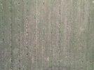
I need to take some overhead photos of some walnut planting acreages for an investor. The orchards are several acres each. Flying at 380 ft, it requires multiple pictures to capture one whole planting area. Also, when looking straight down, everything starts to look the same so it is very difficult to take multiple pictures and stitch them together without some type of landmark. I would appreciate any tips or methods for capturing an overhead/bird's eye/straight down view of an acreage in one image file. Thanks!

PS I've attached an example pic of the area
 

Attachments

  • DJI_0998-1024x768.JPG
    DJI_0998-1024x768.JPG
    223.2 KB · Views: 52
There's no attached picture and no information what drone you are using.
It's quite difficult to give you some advice without the basics.
 
  • Like
Reactions: bleads
I wonder if you could do a Hyperlapse using waypoints with a very long interval between shots and a relatively fast travel speed. Then stitch the originals together as a picture rather than a video? Just thinking out loud,
 
  • Like
Reactions: bleads
I wonder if you could do a Hyperlapse using waypoints with a very long interval between shots and a relatively fast travel speed. Then stitch the originals together as a picture rather than a video? Just thinking out loud,
Possibly, but depending on the drone, a mapping application may be much more accurate.
 
  • Like
Reactions: Fizzbang and bleads
Only if it can do waypoints. My suggestion is for something like an Air 2S.
Air 2s can't do native waypoints, but a mavic 2 pro and earlier can (but doesn't have a mechanical shutter to help cut down on the rolling shutter effect).

But at least the height is far enough that the images can be stitched without as much an impact on perspective shift at the edges.
 
I would appreciate any tips or methods for capturing an overhead/bird's eye/straight down view of an acreage in one image file.
People have been using drones for this purpose since drones became available.
You could use a dedicated mapping app and a supported drone or manually create a simple one with any drone
You need to fly across the scene, capturing a a number of images with good overlaps.
There are several different projections for stitching panoramas, but for what you want, you need to stitch them using a planar projection.
 
  • Like
Reactions: bleads
Thanks, all!! Sorry. Picture is now attached. It had rejected due to size.

Also...I failed to mention the drone I am flying. I am currently flying a DJI Air 2S. I also have a DJI Mavic 2 Pro but have been having calibration issues with it.
 
Thanks, all!! Sorry. Picture is now attached. It had rejected due to size.

Also...I failed to mention the drone I am flying. I am currently flying a DJI Air 2S. I also have a DJI Mavic 2 Pro but have been having calibration issues with it.
The Air 2S can use Litchi. That is probably your best bet.
 
The Air 2S can use Litchi. That is probably your best bet.
Just have to stay in good range as the way point method it has utilizes virtual stick commands, any disruption between the mobile device and drone will halt or alter the waypoint progress.

Probably start from a higher point to ensure there's an unobstructed clearance between rc and drone.
 
  • Like
Reactions: bleads
As said u dont mention yr drone. If yr serious about doing this as a business then you need to get the service of companies like Dronelink where this would be a trivial example. But DJI hasn‘t released the SDK for the M3 & some other drones so you’d have to fall back to the M2P which would be more than good enough for this.
He mentioned in post #8 about having an air 2s and a mavic 2 pro (but calibration issues in the M2P)
 
  • Like
Reactions: bleads
Before photos can be 'stitched together' they need to have the perspective distortion removed. The resulting orthogonal images may be stitched together to make an accurate orthomosaic image of the site. DroneDeploy.com has a mapping engine for a subscription fee. OpenDroneMap.org is an open source mapping engine, if you've got any server admin skills.
 
  • Like
Reactions: bleads
Manual flight with the "rule-of-thirds" grid and the diagonal grid activated. Judge your vertical and horizontal overlap by eye so that you get approximately 60-70% overlap between shots. Make sure the drone is static before you shoot each separate image. For a large area, fly a grid: 7 shots horizontal: drop down to your second "row" with the same overlap and shoot the 7 shot row #2 heading back towards your start point, drop down to row #3.... etc. Download MICROSOFT ICE v.2 (freeware and totally AWESOME) and run the 7/14/21/28 shot sequence through it. Result? 9 times out of 10 a perfect multi-megapixel pano. Just make sure your camera is 90 degrees gimbal-down.
If I try this manual method what do I use for stitching if I have a Mac?
 

DJI Drone Deals

New Threads

Forum statistics

Threads
134,629
Messages
1,597,027
Members
163,120
Latest member
imakshar
Want to Remove this Ad? Simply login or create a free account