Dear people,
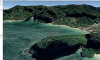
An unfortunate situation happened today to my drone while flying it I lost a signal and drone activated return home mode, at some point, it regained the signal and immediately after tried to land and landed in trees, it was still about 60% charged and was still sending video feed to the controller, but it was tilted up so footage was not useful. Gimble was not responding to the controller and drone was not able to get back to fly, so I had screenshots of what DJI GO4 app was showing, also GPS coordinates from the flight record in the app. The one thing I was able to do is to activate gimble calibration which moved the gimble and I've got to see a bit more useful image from the drone, but then gimble stuck for and also app in fly mode was showing constantly 10% gimble calibration overlay so at the end it didn't help much. We did scout the area where last GPS coordinates were recorded, and couldn't find a drone. Now we are back at the computer analyzing the data from drone what is strange is that crash coordinates are very close to the home position and we were physically close to it and couldn't hear the drone (to be clear around was loud too, but still). Would anybody please with experience be able to look at the log data and tell what is the most probable location (lon, lat) we should look for it?
An unfortunate situation happened today to my drone while flying it I lost a signal and drone activated return home mode, at some point, it regained the signal and immediately after tried to land and landed in trees, it was still about 60% charged and was still sending video feed to the controller, but it was tilted up so footage was not useful. Gimble was not responding to the controller and drone was not able to get back to fly, so I had screenshots of what DJI GO4 app was showing, also GPS coordinates from the flight record in the app. The one thing I was able to do is to activate gimble calibration which moved the gimble and I've got to see a bit more useful image from the drone, but then gimble stuck for and also app in fly mode was showing constantly 10% gimble calibration overlay so at the end it didn't help much. We did scout the area where last GPS coordinates were recorded, and couldn't find a drone. Now we are back at the computer analyzing the data from drone what is strange is that crash coordinates are very close to the home position and we were physically close to it and couldn't hear the drone (to be clear around was loud too, but still). Would anybody please with experience be able to look at the log data and tell what is the most probable location (lon, lat) we should look for it?