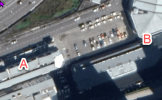
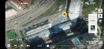
Kindly see the flight data, and I had a section of flight near an apartment block, which resulted in ATTI mode. I can say I've flown this path quite a number of times, maybe roughly at the same altitude even.
This is the first time my Mavic Air 2 has gone into ATTI mode and it did give me quite a scare at first. I encountered this on the way out and back, near the same location.
Questions:
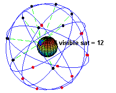
1. Am I right that being so close to tall buildings will occlude the GPS signals? Is this what happened?
2. Next time should I land immediately? Or should I just stay calm like I did and maneuver home via the FPV screen?
3. Should I increase altitude?
Thank you