You are using an out of date browser. It may not display this or other websites correctly.
You should upgrade or use an alternative browser.
You should upgrade or use an alternative browser.
2 Zoom Serious Drought in Southern California
- Thread starter Palerider
- Start date
Sadly, it's a stark look at a year without much rain or snow fall in the West. Great Video!
Our lake up here (Folsom Lake) is almost down to it's lowest point since the dam was finished in 1956. Some of the settlements that were there up to the 1940s are now out of the water. A lake further north (Lake Oroville) is getting to the point they may have to stop generating electricity. I hope we get more snow and rain this year, but not in epic proportions.
Our lake up here (Folsom Lake) is almost down to it's lowest point since the dam was finished in 1956. Some of the settlements that were there up to the 1940s are now out of the water. A lake further north (Lake Oroville) is getting to the point they may have to stop generating electricity. I hope we get more snow and rain this year, but not in epic proportions.
Tfscott
New Member
Hey Propwash, Actually since Jan 2010, Folsom Lake's lowest water level since then on December 4, 2015 was 348.68 feet above sea level and most of the old foundations were visible at that time. As of today the lake is only at 380.66 above sea level. The highest level was 464.53' above sea level set in July 14, 2011. I've been capturing and putting into an Access database the daily levels of the lake since 2015, but went back all the way to 2010. I got my first DJI drone in Oct 2015, the Phantom 3 Advanced.Sadly, it's a stark look at a year without much rain or snow fall in the West. Great Video!
Our lake up here (Folsom Lake) is almost down to it's lowest point since the dam was finished in 1956. Some of the settlements that were there up to the 1940s are now out of the water. A lake further north (Lake Oroville) is getting to the point they may have to stop generating electricity. I hope we get more snow and rain this year, but not in epic proportions.
I fly a lot at Folsom Lake, if your in the area, send me a PM. would like to meet up and fly some time. With all the new FAA stuff coming, i just added the DJI FPV to my collection and looking for an observer.
here is a link to the Department of Water Resources CDEC website for Folsom Lake where I get my data.
FOLSOM LAKE (FOL)
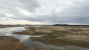
here is one of my first pic's of the Lake taken on Dec 6, 2015, lake level that day was at 349.02' above sea level.

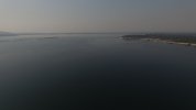
This pic, not the best was taken on Sep 1, 2017, lake level was 446.86' above sea level

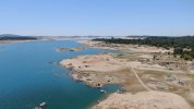
This pic was taken with my Mavic 2 Zoom on 5/12/2021, however about a3/4 of a mile further back, from doton's point. lake level was at 398.45' above sea level.

Happy and safe flying
inno
Last edited:
Hey Palerider
I moved out of the LA area back in 1995. I've been to that reservoir several times. Never saw it that empty. Great shots of it! Though it doesn't look familiar without the water.
Happy and safer flying
inno
@inno - thanks for the link to the lake level. I should have checked. I was reading an article talking about the foundations of Mormon Island being out of the water. Another article talked floating platforms with pumps to keep water flowing down river.
I'm not far from the lake. I've been thinking about going out there to catch the lake low. I wouldn't mind meeting up sometime.
I'm not far from the lake. I've been thinking about going out there to catch the lake low. I wouldn't mind meeting up sometime.
Reinier
Member
Beautiful film of an impressive landscape. Thank you for sharing these images!
Similar threads
- Replies
- 1
- Views
- 742
- Replies
- 2
- Views
- 740
- Replies
- 5
- Views
- 609
- Replies
- 3
- Views
- 863
DJI Drone Deals
New Threads
-
-
-
RC 2 Controller Firmware: v08.00.0000 Mini 4 or v08.01.0100 Mini 5
- Started by Calson
- Replies: 0
-
-


