


- Joined
- Sep 29, 2017
- Messages
- 181
- Reactions
- 25
- Age
- 77
I am finding the GPS location for waypoints in Litchi to be pretty far off. I've only flown them 3-4 times, so probably something I am doing wrong or don't know.
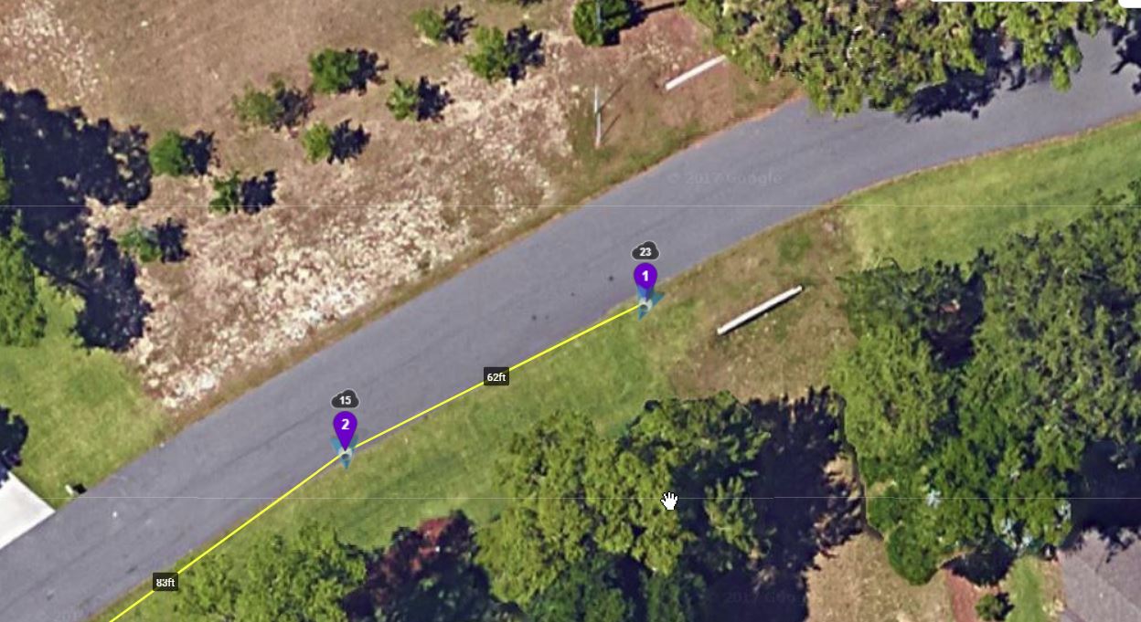
Below is a picture of the mission (topic is based on where it starts near the flagpole):
So I placed the drone in the street, what I consider to be pretty even with that flag pole. So, the very brief video below shows it taking off, then I start the mission, it turns and goes south for 20-25'. I'm wondering why it is so far off from the way point. I had 14 satellites in site. Any thoughts?


