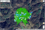
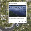
I thought I had seen and taken note of an App or something where you can take a picture or screen shot (of a map) and then overlay where the images were taken in a fairly quick and automatic way.
I'd like to give my clients a sort of "Image Map" so they can get an idea of what the image is depicting etc for those who can't easily decipher Aerial Images.
Mini 4 Pro if that matters.
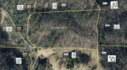
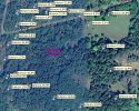
Basically something similar to this VERY rough draft:

I'd like to give my clients a sort of "Image Map" so they can get an idea of what the image is depicting etc for those who can't easily decipher Aerial Images.
Mini 4 Pro if that matters.
Basically something similar to this VERY rough draft:


