DJI Mavic, Air and Mini Drones
Friendly, Helpful & Knowledgeable Community
Join Us Now

Waypoint mission problem

shb

Well-Known Member
Joined
Jul 4, 2017
Messages
857
Reactions
427
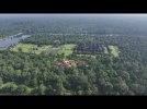
I'm in Cambodia flying out of signal range waypoint missions. So I'm flying toward Ankor Wat, to get some video. I decide to go to a high altitude to get the best shot. So when the drone comes back, it's doing a RTH, so I know something went wrong. I watch the video, and it when it went from the high altitude, to a low altitude, it overshot the low altitude by a mile, and went into the trees. Fortunately, the obstacle avoidance worked correctly, and it executed a RTH. This is something that I found by my house in the Philippines, when it almost hit the ground at a 30 feet wp. I told DJI about it then and they've done nothing to fix it. This is another reason I think they're stupid. Here's the email I just sent them:


A mission hit a tree, and did a RTH, because when your waypoint missions go from a high altitude, to a low altitude, it overshoots the low altitude by miles, and gets way too low. I told you this a long time ago, and you never fixed it. Great job!
 
What do you think the heights that you are set are based on, local AGL or relative to the takeoff point? Did you fly the drone up a slope to reach your destination?

Re garding "I watch the video, and it when it went from the high altitude" I am curious, does that mean you were neither looking at the drone with your own eyes nor watching what the drone was doing live on the screen as it was flying?
 
Last edited:
What height is your RTH set to?
What do you mean by "low altitude?"
RTH is set as a fixed altitude, and not a range of "low" to high.
 
What do you think the heights that you are set are based on, local AGL or relative to the takeoff point? Did you fly the drone up a slope to reach your destination?

Re garding "I watch the video, and it when it went from the high altitude" I am curious, does that mean you were neither looking at the drone with your own eyes nor watching what the drone was doing live on the screen as it was flying?
Actually the terrain does seem to rise near Angkor Wat, because the Drone, even a level flight, seems to get closer to the trees, but it doesn't rise that much, I was well above the trees even an Angkor Wat. Of course, with no signal, you can't see the drone from 5 miles away.
 
What height is your RTH set to?
What do you mean by "low altitude?"
RTH is set as a fixed altitude, and not a range of "low" to high.
My RTH is set around 250 feet. I was told that zoning laws in Siem Reap prevent any building from being higher than ankor wat, which is around 250 ft, but in fact hardly any building is even a hundred feet, so it's good for flying a drone. the only thing is here seem to be a whole lot of cell towers that you have to worry about, but other than that you could set the return to home to 150 ft.
 
Since since we're talking about, ankor Wat, I was just looking on the internet, and there's really no map of where you can't fly. You know, they just say you can't fly around anchor wat, but they don't say exactly where you drone can't go. so I can take a taxi to a fairly close location, and take video of anchor wat, and use my 7x camera to stay far away from Angkor Wat.
 
Actually the terrain does seem to rise near Angkor Wat, because the Drone, even a level flight, seems to get closer to the trees, but it doesn't rise that much, I was well above the trees even an Angkor Wat. Of course, with no signal, you can't see the drone from 5 miles away.
You did not answer the question "What do you think the heights that you are set are based on, local AGL or relative to the takeoff point? "
To which I will add, what heights did you have set for the various points in your flight?

Regarding "Of course, with no signal, you can't see the drone from 5 miles away." and your other threads.
I think you are, in general, flying you drone in a reckless manner and some day you are going to lose it, which might not be a bad thing.
Worse, I fear some innocent person is going to get hurt as a consequence of your use of your drone or drones.

You state that in this particular flight " the only thing is here seem to be a whole lot of cell towers that you have to worry about, " yet you fly in such a way that you can not see the drone or, via the screen, what the drone is approaching and even if you could see the drone you do not even have the possiblity of controlling the drone.

Do you think the way in which you fly your drone or from where you fly your drone, is sensible or 'clever' or 'cool'?
In general I am left wondering how much you know about the way the drone is supposed to behave.
 
Last edited:
  • Like
Reactions: @Rip and Mecan
You did not answer the question "What do you think the heights that you are set are based on, local AGL or relative to the takeoff point? "
To which I will add, what heights did you have set for the various points in your flight?

Regarding "Of course, with no signal, you can't see the drone from 5 miles away." and your other threads.
I think you are, in general, flying you drone in a reckless manner and some day you are going to lose it, which might not be a bad thing.
Worse, I fear some innocent person is going to get hurt as a consequence of your use of your drone or drones.

You state that in this particular flight " the only thing is here seem to be a whole lot of cell towers that you have to worry about, " yet you fly in such a way that you can not see the drone or, via the screen, what the drone is approaching and even if you could see the drone you do not even have the possiblity of controlling the drone.

Do you think the way in which you fly your drone or from where you fly your drone, is sensible or 'clever' or 'cool'?
In general I am left wondering how much you know about the way the drone is supposed to behave.
Sorry, all the waypoint altitudes are relative to the take off point. As Martin Luther King said, people shouldn't obey unjust laws.
 
Sorry, all the waypoint altitudes are relative to the take off point. As Martin Luther King said, people shouldn't obey unjust laws.
I don't know what Mr King has to do with "To which I will add, what heights did you have set for the various points in your flight?"
 
  • Like
Reactions: @Rip
Here's the response I got from DJI. The same thing happened with my Mavic 3. I told them about it. They did nothing. Now it happens with my Mavic 3 pro, and they want me to send it in. There's nothing wrong with my drones. All the mavic 3's do the same thing, and DJI is to stupid to realize there's a problem with their waypoint mission on board code. Stupid, Stupid,Stupid!

Dear Steven,

Thank you for contacting DJI North America Technical Support.

We are sorry to hear about the issue you are having with your DJI Mavic 3 Pro. This is certainly not the experience we want for you. We understand the significance of this device to the main event you are having right now.

However, since the issue cannot be resolved remotely, you may need to have this sent for repair. If you would like to proceed with the repair, kindly complete the details below:
 
Which, at a guess, means the low point/s made no allowance for the rising ground, resulting in it/them being below tree level AGL.
Given your intelligence level, you can probably get a job at DJI. Is this really that hard to understand. the mavic 3 waypoints has a problem when you go from a higher altitude, to a lower altitude, it always overshoots the lower altitude by a large margin. that's why I'm having this problem. is that hard to understand? for instance if you go from a hundred feet, and the next Waypoint is 30, the mavic 3 will go down to five. that's the problem. Do you have a mavic 3? you could try this yourself and find out what it does.
 
Given your intelligence level, you can probably get a job at DJI. Is this really that hard to understand. the mavic 3 waypoints has a problem when you go from a higher altitude, to a lower altitude, it always overshoots the lower altitude by a large margin. that's why I'm having this problem. is that hard to understand? for instance if you go from a hundred feet, and the next Waypoint is 30, the mavic 3 will go down to five. that's the problem. Do you have a mavic 3? you could try this yourself and find out what it does.
If you really want help, you could start by not insulting the well meaning people trying to help you. It's also a blatant violation of the Forum TOS. Answering their poignant questions, instead of posting snarky replies like "it's classified" will also help.

Contained within this last insulting post is the only helpful additional information you have supplied. This is the first clarification of your poor communication of what you meant by upper and lower altitudes. However, having offended so many along the way, I doubt you will receive any more help here.

======

For those of you still following along, it appears he is reporting that programmed changes in elevation between waypoints from high to low are leading to the lower elevation being overshot by as much as 25 feet.

Worthy of investigation, and a cautionary tale.
 
Given your intelligence level, you can probably get a job at DJI. Is this really that hard to understand. the mavic 3 waypoints has a problem when you go from a higher altitude, to a lower altitude, it always overshoots the lower altitude by a large margin. that's why I'm having this problem. is that hard to understand? for instance if you go from a hundred feet, and the next Waypoint is 30, the mavic 3 will go down to five. that's the problem. Do you have a mavic 3? you could try this yourself and find out what it does.
I imagine there are quite a few MSc and or PhD at DJI, way above my 'pay grade'.

I don't have a Mavic 3 so can't test it but you can and you could post the flight log and possibly the waypoint flight plan, they would be interesting to see.
Would you care to?
You could even fly a flight just to demonstrate this. Just keep the drone under applicable AGL limitations and, so that you can intervene if necessary and the log is complete, close enough to maintain constant control/data connection.

That said, if it is such a common occurrence that " .... has a problem when you go from a higher altitude to a lower altitude, it always overshoots the lower altitude by a large margin." is applicable, I would have thought that others would have encountered the problem and that there would other threads about it, I do not recollect seeing any.
Have you seen any such threads? If so could you post links to them, they'd be an interesting read and might contain logs and flight plans.
That said it has just come to mind that there was one possible related thread where a drone, type not remembered, might have overshot a lower altitude. I think the flight was around what the British would call a "Stately Home" but the flight was possibly in Europe and the overshoot, if it was an overshoot, was over water, a lake or river. Obviously I don't remember all the details so I can not say this was a Mavic 3 or even if it was a Fly App flight.

Since "the Mavic 3" or perhaps 'your Mavic 3' "always" descends below the programmed height have you spotted a pattern to the amount by which it "overshoots"?
If so why not raise the programmed height accordingly?

I would also ask
a) why continue to fly flights using the waypoints, especially waypoint flights that will take the drone out of control range where you have no way to intervene?
b) Why not post about the "overshoot" on the DJI forum where the post/thread would draw the matter to DJI's attention, for that matter have you raised the problem with DJI yourself ?
 
Last edited:
  • Like
Reactions: GadgetGuy

DJI Drone Deals

New Threads

Forum statistics

Threads
134,453
Messages
1,594,940
Members
162,989
Latest member
AuroraBrights
Want to Remove this Ad? Simply login or create a free account