DJI Mavic, Air and Mini Drones
Friendly, Helpful & Knowledgeable Community
Join Us Now

WHAT3WORDS

KoorbeladDigital

Active Member
Joined
May 20, 2020
Messages
32
Reactions
53
Location
Northern Ireland
Hello again,

Not sure if this is the right place to post this, but here goes.

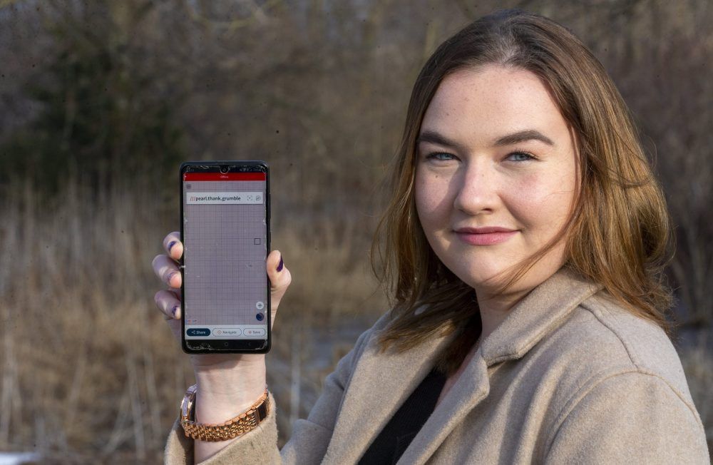
I am constantly scanning for areas from where to launch my drone as I drive about the countryside, but as I dont always have my MM with me or the conditions may not be right for safe flights I use an app on my mobile device called "what3words" which logs the position to within a 3x3m area.

I love photography and have used this app many times in the past to great effect. I usually add the name of the closest town or city and add "drone" to the name it saves it under in my favorites, so that i know its where to take off from at a later date.

This app is used extensively by emergency services the world over for its accuracy, as no two 3x3m squares have the same designated names, even world wide.

I have provided a link below which shows Ballintoy Harbour where Game of thrones was filmed as an example ........


K.
 
  • Like
Reactions: pelagic_one
Hi, I have heard of 3 words and just looked at the link. It's a shame that you cant get the three words to work on the UK drone safety map directly! But it's certainly a good way of listing possible drone spots :)
 
  • Like
Reactions: KoorbeladDigital
What 3 words can be useful where
1. You can't pass Lat/lon coordinates, map references are anything else. I think emergency services find people in a panic end to scramble numbers.
2. You are working with people who speak the same language and believe in What 3 Words and so can translate the words back into somewhere they can go to. AFAIK no sat nav will take the 3 words, so location has to be translated in and translated out again. It is a commercial service and they would charge something like a drone safety map for decodes. Why bother when there are free services which will translate address to lat/lon and vice versa.

The small squares make it good for things like geocaching (and you can combine it with a puzzle to find each word) but
not really for drone spots because If I tell you can't fly at train.assure.stores it doesn't give you any clue that you can't fly at eaten.region.formed - both of those are in Trafalgar square. If I send you to 51.5081,-0.1277 you might draw a box 51.5076 to 51.5086 and -0.1272 to -0.1282 and have a reasonable idea what's not flyable. (But way too big an area to look for a geocache)

If you mistype one letter say eaten.region.foamed you end up in italy and train.assure.stones is in California. So that adds a third condition, you can't just say the location the recipient has to enter it and verify they got the right place. Even that isn't infallible eaten.region.form is in surrey, so slight transcription errors are no certain to be found.
 
  • Like
Reactions: pelagic_one
What 3 words can be useful where
1. You can't pass Lat/lon coordinates, map references are anything else. I think emergency services find people in a panic end to scramble numbers.
2. You are working with people who speak the same language and believe in What 3 Words and so can translate the words back into somewhere they can go to. AFAIK no sat nav will take the 3 words, so location has to be translated in and translated out again. It is a commercial service and they would charge something like a drone safety map for decodes. Why bother when there are free services which will translate address to lat/lon and vice versa.

The small squares make it good for things like geocaching (and you can combine it with a puzzle to find each word) but
not really for drone spots because If I tell you can't fly at train.assure.stores it doesn't give you any clue that you can't fly at eaten.region.formed - both of those are in Trafalgar square. If I send you to 51.5081,-0.1277 you might draw a box 51.5076 to 51.5086 and -0.1272 to -0.1282 and have a reasonable idea what's not flyable. (But way too big an area to look for a geocache)

If you mistype one letter say eaten.region.foamed you end up in italy and train.assure.stones is in California. So that adds a third condition, you can't just say the location the recipient has to enter it and verify they got the right place. Even that isn't infallible eaten.region.form is in surrey, so slight transcription errors are no certain to be found.

Thank you for your input. I have found however, that when using the app, which is free,there is no problem identifying the location as the app shows the site on a map once the words have been input. My son is a location scout for the film industry, and uses the app to send me possible flying locations when he is travelling around the countryside. I open the link and if it looks promising, i save them using the nearest city or town name to reference and then use at a suitable date.

K.
 
I played with it but struggling to see the points.
I can equally as easily pass a lat/long or grid reference for a location.
W3W also has issues with some people misspelling and each language has its own grid system.
Pretty much every messaging and location app these days can display and send locations in any format you want.

Its a clever idea but might have been overtaken by the ease of sharing standard coordinate systems already.

Also it requires a data connection at some point to get the words and grid. A proper offline navigation system does not.
 
  • Like
Reactions: Johnmcl7
Thank you for your input. I have found however, that when using the app, which is free,there is no problem identifying the location as the app shows the site on a map once the words have been input. My son is a location scout for the film industry, and uses the app to send me possible flying locations when he is travelling around the countryside. I open the link and if it looks promising, i save them using the nearest city or town name to reference and then use at a suitable date.

K.
Yes if two of you use the same app (which is free, for now, to try to drive adoption) then you can encode your location as 3 words, send the 3 words and decode them again and it all works. On my phone I just press on the map and it sends a link with the lat/lon plainly readable in the middle of it, someone can open the link or key the numbers into the sat nav in their car / phone.

If someone tells me they're at 51.75, -1.25, I know that's Oxford and not very far from me
train.assure.stones has no meaning until the app has decodes it but 51.5, -0.1 means a little south of me , just my side of Greenwich so central London.
train.assure.stores is somewhere around 38 , -122, very quickly I can tell you 120 degrees (8*15) puts it 8 hours behind London - US West Coast, and it's 13 degrees South of London/Oxford - a nautical mile is 1 minute of latitude so 13*60 = 780 nautical miles south from here, too far for France, might make it to North Africa, but I'd guess Spain - too low for Canada, probably not low enough for Mexico. United states a bit more than halfway down on the West - california. But even without working that out you can tell it's nowhere in England.

So if it helps communication because you can't (or haven't worked out how to) send Lat/Lon or similar - great. Otherwise it's a solution in search of a problem.
 
I played with it but struggling to see the points.
I can equally as easily pass a lat/long or grid reference for a location.
W3W also has issues with some people misspelling and each language has its own grid system.
Pretty much every messaging and location app these days can display and send locations in any format you want.

Its a clever idea but might have been overtaken by the ease of sharing standard coordinate systems already.

Also it requires a data connection at some point to get the words and grid. A proper offline navigation system does not.

Agreed, standard tools on phones make it easy to store a location as a link which can then be saved for later or sent to someone else and crucially can also easily be navigated to. It's even possible now to share a live location which can make it easier for meet ups when there's data available. In the emergency scenario since most phones are very similar these days even with no software installed it's relatively easy to get a longitude and latitude out of them which while meaning nothing to do the stranded person, nor will the three words. And at least with a longitude and latitude it's possible to guide someone since they can see the numbers change whereas the three words cannot be used at all for navigation.

I've spoken to friends who do mountain rescue or remote hill walking to see what their thoughts were on the system and they highlighted the concerns that despite the push for public services to use the system, the database and generation algorithm are proprietary and fully in control of the company who have been very aggressive about blocking any open systems similar to them.
Actually the three words CAN be used for navigation if you have the app. It is built-in to the app to navigate to the location using three words.
 
Actually the three words CAN be used for navigation if you have the app. It is built-in to the app to navigate to the location using three words.

It couldn't last time I used the in the situation I described where it's offline with no data and I can't see any way it can do it currently either, it relies on road data to be able to navigate.
 
If you just want to send your location to someone (including the emergency services) and you have an iPhone, there are a few easy ways to do it without having to use an app. If you send an iMessage, just start off the message with "I'm at " and "Current location" will appear above the keyboard. Click on it and it inserts a map with your location marked which the recipient can use to get directions. You can do the same with standard text messages by clicking the little arrow next to the recipient's name at the top of the screen, then Info, "Send My Current Location". If you live in the UK, there's another app called "GPS OS Grid Reference" which shows your grid position (up to 10 figures). The basic app is free but if you pay for the premium features (only 99p) it lets you share the position to just about any message or mail address.
 
  • Like
Reactions: Hawkwind
@maelstrom Good tip on sharing location. I think the advantage of the what3words is in situations where you have voice communications but no cellular data.

One may display your lat/long coordinate just using Apple Maps or Google Maps also.
 
Lycus Tech Mavic Air 3 Case

DJI Drone Deals

New Threads

Forum statistics

Threads
130,584
Messages
1,554,091
Members
159,586
Latest member
maniac2000