DJI Mavic, Air and Mini Drones
Friendly, Helpful & Knowledgeable Community
Join Us Now

2 Pro With a lot of head scratching and a lot of time put in finally my 360° panorama has a full sky.....

MavicFlyer2

Well-Known Member
Premium Pilot
Joined
May 1, 2021
Messages
718
Reactions
1,665
Location
Minnesota
With a continuing effort in the 360° panoramic photo world my effort has finally produced a better photo. Its color definition is better, sharpness and clarity has improved without distortion and now comes with a full sky view. Kuula shows the difference's between the photo.
*New* 360° shows the shingle's of the homes are clearer/cleaner, the grass, tree's and evergreen's clarity and color is enhanced and improved along with the full sky view while looking up.....Much better then the Mavic 2 Pros drone produced 360° photo in my words....;)

https://kuula.co/post/NDNh5 .... Drone produced 360° photo
https://kuula.co/post/NDN5z .... *New* 360° photo
Yes and no, Perhaps its just me, but you can zoom in closer on the Drone produced image, than the New 360.
Are the final images different sizes? (I think it is just me.)

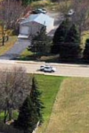
Clearly they are produced differently now you see it
1652104229769.png
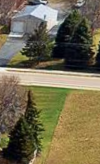
and now you don't
1652104422396.png
I guess its a matter of opinion.


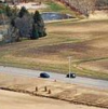
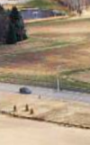
Cars disappearing everywhere.
1652104763753.png
1652104811402.png
spooky.
 

Attachments

  • 1652104241423.png
    1652104241423.png
    131.8 KB · Views: 2
Last edited:
so...no explanation of what you did to improve your 360's ?
 
Yes and no, Perhaps its just me, but you can zoom in closer on the Drone produced image, than the New 360.
Are the final images different sizes? (I think it is just me.)

Clearly they are produced differently now you see it
View attachment 147974
and now you don't
View attachment 147976
I guess its a matter of opinion.


Cars disappearing everywhere.
View attachment 147983
View attachment 147984
spooky.
It's funny you mentioned being able to zoom in better with the drone produced photo...lol...I thought the same thing. So I opened 2 browser windows and sized them exactly and open both in its own window and zoomed fully in. I was amazed to see they were exactly the same, maybe a minor difference but not anything to talk about basicially exactly the same....13.5 MB -vs- 18.5 MB with the *New* 360° being the larger file of course....
Thank you for pointing out the vehicle's appearance's and disappearance's too and all I have to say about it is duplication. The white van in front of the pine trees is also down the road and turned left and heading away from the camera. Also the photo with the dark car is another duplication of the same car that's behind it. Duplication happens and traffic isn't stop for me during the process of capturing 26 photos, they're moving up and down and all around on the road. So rest assured everything is okay !
 
so...no explanation of what you did to improve your 360's ?
Oh my [B]akdrone[/B] where to start and by the way make a folder specifically for this project and keep everything inside of it...So it starts with shooting the normal 360° sphere but doing it with 12 extra RAW photos for adding to the sky (For Panorama shot RAW photos @ 3:2 not 16:9). This is done by leaving the drone in the air after the intelligent flight process is done then carefully raising the gimbal angle up to 20° and taking the extra photo's manually. Spin a complete circle taking a photo with the correct overlap on each for stitching together later. You actually don't have to do this part if you don't want to. I did it just to get that little extra sky. Later I explain how to, or it's a Youtube video, on making a full sky off just your intelligent flight photo's.
Next is post editing each photo in Photoshop and saving each as a TIFF file for lossless editing later. After that I stitch them all together with Hugin software and it produces the finished 360° photo without the sky full.
A true 360° panorama photo is 2:1 and your Hugin photo won't be that so you have to change the Canvas size. Here's the YouTube I used and it explains how to do this process....
To view this content we will need your consent to set third party cookies.
For more detailed information, see our cookies page.
Once you make your sky and save it you have your final 360° photo, all that's left is post editing with you're own personal editing techniques and 360° viewer.
Hopefully this is helpful and good luck !!!!

 
  • Like
Reactions: hhung516
I don't understand. You take extra photos with the gimbal angled up 20° (which does not cover all of the sky) and add them to your panorama. In the YouTube video, you use a photoshop feature to "fill in" the missing sky, using only original photography. You then arbitrarily edit the sky at the edge to blend it with the other edge (which you could do easily with the any projection). Why not use the default constructed panorama from the drone, or from your own panorama software? Thanks for your presentation.
 
I don't understand. You take extra photos with the gimbal angled up 20° (which does not cover all of the sky) and add them to your panorama. In the YouTube video, you use a photoshop feature to "fill in" the missing sky, using only original photography. You then arbitrarily edit the sky at the edge to blend it with the other edge (which you could do easily with the any projection). Why not use the default constructed panorama from the drone, or from your own panorama software? Thanks for your presentation.
Yes I do...it's just to get that little extra help for the filling process while using Adobe Photoshop "Fill In". Reasoning is the drone produced photo is JPEG, which is still pretty good, but stitching the RAW photo's together with your own software program produce a finer image to work with.
When you work with both the drone produced, and then your own produced 360°, and then view them with your own 360° panorama viewer it's amazing. Some may call it extra work but I prefer to try for the best of what I can do and produce.
 

DJI Drone Deals

New Threads

Members online

Forum statistics

Threads
134,568
Messages
1,596,338
Members
163,068
Latest member
Liger210
Want to Remove this Ad? Simply login or create a free account