

Hey everyone! It’s been far too long since I’ve written anything on here. I generally pick people’s brains, but today I thought I’d share some of the work I’ve been doing with my drone this summer. This is a sizeable post, so thanks in advance if you read the whole thing!
For some background: I am a master’s student in Archaeology at Michigan State University, working in southern Peru. I bought my MP so that I could do some site-scale modeling, photogrammetry, and aerial photo (orthophoto) production. This is the first season I’ve had it, so I am trying to use the crap out of it.
Without further ado, here’s some fun stuff!
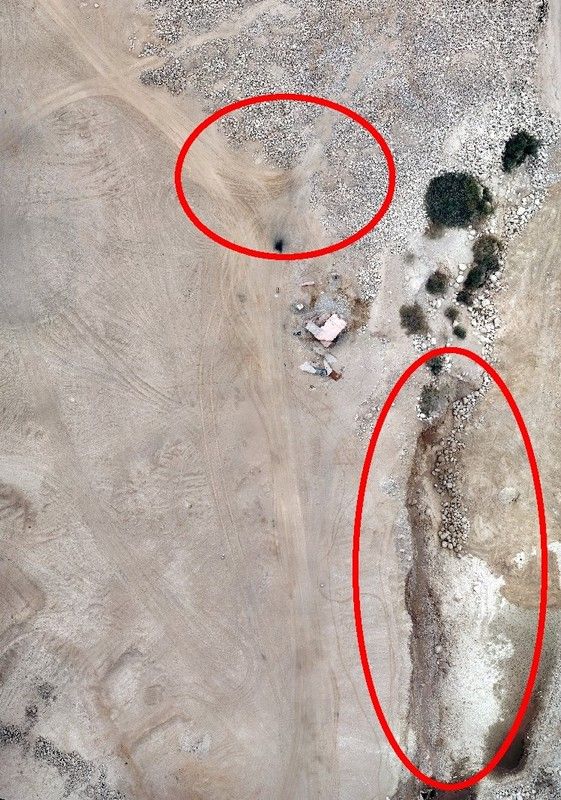
This is an orthophoto of an archaeological site we excavated last year, which is adjacent to an active gravel mine. It is an extremely important site; one of the oldest coastal sites in the Americas. Since we were there last year, parts of the site (see circled spots) have been encroached by the mining operation. I flew the site to produce an updated aerial photo illustrating the damage done in just the 10 months since we’d worked there. (The site was originally flown last year using a friend’s Phantom 3 Pro; however, those photos are not mine to share and therefore I have left them out pending his approval)
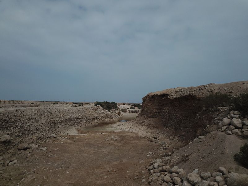
This is where a tallus slope used to exist; the site is up on top of what is now this cliff. The mining operation has completely undercut this part of the site.
That damage assessment was the first real task for the drone this summer. Yesterday though, it earned it’s place in my field bag.
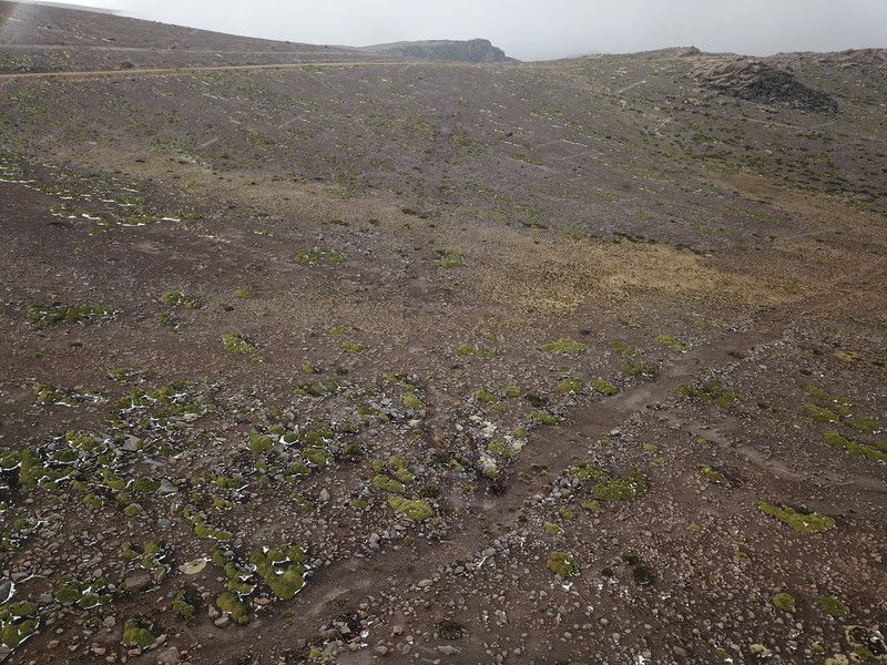
This is a photo of an Inca road high in the Andes (I started this flight at about 4,500 meters above sea level).
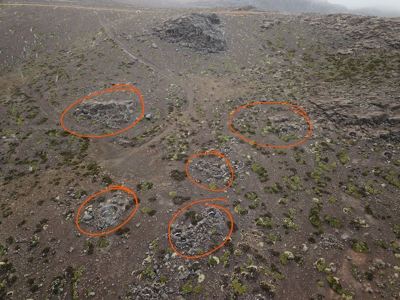
Here is another angle, where you can see some of the structures of what might have been a way-station (I’m honestly not sure; not my area of archaeological expertise). I drew some circles around a few examples; my non-archaeological father had trouble seeing them when I first shared the photo with him.
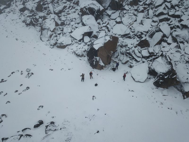
But the highlights of the day, at least for me, were the afternoon flights. We (one classmate, my advisor, and his collaborator/friend) hiked up to follow another segment of the previous Inca road, reaching about 5000masl in the process. Given what I had seen in the DJI MP specs, I wanted to test the drone as high as possible. And boy did I.
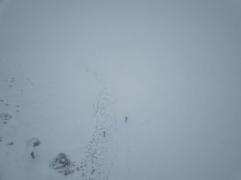
MP did very well, even above the listed ceiling. I managed to get it as high as 5258m (absolute altitude). As you can see the weather was atrocious; I only got one very short flight before the rotors and arms iced up enough that it wouldn’t fly. But they thawed quickly, and I did some test flights last night and this morning with no issues on the drone. It did very well in the high-altitude test.
Here is all of us in the snow; it was a wet and cold day. My classmate got some wonderful photos of our crew through the hike and drone flights; unfortunately, she’s still out in the field for another 10+ days. As soon as she returns, I’ll either add the photos she took to this thread or post anew to give the complete picture (no pun intended) of our day’s activities. I also have some video which I am going to work on editing, not just of the snowy adventure but of a some other project work. More exciting stuff to come!
And with that, thanks for reading! If I've peaked your interest and you want more information about our project, please visit www.paleoandes.com or send me a message and I’ll be more than happy to discuss it further. I’ll leave you with a “selfie” of our crew taken with the MP yesterday!
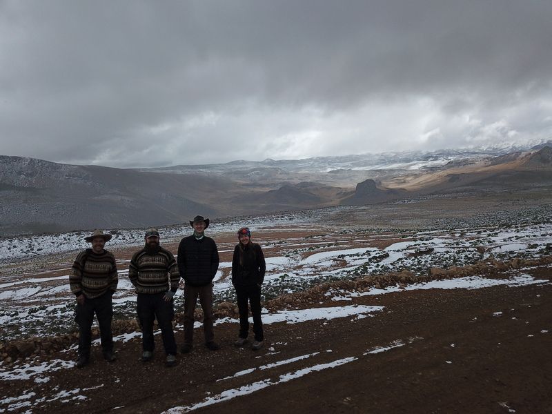
Cheers!
For some background: I am a master’s student in Archaeology at Michigan State University, working in southern Peru. I bought my MP so that I could do some site-scale modeling, photogrammetry, and aerial photo (orthophoto) production. This is the first season I’ve had it, so I am trying to use the crap out of it.
Without further ado, here’s some fun stuff!

This is an orthophoto of an archaeological site we excavated last year, which is adjacent to an active gravel mine. It is an extremely important site; one of the oldest coastal sites in the Americas. Since we were there last year, parts of the site (see circled spots) have been encroached by the mining operation. I flew the site to produce an updated aerial photo illustrating the damage done in just the 10 months since we’d worked there. (The site was originally flown last year using a friend’s Phantom 3 Pro; however, those photos are not mine to share and therefore I have left them out pending his approval)

This is where a tallus slope used to exist; the site is up on top of what is now this cliff. The mining operation has completely undercut this part of the site.
That damage assessment was the first real task for the drone this summer. Yesterday though, it earned it’s place in my field bag.

This is a photo of an Inca road high in the Andes (I started this flight at about 4,500 meters above sea level).

Here is another angle, where you can see some of the structures of what might have been a way-station (I’m honestly not sure; not my area of archaeological expertise). I drew some circles around a few examples; my non-archaeological father had trouble seeing them when I first shared the photo with him.
But the highlights of the day, at least for me, were the afternoon flights. We (one classmate, my advisor, and his collaborator/friend) hiked up to follow another segment of the previous Inca road, reaching about 5000masl in the process. Given what I had seen in the DJI MP specs, I wanted to test the drone as high as possible. And boy did I.

MP did very well, even above the listed ceiling. I managed to get it as high as 5258m (absolute altitude). As you can see the weather was atrocious; I only got one very short flight before the rotors and arms iced up enough that it wouldn’t fly. But they thawed quickly, and I did some test flights last night and this morning with no issues on the drone. It did very well in the high-altitude test.

Here is all of us in the snow; it was a wet and cold day. My classmate got some wonderful photos of our crew through the hike and drone flights; unfortunately, she’s still out in the field for another 10+ days. As soon as she returns, I’ll either add the photos she took to this thread or post anew to give the complete picture (no pun intended) of our day’s activities. I also have some video which I am going to work on editing, not just of the snowy adventure but of a some other project work. More exciting stuff to come!
And with that, thanks for reading! If I've peaked your interest and you want more information about our project, please visit www.paleoandes.com or send me a message and I’ll be more than happy to discuss it further. I’ll leave you with a “selfie” of our crew taken with the MP yesterday!

Cheers!
Last edited:


