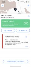
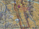
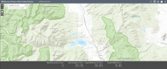
I am new to having a drone. I do a lot of camping and I am looking to get some cool photos and videos as a hobby. I am confused about the maps on Aloft and B4U Fly in the mountains in CO. The section of MAP attached shows wilderness area around some white area. When I click on the white area, which is where I will be, I get a clear for takeoff. However, listed below it says FS Wilderness Area. I am confused, am I good to fly or not? The wilderness area warning has a mileage distance and I believe it might just be giving me a warning that wilderness area is within 2.07?? Aloft shows it as very similar. I get a green symbol with an exclamation point with the same wilderness area notification.
Can anyone help me understand what this means?

Can anyone help me understand what this means?


