DJI Mavic, Air and Mini Drones
Friendly, Helpful & Knowledgeable Community
Join Us Now

Air 2 Climbing Colorado's Tallest, Mount Elbert & Flying at almost 15,000' MSL, Breathtaking Adventure!

My goodness, that is the first time I’ve been called a drama queen. . .the only drama here was getting a late start on a 12 mile hike in ski boots. This was, as mentioned above, a low stress non technical trip. . . some of my other adventures are quite a bit more dramatic. . . Thank you all for the praise. I’ll be posting the slot canyon adventure shortly, ”Moonshine Canyon!”
That was mean of me. I was just teasing.
 
  • Like
Reactions: Karlewski
Fabulous photography, with amazing exposure control! Can you share the settings you used on the summit footage? And did you use neutral density filter(s)?

Also, what map source are you using for the terrain maps, e.g. at 0:35? I've been looking for exactly that style map, but I haven't come across one as good as this.

Many thanks.
 
This climb was better than expected, low stress & exceptional vistas from the roof of Colorado. I thought I'd mix it up a bit and do an adventure high above the deserts I've been visiting lately! The drone flying was very challenging, with strong winds, many warnings, and really bright glare coming off the snow made seeing the video feed tough. I could not use my sunglasses since they were way too dark but without them the the conditions were literally almost blinding. Staying in the shadow of my 'Sombrero," was the best I could do, I think it was good enough. . .
Great video, thanks for posting. Fantastic views from the summit on a beautiful sunny day. Having a drone to film the aerials really caps off the visuals; we are very lucky to have such affordable technology available. Safe climbing. ????
 
My goodness, that is the first time I’ve been called a drama queen. . .the only drama here was getting a late start on a 12 mile hike in ski boots. This was, as mentioned above, a low stress non technical trip. . . some of my other adventures are quite a bit more dramatic. . . Thank you all for the praise. I’ll be posting the slot canyon adventure shortly, ”Moonshine Canyon!”
Ignore it. Some people can’t help themselves pouring cold water on to a generous effort. You put a lot of work into the climb and the video editing. Nice job. Thanks for sharing. And yes - good luck for the next one! ??
 
Thank you for your support David, it is weird since I often see videos where the "drama factor," does seem a bit high but, I think the truth of it, if your doing something outside of your comfort zone, especially if it could be dangerous, that takes real courage and those memories are dramatic for that courageous participant. I have lots of respect for that but hardly ever see it on camera. As for me, this is what I do and have done all my life. I already know, for the most part, how things are going to go and exactly what I'm capable. When I feel fear for my safety it is likely quite serious and I am dumping the camera gear and commentary as I have done on several videos. I'm not that courageous. . . just experienced. Nor dumb enough to waste time and focus on the camera when it is needed elsewhere. I guess Flightlogic is tired of the "fictional drama," that is common on Youtube and I get that also, I feel it cheapens other's honest accomplishment. . . Sorry for the rant. . . My goal is to share and preserve amazing experiences safely that others may not be able to have any other way, and help those who can to do it safely. . .


CaseyGuy I honestly do not do much in the field, for this shoot I just left my ND16 filter with CP on, auto exposure, obviously low ISO. I think if anything the CP was most important for glare off the snow and better saturation though I may have gotten some blur out of the 16. Done properly I'd have to think a 64 would be most appropriate to get a 1/60'" shutter speed for my 30FPS, it was as bright as it could be. . . . While I do like the blur effect dealing with that stuff in wind, cold, rocks and fiddling with a tiny filter is tough and may well only end in loosing a filter. Sometimes I will just use a variable ND filter and that is manageable but, I was thinking the polarizer was more important for that crazy sun glare off the snow. . . Exposure itself is just on auto with a low ISO locked in. For me, part of this hobby is post production, I like shooting in LOG, flat, GAMMA color settings, whatever the camera offers and doing my own color corrections/grading. . . I just love seeing the shots come to life that way BUT I do wish there was a bit more contrast at the least while flying just to see obstacles more clearly. . . .I want goggles, I could definitely fly more aggressively if I could see better. . . .​

That was just google maps BUT, in google on the left side menu go to the 3 bars, open that and select Terrain, I too was too happy to find that! One pooper, you can only zoom in so much before loosing the Topo lines, take a screen shot and then use that to zoom in if needed. Hiking project, phone app or on-line is not bad either as is alltrails. . .
 
That was just google maps BUT, in google on the left side menu go to the 3 bars, open that and select Terrain, I too was too happy to find that! One pooper, you can only zoom in so much before loosing the Topo lines, take a screen shot and then use that to zoom in if needed. Hiking project, phone app or on-line is not bad either as is alltrails. . .

If you have an iphone, download Mapout and take a look.
I use it a lot for recording .gpx files from bushwalks and 4WD trips . . . the more you zoom in the more detail you get.
Free app on iphone (not sure if out for android it's been years) and you can download maps free as needed, Worldwide, at home with wifi, they stay on the device, can be deleted if all you need is the gpx, map not needed again.
It shows an incredible and unexpected amount of detail, even very minor walking tracks, I'd be keen if anyone in the US and other places finds the same for areas like this.
I've found remote trails walked in places we've walked in Nepal, Bhutan, PNG, New Zealand and all over Oz.
 
  • Like
Reactions: B52-D
If you have an iphone, download Mapout and take a look.
I use it a lot for recording .gpx files from bushwalks and 4WD trips . . . the more you zoom in the more detail you get.
Free app on iphone (not sure if out for android it's been years) and you can download maps free as needed, Worldwide, at home with wifi, they stay on the device, can be deleted if all you need is the gpx, map not needed again.
It shows an incredible and unexpected amount of detail, even very minor walking tracks, I'd be keen if anyone in the US and other places finds the same for areas like this.
I've found remote trails walked in places we've walked in Nepal, Bhutan, PNG, New Zealand and all over Oz.
Outstanding adventure, and most of us appreciate your efforts and sharing with us. No drama exhibited here, just skill, determination, planning, execution, and capturing it all for others to experience. You can be proud of your accomplishments, and again, thanks for sharing. ?➰
B52 D
Blue Skys and Happy Contrails.
1621857707424.png
 
Last edited:
You guys have been the best audience I could ever hope for, not only kind thoughtful support but a wealth of information!
South Oz, I checked out Map out, looks GREAT. The ability to draw routes on the maps sound so nice and the high level of detail, sweet. It is now $5 on the App Store but, I think that is going to be well spent $$$.
 
  • Like
Reactions: MAvic_South_Oz
You guys have been the best audience I could ever hope for, not only kind thoughtful support but a wealth of information!
South Oz, I checked out Map out, looks GREAT. The ability to draw routes on the maps sound so nice and the high level of detail, sweet. It is now $5 on the App Store but, I think that is going to be well spent $$$.

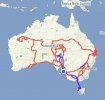
Let me know how you find it, I think I’ve been using it for at least a decade.
Lost all trip routes a couple of times when phones have failed badly and app uploaded again to a new phone, but love adding to the travels on the still iPhone 6.

IMG_8958.JPG
 
Let me know how you find it, I think I’ve been using it for at least a decade.
Lost all trip routes a couple of times when phones have failed badly and app uploaded again to a new phone, but love adding to the travels on the still iPhone 6.

View attachment 129582
Very similar to the base map in GaiaGPS, which is not surprising since they are both based on OpenStreetMap data. Mapout maybe has a nicer scaling method though, which is impressive. It lacks the huge library of map sources in Gaia, but for many users that's not going to matter at all.
 
  • Like
Reactions: MAvic_South_Oz
This climb was better than expected, low stress & exceptional vistas from the roof of Colorado. I thought I'd mix it up a bit and do an adventure high above the deserts I've been visiting lately! The drone flying was very challenging, with strong winds, many warnings, and really bright glare coming off the snow made seeing the video feed tough. I could not use my sunglasses since they were way too dark but without them the the conditions were literally almost blinding. Staying in the shadow of my 'Sombrero," was the best I could do, I think it was good enough. . .
Very nice! It's always nice to see videos of our beautiful State!
 
This climb was better than expected, low stress & exceptional vistas from the roof of Colorado. I thought I'd mix it up a bit and do an adventure high above the deserts I've been visiting lately! The drone flying was very challenging, with strong winds, many warnings, and really bright glare coming off the snow made seeing the video feed tough. I could not use my sunglasses since they were way too dark but without them the the conditions were literally almost blinding. Staying in the shadow of my 'Sombrero," was the best I could do, I think it was good enough. . .
Great video, really enjoyed it!
 
Let me know how you find it, I think I’ve been using it for at least a decade.
Lost all trip routes a couple of times when phones have failed badly and app uploaded again to a new phone, but love adding to the travels on the still iPhone 6.

View attachment 129582
I got it, Map out. . . It is AWESOME, especially for the $5 one time fee. All the rest of them are in app purchases, no thanks. Love the easy route drawing right on the map to set up an adventure. The only thing I will need to get used to is the spread of the Topo lines, hard to tell if some areas are cliffs but, I always scope thinks out on a tight map at home, even those lack some clarity, and then will just draw my route on Map out from there. Amazingly, it does show many cliffs as well with a special icon too. . . . Thanks OZ! I will be using it and likely be putting it in my videos. I think it is cool to screen shot my location to add into my videos for clarity and the Garmin map that comes with my In-Reach is ugly and not an efficient use of screen space either. . . This one is definitely better!
 
  • Like
Reactions: MAvic_South_Oz
Great, glad you like it !
The contour lines are hard to see initially as they appear zooming in.
They also change in altitude distance as you zoom in / out far enough too, just a matter of getting used to the changes from (for us here, your version may show feet ?) 50m down to 20m, then down to 10m as you zoom in.
I see you use inreach, good to hear you use such a device for safety on your adventures.
 
Lycus Tech Mavic Air 3 Case

DJI Drone Deals

Forum statistics

Threads
131,526
Messages
1,563,914
Members
160,425
Latest member
Dean1980