LOL, I guess you caught me trying to bait you.
Well I'm slightly embarrassed to admit that I was hoping that you would have put the whole issue to bed before I got around to delving into it. Now it looks too interesting to ignore.
LOL, I guess you caught me trying to bait you.
I looked at this one. At first glance there doesn't seem to be much to be concerned about. There are a few brief intervals where it drops into ATTI. But, it's much worse. There are several times where there is a magYaw/Yaw separation that occurs right after a rotation. E.G.I just noticed that the dropbox upload was not complete. Now the late
st DAT is there. In that full DAT, there are two cases where it drops to ATTI. So this is after my latest calibration. What comes to my norden location, there are hundreds of drone pilots in Finland, some live in the artic circle. I did not find anything unusual about Finlands location and using drones. GPS can sometimes get shadowed, but this was not the case here.
There is this one taller hill near where I live. It's 200 meters from the last test position. But it's more to the east, so it doesn't block satellites. But could it have affect to the compass, who knows. I imported the CSV-file to QGIS and was able to produce some map views. The drone is flying around 80 meters, the ground beneath is at 70 meters.
What I'll do is that I'll calibrate the IMU and other calibratable items, and go to a seperate, open field location. This way we can rule out my location. But that odd drift to the left, this has happend on any location.
Maybe... The supposition is that the geoDeclination at the launch site is substantially different from the model that the Mavic uses to determine geoDeclination. It's easy enough to find out though if you can place the Mavic on level surface and point it precisely true north. Power on and let it sit for a minute or so. Then provide the .DAT. The Yaw value from the .DAT should be 0.0° because it's been corrected with the model. You might be able to see if it's not 0.0° by looking at the Go App map heading indicator.I did investigate this magnetic theory a bit more. I found an aeromagnetic anomaly dataset for Finland, and process it on QGIS. I don't know how much these should affect Mavic's compass, but atleast the next test site can be selected to rule out any of these infulenses.
There seems to be something nearby. And when you look at the larger image, it looks like there is something larger going trough the test site.
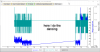
1) What app do you use to do the screen recordings?
2) Are you aware that you can get a GoogleMap key that will allow you to see the GM images in the GeoPlayer? Maybe the process of getting a key looks to be too much of a hassle?
But, before you do that can you do one more test that doesn't require an actual flight. Hold the AC in front of you with the X axis pointing away from you. Now, turn slowly in a circle while at the same time rotating the AC end over end in front of you. After turning 360 degrees stop and turn the AC so that it has the X axis pointing to your right. Repeat the slow turning while rotating the AC end over end in front of you. Finally, orient the AC with the X axis pointing to the left and repeat the slow turning while rotating the AC end over end in front of you. Then retrieve and provide the .DAT.


I appreciate your input.
1, I use Camtasia 9 for these simpler productions, it has an easy editor and it can upload to Youtube directly. And it makes digital captions, although it would be nice to have the option to burn them. For screen captures I use Snagit 2018, it's a great tool.
2, Yes I know about the key, and your are correct, I was lazy. Google doesn't usually represent the environment height correctly, with QGIS you get better local results. And you can upload the flight CSV to it.
I'm having trouble understanding your instructions. First, is the X-axis like in this picture:
View attachment 35422
And is this the type of motion your looking for?
View attachment 35423

It doesn't matter much. All we're trying to do is place the AC in as many different orientations as possible. The dance I described is just one way of methodically achieving this. Imagine the AC is at the center of a sphere and we want every point on the sphere to have been pointed at the geoMagnetic field. All such points should have the same value for field strength. With this data we can use the MagData player to see if there are any anomalies.I appreciate your input.
1, I use Camtasia 9 for these simpler productions, it has an easy editor and it can upload to Youtube directly. And it makes digital captions, although it would be nice to have the option to burn them. For screen captures I use Snagit 2018, it's a great tool.
2, Yes I know about the key, and your are correct, I was lazy. Google doesn't usually represent the environment height correctly, with QGIS you get better local results. And you can upload the flight CSV to it.
I'm having trouble understanding your instructions. First, is the X-axis like in this picture:
View attachment 35422
And is this the type of motion your looking for?
View attachment 35423
It doesn't matter much. All we're trying to do is place the AC in as many different orientations as possible. The dance I described is just one way of methodically achieving this. Imagine the AC is at the center of a sphere and we want every point on the sphere to have been pointed at the geoMagnetic field. All such points should have the same value for field strength. With this data we can use the MagData player to see if there are any anomalies.
Okey. So I have the drone facing away from me, so that I'm looking at the rear end. Then I rotate my self 360 (clockwise), while rotating the drone 360 in my hand (clockwise).Then I have the drone facing right, and repeat. And then facing left, and repeat.
")
The motors don't need to be started. A .DAT will be created when the battery is turned on. Here's a YouTube that I threw together.Rotating it on my hand did not work. With my first attempt, it didn't even register it, since I never turned the motors on. On the second try, I first started the engines and then stopped them. Then I rotated it around. Then I ran the engines one more time. It only recorded the parts when engines ware shortly on. I do hesitate turning it around on my hand while engines are on
I'll go and fly it on a clean site tomorrow and let's see what we get.
The motors don't need to be started. A .DAT will be created when the battery is turned on. Here's a YouTube that I threw together.
The short answer is no, we're running the same firmware. Please don't take this the wrong way, this happens to me all the time. I think you're probably looking at the wrong .DAT. You've probably run into the problem where you can't retrieve the .DAT from your Mavic. I managed to test this with the Mavic I have that is running 01.04.0300. But, I had to cheat some to be able to retrieve the .DAT - normally I can't do that. My method is explained below but, alternatively, you could get a lower resolution version of this data by retrieving it from the tablet (look here). You'd need to redo the test with the RC and Go App connected to the Mavic to make sure a .DAT gets recorded.Could it be that you have different firmware? Mine did not create a DAT, at least one that I could download with DJI assistant, when motors did not run. And the one that I was able to make, did not have yaw data when motors ware not running. I have the latest version.


Without yet having looked at the DAT file data, I can answer your question about the effect of the compass error (fusion.gps_yaw_err) and why it then ignores the GPS location data.
The compass error arises when the IMU rate gyro data (primary yaw diagnostic) disagree with the magnetometer data to such an extent that the sensor fusion scheme is unable to reconcile them. At that point the FC is programmed to conclude that it cannot have any confidence in its yaw (heading). So even though it still knows exactly where it is and in which direction it is moving relative to the earth, from GPS, it has no idea in which direction, relative to the aircraft, to apply thrust to move in any given direction or hold position against drift. Its only viable option at that point is ATTI mode, in which it simply holds the aircraft level and maintains altitude.
As for what caused the problem - standby.
But what is the reason? I got the same problem, i'm scared of flying now, cuz everytime i fly i get those errors!
Weak GPS signal
Compass error, exit P-GPS mode
IMU encounters heading exception
And then i loose control of drone, it turns to ATTI mode!
What should i do?
I calibrated compass, got latest updates!
First you should check if there is an enviromental issue. If there is metal objects nearby, or beneath you. And does the GPS get satellites or not, is there anything tall between the drone and the sky. Then you could try to calibrate the compass and the IMU. If these doesn't resolve the issue, you need to get it fixed.
What you can do, is use flight records to check what's going on. Download DJI assistant 2 and then you can download a DAT file from the drone.With CsvView, you can open the DAT. You can see from the DAT, if it lose satellites, does it lose compass, or like in my case, it has multiple issues.
Here's a short video that explains how to get and view the DAT:
Turn the captions on
I try to fly in different places! Even in countryside with open field without any metal interference, without any objects around!
And get the same errors, it just freaks me out!
Of course i calibrated compass, did IMU calibration, calibrated sensor with dji assistant 2
Every time i get plenty of satellites
Any suggestions?
But what is the reason? I got the same problem, i'm scared of flying now, cuz everytime i fly i get those errors!
Weak GPS signal
Compass error, exit P-GPS mode
IMU encounters heading exception
And then i loose control of drone, it turns to ATTI mode!
What should i do?
I calibrated compass, got latest updates!


We use essential cookies to make this site work, and optional cookies to enhance your experience.