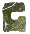
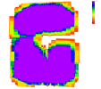
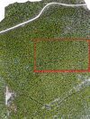
I recently did a flight to capture LiDAR data and RGB of a forested area, using the Matrice 350 RTK. We're running into a problem with the quality report generated by Terra. The LiDAR point cloud looks great, however the ortho preview as well as the scene overlapping visual show a significant missing chunk. Is there any way to tell what is causing the exclusion of this area?
TDOM Preview:

Scene Overlapping:

TDOM Preview:

Scene Overlapping:


