DJI Mavic, Air and Mini Drones
Friendly, Helpful & Knowledgeable Community
Join Us Now

Don't crash your Mavic 3 with Waypoints missions

mavsam

Member
Joined
Jan 7, 2023
Messages
8
Reactions
16
Age
42
Location
America
Helpful hint for those taking advantage of the Mavic 3's new Waypoints firmware: DJI Fly constantly bugs you with exaggerated warnings we've grown used to ignore, but it doesn't warn you of a glaring danger with waypoints missions. When you record a waypoint mission, the waypoint heights are *relative* to your takeoff spot. If you record a waypoint mission having taken off from one spot, then move to another spot that's at 100 feet lower altitude, take off from there and reload your mission, the Fly app won't warn you that all your waypoints are now 100 feet lower, in absolute terms, than when you recorded the mission (because the relative altitudes stayed the same but they are relative to a different takeoff spot). So the waypoint that you marked back when you were at 800ft from sea level, the drone will now move towards that point while flying at 700ft from sea level.
Combine that with the fact that obstacle sensing doesn't detect fine objects like wires, and branches without foliage, and with the ability to set the drone to Continue on Signal Loss, and you have the recipe for disaster.

I wish DJI would at least warn about taking off at a lower absolute height than the one the waypoints were recorded.
 
Waypoints have always been tricky, I have made a few mistakes as well, so some extra warning might be a good idea Afterall.

All though I hate the idea of more warning on the Drone , when it comes to the Way Points might be a good idea.

Phantomrain.org
Gear to fly in the Rain. Land on the Water.
 
Last edited:
Helpful hint for those taking advantage of the Mavic 3's new Waypoints firmware: DJI Fly constantly bugs you with exaggerated warnings we've grown used to ignore, but it doesn't warn you of a glaring danger with waypoints missions. When you record a waypoint mission, the waypoint heights are *relative* to your takeoff spot. If you record a waypoint mission having taken off from one spot, then move to another spot that's at 100 feet lower altitude, take off from there and reload your mission, the Fly app won't warn you that all your waypoints are now 100 feet lower, in absolute terms, than when you recorded the mission (because the relative altitudes stayed the same but they are relative to a different takeoff spot). So the waypoint that you marked back when you were at 800ft from sea level, the drone will now move towards that point while flying at 700ft from sea level.
Combine that with the fact that obstacle sensing doesn't detect fine objects like wires, and branches without foliage, and with the ability to set the drone to Continue on Signal Loss, and you have the recipe for disaster.

I wish DJI would at least warn about taking off at a lower absolute height than the one the waypoints were recorded.
Unless you switch-off your drone before reloading the mission at you new launch point it will do as you have discovered. The zero altitude point is set on power-up.
 
I set points for a bridge video. Two of them were meant to follow the line of the bridge in parallel. I dont know what it was thinking but from one point to the other it wanted to hit the bridge so I stopped it and remade the points with one in between the two which fixed the issue. Point is, yep, we have to be careful with these points. Love the option but it’s a bit of learning. I will keep in mind your experience. Haven’t had time but plan to do a few at different times of the day so I can overlay them like you could for hyperlapse points.
 
Helpful hint for those taking advantage of the Mavic 3's new Waypoints firmware: DJI Fly constantly bugs you with exaggerated warnings we've grown used to ignore, but it doesn't warn you of a glaring danger with waypoints missions. When you record a waypoint mission, the waypoint heights are *relative* to your takeoff spot. If you record a waypoint mission having taken off from one spot, then move to another spot that's at 100 feet lower altitude, take off from there and reload your mission, the Fly app won't warn you that all your waypoints are now 100 feet lower, in absolute terms, than when you recorded the mission (because the relative altitudes stayed the same but they are relative to a different takeoff spot). So the waypoint that you marked back when you were at 800ft from sea level, the drone will now move towards that point while flying at 700ft from sea level.
Combine that with the fact that obstacle sensing doesn't detect fine objects like wires, and branches without foliage, and with the ability to set the drone to Continue on Signal Loss, and you have the recipe for disaster.

I wish DJI would at least warn about taking off at a lower absolute height than the one the waypoints were recorded.
The safe solution is to never deviate from the original launch point when flying the recorded waypoint mission. Each waypoint mission should include its unique original launching location. If you want to change the launch location, you should create a new waypoint mission.
 
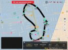
I don't see how the launch point matters, because it always flies to waypoint 1(unless you change it) before it starts the mission. So it should always start at waypoint ones position and height. Here's a mission I made manually. You can see, wherever you fly it from, it will goto waypoint one at waypoint one's height. But on second thought, I do see what you mean about all heights being relative to your takeoff altitude. So if you took off from a 100 foot building, all the waypoint heights would be 100 feet higher. I think Einstein first noticed this. He called it relativity!
Screenshot_20230108-161442.jpg
 
Last edited:
I don't see how the launch point matters, because it always flies to waypoint 1(unless you change it) before it starts the mission. So it should always start at waypoint ones position and height. Here's a mission I made manually. You can see, wherever you fly it from, it will goto waypoint one at waypoint one's height. But on second thought, I do see what you mean about all heights being relative to your takeoff altitude. So if you took off from a 100 foot building, all the waypoint heights would be 100 feet higher. I think Einstein first noticed this. He called it relativity!
View attachment 159203
Regarding waypoint missions made in advance, I’d like to see more of this from people making them and their thoughts and what else they have leaned. Such as speeds, heights, POI’s, etc I’ve been experimenting quite a bit lately but still need more time and missions. My first thought was as MAVSAM’s concern about AGL between points. But so far, I typically use heights around 268ft in areas it hasn’t been an issue so far, and I’ve liked speeds around 20mph between points and I have tried POI’s that I typically set as 50ft. That’s gives me a view if the POI and many times the horizon unless I’m right on top of the POI. A few things still needing to experiment with are multiple POI’s on the mission.
My first first attempt was POI’s on each end of a route that may look like a long racetrack. But the issue I had was either not enough points between one end and the other, or I had my YAW tuned to slow as my first attempt showed the video turning the whole length of moving to the second POI. I was trying to get it to immediately turn to the second POI, then fly along the path to the second,after going past the first.
My second attempt, I made two changes and I should have probably just made one so I know what it was that made the change (maybe both). I changed the yaw more aggressive AND i added another point after rounding the first POI with that second waypoint to look at POI number two. Ultimately it turned really quick, but I’m not sure which of the two changes made the difference. Anyway, sorry to change the focus of the thread, but very interested in what people do on their missions for variables…
 
  • Like
Reactions: eaglewings
Great pick up and one that could catch a few
 
  • Like
Reactions: Surfnut
I don’t recall this being an issue with Litchi likely because Litchi missions were entirely based upon GPS altitude and position. That said, I nearly crashed with a Litchi mission when flying a mission created a couple of years before. A tree had added enough height to clip my drone where it had cleared it before.
 
  • Like
Reactions: shb
Helpful hint for those taking advantage of the Mavic 3's new Waypoints firmware: DJI Fly constantly bugs you with exaggerated warnings we've grown used to ignore, but it doesn't warn you of a glaring danger with waypoints missions. When you record a waypoint mission, the waypoint heights are *relative* to your takeoff spot. If you record a waypoint mission having taken off from one spot, then move to another spot that's at 100 feet lower altitude, take off from there and reload your mission, the Fly app won't warn you that all your waypoints are now 100 feet lower, in absolute terms, than when you recorded the mission (because the relative altitudes stayed the same but they are relative to a different takeoff spot). So the waypoint that you marked back when you were at 800ft from sea level, the drone will now move towards that point while flying at 700ft from sea level.
Combine that with the fact that obstacle sensing doesn't detect fine objects like wires, and branches without foliage, and with the ability to set the drone to Continue on Signal Loss, and you have the recipe for disaster.

I wish DJI would at least warn about taking off at a lower absolute height than the one the waypoints were recorded.
Wow - I don't think that would have occurred to me - and it's really important information..thank you
 
I don’t recall this being an issue with Litchi likely because Litchi missions were entirely based upon GPS altitude and position. That said, I nearly crashed with a Litchi mission when flying a mission created a couple of years before. A tree had added enough height to clip my drone where it had cleared it before.
Wonder why DJI doesn't use gps altitude. Seems like commercial airliners could too in an emergency.
 
  • Like
Reactions: Surfnut
Thanks for sharing
 
  • Like
Reactions: E.151 and AnzacJack
I don’t recall this being an issue with Litchi likely because Litchi missions were entirely based upon GPS altitude and position.
Your drone uses the barometric sensor for altitude, whether you are flying with Litchi or a DJI app.
For years Litchi used waypoint heights relative to startup location.
Later on they offered a height above ground option, but nothing that used GPS for height.
Wonder why DJI doesn't use gps altitude. Seems like commercial airliners could too in an emergency.
The barometric sensor gives more accurate height readings than GPS does.
 
Great info. Personally, I always stay right where I launch from and always create new waypoint missions for each flight.
Of course, I'm in Savannah which is on the coast with nearly ZERO undulations in my typography around here.
I can see where this would be a problem in mountainous terrain.
 
  • Like
Reactions: GadgetGuy
Regarding waypoint missions made in advance, I’d like to see more of this from people making them and their thoughts and what else they have leaned. Such as speeds, heights, POI’s, etc I’ve been experimenting quite a bit lately but still need more time and missions. My first thought was as MAVSAM’s concern about AGL between points. But so far, I typically use heights around 268ft in areas it hasn’t been an issue so far, and I’ve liked speeds around 20mph between points and I have tried POI’s that I typically set as 50ft. That’s gives me a view if the POI and many times the horizon unless I’m right on top of the POI. A few things still needing to experiment with are multiple POI’s on the mission.
My first first attempt was POI’s on each end of a route that may look like a long racetrack. But the issue I had was either not enough points between one end and the other, or I had my YAW tuned to slow as my first attempt showed the video turning the whole length of moving to the second POI. I was trying to get it to immediately turn to the second POI, then fly along the path to the second,after going past the first.
My second attempt, I made two changes and I should have probably just made one so I know what it was that made the change (maybe both). I changed the yaw more aggressive AND i added another point after rounding the first POI with that second waypoint to look at POI number two. Ultimately it turned really quick, but I’m not sure which of the two changes made the difference. Anyway, sorry to change the focus of the thread, but very interested in what people do on their missions for variables…
The drone will move from point to point with even increments between. So, if you have point 1 to point 2 where point 2 is 90 degrees right it will make a smooth transition between the two ending at point 2 90 degrees from the start. Half way through it will have turned 45 degrees (half the 90). If you want a sharper movement, you want to set the second point closer to the first, it can even be in the same spot. So point 1 set, yaw 90 with no other changes, set point 2 then point 3 would be the end of that track. I am still playing with them as well but that is what I found so far. If you want finer control use more points.
 
Your drone uses the barometric sensor for altitude, whether you are flying with Litchi or a DJI app.
For years Litchi used waypoint heights relative to startup location.
Later on they offered a height above ground option, but nothing that used GPS for height.

The barometric sensor gives more accurate height readings than GPS does.
So are you saying, the problem the OP cited in his first post, doesn't exist?
 
No .. and I can't imagine why you would think I did.
Because, to me, you are saying all DJI drone altitudes are determined by barometric pressure. This would mean, they are absolute, and not relative. Then it wouldn't matter what the altitude of your starting point was.
 
  • Like
Reactions: TwoSticks
Stay on topic gents
 

DJI Drone Deals

New Threads

Forum statistics

Threads
134,457
Messages
1,594,970
Members
162,989
Latest member
AuroraBrights
Want to Remove this Ad? Simply login or create a free account