DJI Mavic, Air and Mini Drones
Friendly, Helpful & Knowledgeable Community
Join Us Now

FAA Drone ID Proposal:

Status
Not open for further replies.
No it isn't because (1) there isn't anything like a 20-year history of widespread sUAS use and (2) we are heading for an even different future, with rapid growth of commercial autonomous sUAS.

I really don't understand your dogged refusal to accept that the widespread use of this technology is going to require some kind of integrated and automated traffic management system.

First, you go with the history you have over speculations until real events dictate otherwise.

Second, I'm not opposed to regulations that are grounded in facts, logic and reason. The facts we have don't support the safety argument, logic and reason don't support the idea that this type of control is necessary in dealing with drones that make up a miniscule amount of flight operations in 0.1 percent of the NAS.

Third, nothing I've heard so far is a convincing argument that the dollars being spent on this initative would have a more beneficial impact versus directing those resources toward the real issue that cause the highest number of aviation accidents, injuries and deaths.

Until there is a convincing rebuttal to the above this is a solution looking for a problem.
 
  • Like
Reactions: Robert Mitchell
First, you go with the history you have over speculations until real events dictate otherwise.

Not if the history is completely inapplicable.
Second, I'm not opposed to regulations that are grounded in facts, logic and reason. The facts we have don't support the safety argument, logic and reason don't support the idea that this type of control is necessary in dealing with drones that make up a miniscule amount of flight operations in 0.1 percent of the NAS.

You are completely stuck in the past, and you have no facts. This proposal is proactive, in preparation for the anticipated heavy use of sUAS.
Third, nothing I've heard so far is a convincing argument that the dollars being spent on this initative would have a more beneficial impact versus directing those resources toward the real issue that cause the highest number of aviation accidents, injuries and deaths.

That's because you are completely determined not to listen - as evidenced by your refusal to look forwards rather than backwards.
Until there is a convincing rebuttal to the above this is a solution looking for a problem.

No - it isn't - it's simply a solution that you completely refuse to understand.
 
  • Like
Reactions: deleted member 877
First, you go with the history you have over speculations until real events dictate otherwise.

Second, I'm not opposed to regulations that are grounded in facts, logic and reason. The facts we have don't support the safety argument, logic and reason don't support the idea that this type of control is necessary in dealing with drones that make up a miniscule amount of flight operations in 0.1 percent of the NAS.

Third, nothing I've heard so far is a convincing argument that the dollars being spent on this initative would have a more beneficial impact versus directing those resources toward the real issue that cause the highest number of aviation accidents, injuries and deaths.

Until there is a convincing rebuttal to the above this is a solution looking for a problem.
The driving force behind these and other regulations in the US (I don’t comment about laws and culture in other countries, unlike some here) to drones is POLITICS hiding behind the facade of “safety”. No matter what your political bent is, everybody knows that this is true including those advocating for them. The reason that a real discussion about this cannot happen here is political discussion and debate is conveniently barred thus guaranteeing the outcome.
Simply put, this so-called “problem” doesn’t exist and we all know it. Common sense doesn’t just show us this but YEARS of unregulated (in effect) quadcopter use proves it.

Note to the more regulation crowd: you’ve run out of justification for this garbage. You just look silly now
 
Not if the history is completely inapplicable.


You are completely stuck in the past, and you have no facts. This proposal is proactive, in preparation for the anticipated heavy use of sUAS.


That's because you are completely determined not to listen - as evidenced by your refusal to look forwards rather than backwards.


No - it isn't - it's simply a solution that you completely refuse to understand.

No, I'm stuck on the facts are the rational reasoning based on those facts. Proactive proposals should be based on facts and reasonable considerations about the future rather than gross speculations. You claim if I don't agree with you I haven't listen. Total nonsense. It's as nonsensical as claiming if you don't read all 300+ pages of the proposal you're intellectually lazy and not qualified to comment.
 
DJI and other stakeholders have indicated remote ID can be achieved via software.

Exactly for example the Kitty app you can for those who are using that application for their flight you can see their exact coordinates and the height they are flying at. I’m sure DJI would be able to add that into the software and create a remote ID as long as your using a device that is connected to the internet. IMG_4053.JPG
 
so, i watched our NZ brother’s video commentary over here and his counter-proposal to the FAA is that they just adjust the designated altitudes zones. hobbyists get up to 400 ft, commercial UAVs (for delivery, etc.), get 500 to around 1000 ft (or perhaps tighter, as they will be precisely controlled), and manned aircraft get 1000 ft and up.

since the main concern being hyped is the 1.5 million small UAVs being a safety risk for commercial UAV activities and manned flights, this gives a huge safety increase compared to the burden/cost/inconvenience of a whole new tracking system.

i plan to include this suggestion in my response to the FAA. any chance they will reconsider based on technical feasibility and practicality?

I am only up to page 52 of this thread, but hadn't seen any responses to this at that point, and wanted to respond.

Those “lanes” don't seem practical. In the case of delivery drones, even if they are parachuting packages downward, something will need to pass through the lower lanes where there could be traffic. Same for manned aircraft. First thing that comes to mind is our local Flight for Life helicopter.

Just my uneducated $.02 worth...
 
No, I'm stuck on the facts are the rational reasoning based on those facts. Proactive proposals should be based on facts and reasonable considerations about the future rather than gross speculations. You claim if I don't agree with you I haven't listen. Total nonsense. It's as nonsensical as claiming if you don't read all 300+ pages of the proposal you're intellectually lazy and not qualified to comment.

That's rather ironic, given the level of misinformation that you have spread on this thread. Full marks for perseverance though.
 
That also had me confused until a few pages back. But I'm still unsure about a few matters. I use a Crystal Sky monitor and other that being at home next to my router, I'm never (or at least I thought) connected to the internet. I also rec fly where there is no internet and ONLY in class g airspace.

So my M-Pro will be sending out a signal (it doesn't matter if nobody is receiving due to my location) as required and in that situation am I subjected to the 400' radius bubble or can I fly as usual out to say 2500' provided I'm still in VLOS and under 400'AGL?

I can care less about my drone telling the world about my location. I only want to stay w/i the regs but I do not want to be restricted to only 400' out or an AMA type field.

Also if my drone already transmits that data w/o the internet, why would I pay for a service to connect to? What is the advantage of internet connection? I'm thinking (and may be wrong) that if I'm not connected to the internet I'd be subjected to flying no further that 400' from my transmitter. Is that the case?

I do think there are a lot of drone operators who are (secretly) crying about the privacy thing because it will show if they're flying in the wrong place or BVLOS and/or too high. If those persons are planning to use privacy as a reason to lobby rather than accept the rules (such as VLOS), IMO they are barking up the wrong tree. The FAA will just laugh. I'm more for expanding the VLOS bubble to further distances and this might be accomplished if all rec pilots are on the same page and voice their opinion. If we cannot get on the same page, and be willing to compromise, the FAA will probably not change a thing.

Great post dronerdave! Like you I couldn't care less about third parties having access to my flight data and agree in principal with your other sentiments in this regard.

It terms of your hoping that everybody could "get on the same page," unfortunately I don't believe that this is possible. The divisions, based on what I have so far gathered from the ongoing debate, are just too deep for an effective compromise to be achieved IMHO, at least not at this early stage.

On one side there are some who may be predisposed to the notion that all government agencies are corrupt and that nothing good can likely come of anything that they own or represent. For those who are not anti-government it may be that they simply don't like anything about this FAA Drone-ID proposal and would vote to have it rejected in its entirety.

In the other corner there are those who might say, "Hey, this all looks OK - it could maybe do with some tweaking here and there, but on the whole, we don't see anything sinister going on". And then of course there is everything in between with a few also sitting 50/50 on the fence.

The other thing that makes forming any sort of consensus difficult is that there is no central self regulated body administering the drone flying community, at least not for the recreational operators. Brave individuals with time on their hands would need to come forward as leaders and organisers with a view to getting signatures on petitions and what not.

Anyway I'll stop now before this post begins to rival War and Peace :)
 
  • Like
Reactions: dronerdave
Long-time reader and first-time poster here.

I'm surprised no one seems to be mentioning the national security ramifications and threats posed by the FAA's proposed regs on drones. As a poster on DJI's official facebook page writes, 'Chinese made drones collecting, storing and transmitting all, what could possibly go wrong? This is a dream come true for Communist China, and Chinese law requires all people cooperate fully with Chinese intelligence gathering agencies.'

Interesting thing is, China by law forbids all mapping and surveying activities over its own territory. "Private surveying and mapping activities are illegal in mainland China. "Since at least 2007, it has been effectively illegal for foreigners to operate a GPS device in China."

Tariffs by Trump against China? Not with this proposal allowing Chinese companies free, one-sided access to American skies and geographic mapping.

Who by the way will own all this data? As a working professional photographer, I should hold the copyright on all data produced by my quad.

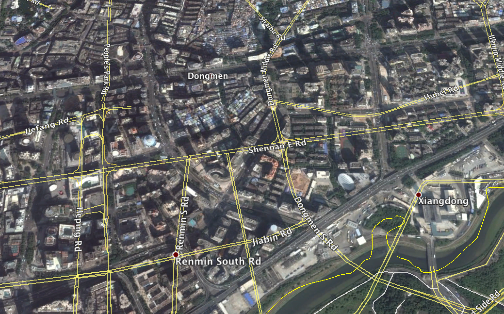
WikiProject China - OpenStreetMap Wiki
 
Last edited:
Don't throw out "the level of misinformation that you have spread" without specifics. That by itself is misinformation.

It isn't - I've detailed it in detail, repeatedly, in this thread. And at this point I'm fairly convinced that you are trolling me, so there goes the ignore button.
 
  • Haha
Reactions: Matriculated01
Long-time reader and first-time poster here.

I'm surprised no one seems to be mentioning the national security ramifications and threats posed by the FAA's proposed regs on drones. As a poster on DJI's official facebook page writes, 'Chinese made drones collecting, storing and transmitting all, what could possibly go wrong? This is a dream come true for Communist China, and Chinese law requires all people cooperate fully with Chinese intelligence gathering agencies.'

Interesting thing is, China by law forbids all mapping and surveying activities over its own territory. "Private surveying and mapping activities are illegal in mainland China. "Since at least 2007, it has been effectively illegal for foreigners to operate a GPS device in China."

Tariffs by Trump against China? Not with this proposal allowing Chinese companies free, one-sided access to American skies and geographic mapping.

WikiProject China - OpenStreetMap Wiki

I seriously doubt (that means there is a little concern) the Chinese view the information from drones being flown by DJI pilots as a major intelligence resource. If that were the case I'm pretty sure the President has the authority to ban all flights by executive order if they were really a national security threat. They have a network of satellites that probably can provide them with more detailed information from more places than all the DJI drones combined.
 
To view this content we will need your consent to set third party cookies.
For more detailed information, see our cookies page.
 
I seriously doubt (that means there is a little concern) the Chinese view the information from drones being flown by DJI pilots as a major intelligence resource. If that were the case I'm pretty sure the President has the authority to ban all flights by executive order if they were really a national security threat. They have a network of satellites that probably can provide them with more detailed information from more places than all the DJI drones combined.
Are you kidding? In the intelligence gathering game every little bit helps. Loose lips sink ships, and all that rot. Beyond this, it's an issue of parity. American companies certainly aren't allowed to gather this same Orwellian information in China. Why not? China itself regards all mapping and geographic data as military intelligence:

'While the rest of the world uses the most common GPS standard known as the World Geodetic System 1984, or WGS-84, for all digital mapping products, China chose to adopt a system of coordinates that debuted during the Cold War era to bamboozle foreign intelligence agencies.

'The ‘Surveying and Mapping Law of the People’s Republic of China’ puts mapping and documenting of all “elements of physical geography or the shapes, sizes, space positions, attributes, etc., of man-made surface installations” under state supervision in the name of “national defence and progress of the society.”


Last edited:
It isn't - I've detailed it in detail, repeatedly, in this thread. And at this point I'm fairly convinced that you are trolling me, so there goes the ignore button.

You've detailed nothing of the sort. I've discussed the drone safety record (accidents, injuries and deaths) and compared it to the safety record of manned aircraft. There is no comparison. We've talked about how much of the NAS is involved with respect to drone flights. Miniscule compared to manned aircraft. You haven't counter anything I've said and you try to dodge by name calling (troll) and hiding (ignore button). You fancy yourself as an intellectual and anyone that hasn't read all 300+ pages of the proposal as lazy. When you're ready to have a serious discussion on the issue without the name calling and slander I'm here for you.
 
Are you kidding? In the intelligence gathering game every little bit helps. Beyond this, it's an issue of parity. American companies certainly aren't allowed to gather this same information in China. Why not? China itself regards all mapping and geographic data as military intelligence:

'While the rest of the world uses the most common GPS standard known as the World Geodetic System 1984, or WGS-84, for all digital mapping products, China chose to adopt a system of coordinates that debuted during the Cold War era to bamboozle foreign intelligence agencies.'


No I'm not kidding and you don't get off with a statement like "every little bit helps". If that's the case we need to build a wall around the whole country and a dome over the top. This isn't China. This is a free society and with that freedom come some risk. The proposal is a step toward more control not less, it's a step toward become more like China, not less.
 
  • Like
Reactions: dwolfe002
No I'm not kidding and you don't get off with a statement like "every little bit helps". If that's the case we need to build a wall around the whole country and a dome over the top. This isn't China. This is a free society and with that freedom come some risk. The proposal is a step toward more control not less, it's a step toward become more like China, not less.
I don't get what you're arguing. That we in a free society should turn over our skies and flight data to foreign interests, while we have no access to Chinese skies or the same drone flight data in China? How is that responsible, let alone fair? In the long history of the world, totalitarian societies have taken advantage of open democracies to destroy same. It's what totalitarian societies, and authoritarians, do.
 
Last edited:
The Mavic Mini weighs less than 250 grams and so is not in scope. You will not be affected unless by some chance the 250 gram threshold is reduced. The FAA has indicated that they are not ruling out such a change and are taking a "wait and see" approach - a lot will depend on compliance related factors

As suggested above you've got 3 years of fun before you need to be concerned about anything really. The worst that could happen in the interim is that you may have to pay $5 to register your drone.
Great to hear! I figured that the limit would dro after reading all three reviews and research on the mini... thanks for the input, it really helps
 
  • Like
Reactions: deleted member 877
As Thomas B said, it's probably going to take 3 years to get all of this firmly established and the infrastructure in place. So get the Mini and enjoy flying it. Of course fly by the current regulations (altitude less than 400', within line of sight, no flight over people or moving vehicles, outside of controlled airspace, etc.).
I tend to be a stickler fir the rules, So I think I'll be fine! Thanks fir ther input! Gonna let the drone come in!
 
Status
Not open for further replies.

DJI Drone Deals

New Threads

Forum statistics

Threads
134,485
Messages
1,595,523
Members
163,013
Latest member
GLobus55
Want to Remove this Ad? Simply login or create a free account