DJI Mavic, Air and Mini Drones
Friendly, Helpful & Knowledgeable Community
Join Us Now

Hivemapper Network seeking Mavic pilots for aerial mapping projects

Joined
Oct 22, 2020
Messages
8
Reactions
1
Age
38
Location
Los Angeles
Greetings Mavic Pilots Community!

My name is Bryan and I work at Hivemapper.com - we specialize in creating 3D “Living Maps” that show changes using video footage without the need for expensive cameras, aircrafts, or satellites.

The network of mappers is made up of folks just like you who collect aerial (drone) or street level (dash cam) video footage and upload it to our network to create cost-effective and intelligent mapping solutions for use in a variety of projects.

Our maps update in nearly real-time, unlike the large gaps of time from other mapping companies where sometimes the information is several years old.
Check out this blog article which goes into detail on what we’re about and how we’re changing the landscape of the industry and giving you the power to create up-to-date and detailed maps without a million dollar satellite:


Feel free to reach out if you're interested in working with us and I can provide more information.lagos2.JPG
 
Hi Bryan,

I believe I saw your site a long time ago and it has probably changed a lot since then. I just looked over the various pages and have a few questions that may also interest other pilots here:
  • How quickly and when would you be adding gold and silver tiles to the map? I am making the assumption that large metropolitan areas would be getting more of those as opposed to open plains with nothing but grass and cows. For instance I just looked at downtown Philadelphia and there are zero gold tiles there. It is hardly worth the effort of making the missions if there are not any high-value tiles there.
    I did see the form to request tile additions but that can be a hassle to do every time. How long would it take from form submission?
  • I see that you normally map at an altitude of 110 meters. How are you handling big cities with skyscrapers? Again I will use Philadelphia as an example, with the tallest buildings topping out at over 1,100 feet AGL. Is there any manual flight mode for those of us with the experience (and Part 107 certification) to fly missions in these areas?
  • Again when flying in major cities, is there a manual mode so that we can fly missions and still stay legal per FAA regulations regarding VLOS, flying over people, etc? Flying manually I can fly such missions in a big city, but with an autonomous flight there are no controls to keep the flight legal.
  • I may have missed this in the pilot mapper details but how payments made to the pilots? Check? PayPal?
  • I see a few mentions of a grid tile being "owned" by the pilot that shoots it. What exactly does that mean? Does it mean that no other pilot would be paid to map that same tile? How often do you pay a pilot to re-map the same grid tile? You make a point of saying on your main page that the big advantage of your project is how dynamic and up-to-date the map is. Wouldn't this require frequent and regularly scheduled remapping missions?
THANKS in advance for your response!
 
  • Like
Reactions: MMPerrish
Hi Bryan,

I believe I saw your site a long time ago and it has probably changed a lot since then. I just looked over the various pages and have a few questions that may also interest other pilots here:
  • How quickly and when would you be adding gold and silver tiles to the map? I am making the assumption that large metropolitan areas would be getting more of those as opposed to open plains with nothing but grass and cows. For instance I just looked at downtown Philadelphia and there are zero gold tiles there. It is hardly worth the effort of making the missions if there are not any high-value tiles there.
    I did see the form to request tile additions but that can be a hassle to do every time. How long would it take from form submission?
  • I see that you normally map at an altitude of 110 meters. How are you handling big cities with skyscrapers? Again I will use Philadelphia as an example, with the tallest buildings topping out at over 1,100 feet AGL. Is there any manual flight mode for those of us with the experience (and Part 107 certification) to fly missions in these areas?
  • Again when flying in major cities, is there a manual mode so that we can fly missions and still stay legal per FAA regulations regarding VLOS, flying over people, etc? Flying manually I can fly such missions in a big city, but with an autonomous flight there are no controls to keep the flight legal.
  • I may have missed this in the pilot mapper details but how payments made to the pilots? Check? PayPal?
  • I see a few mentions of a grid tile being "owned" by the pilot that shoots it. What exactly does that mean? Does it mean that no other pilot would be paid to map that same tile? How often do you pay a pilot to re-map the same grid tile? You make a point of saying on your main page that the big advantage of your project is how dynamic and up-to-date the map is. Wouldn't this require frequent and regularly scheduled remapping missions?
THANKS in advance for your response!

Hey there and thanks for reaching out.
  • We can add gold tiles to high value areas very quickly. I can even add a few near where folks live to get them started on the workflow if they aren't in a major metro area. If you live in a remote area, I can't guarantee an abundance of gold tiles. That said, we're interested in mapping rural industrial infrastructure, oil and gas sites/pipelines, stone quarries, etc. This type of thing. Aside from this, you are right and that a majority of gold tiles are for major metro areas such as Philly. Speaking of Philly, it's on the list for a large amount of gold - so no need to worry too much about that regarding Philly specifically. You can always reach out to us and request gold tiles, we'll take a look at the area, and if it meets some of our criteria for "high value" we'll place gold down for you.
  • You can map tall buildings with manual flight, yes. Technically you can fly 400 feet above the prevailing object below you, aka 400 feet above a tall building. You may have to raise an on-board limiter on your drone if any through the drone's native operation app (most DJI products top out at 1500 ft I believe).
  • If you're mapping in tricky areas with a lot of obstacles/buildings, you can absolutely map manually. We have youtube videos to demonstrate the best way to do this. If you're flying an automated waypoint mission, switching your drone to "sport mode" gives you manual control at the flip of a switch.
  • Currently we pay through Paypal, but will be opening up other payment methods in the future.
  • When a tile is "owned" another pilot may not be paid for it until the tile is reactivated (then any pilot can reclaim it). Keeping the map "up to date" would require reactivating tiles, yes. Right now our main goal is a large base map to work from and update. That said, we may reactivate certain priority tiles more often than others so each area is a little different in terms of priority for reactivation. Examples of this include: completion of major construction projects, showing weather patterns/storm damage, major changes in terrain.
  • To be clear, anyone can update the map as often as they like for their own projects. You just can't be paid multiple times on the same tile unless it's reactivated.
Hope this helps and if you or anyone else would like to get in on one of our orientation webinars we have them weekly on:

Wednesdays at 10:00 a.m. PDT / 1:00 p.m. EST
Thursdays at 5:00 p.m. PDT / 8:00 p.m. EST

We go over the full workflow, payment details, flying tips and answer your questions at the end.

Feel free to email [email protected] and we can schedule one for you.
 
One of the problems is that as soon as money becomes involved it becomes commercial and you need 107.
 
One of the problems is that as soon as money becomes involved it becomes commercial and you need 107.
Actually you would need a Part 107 license whether there is money involved or not. Since you are flying for another entity, it is strictly Part 107 right from the start.
 
  • Like
Reactions: Ron Caballero CAP
Hi Bryan,

Thanks for the answers. I will keep the general questions here since I think it will benefit others. I also saw that you reposted the answers over on Phantom Pilots. THANKS for that. I will reach out via E-Mail with any other specific questions for mapping in my area.

We can add gold tiles to high value areas very quickly. I can even add a few near where folks live to get them started on the workflow if they aren't in a major metro area.
That's a great option to get started and learn the process before moving to a large metro mapping mission. I'll be in touch as I would like to give it a try.

Speaking of Philly, it's on the list for a large amount of gold - so no need to worry too much about that regarding Philly specifically. You can always reach out to us and request gold tiles, we'll take a look at the area, and if it meets some of our criteria for "high value" we'll place gold down for you.
Great. Let me know when you atart putting some gold down in Philly.

Technically you can fly 400 feet above the prevailing object below you, aka 400 feet above a tall building.
True BUT it is very important to note that this is ONLY for Part 107 certificated pilots. Even then, you can fly to that altitude only if you are not entering any Controlled airspace above you. In Philly for instance, there is Class B airspace directly above those skyscrapers. A pilot needs to know the regulations and the airspace in the area.
Another very important point is that in order for any pilot to fly these missions for you, they MUST hold a Part 107 certificate, since these missions would not in any way fit into the Recreational exclusion.
I did not see Part 107 requirement mentioned anywhere on your site and that is an issue. If a non Part 107 licensed pilot maps a grid for you, not only can they get in trouble with the FAA but your company could be liable as well. You need to be very careful about this.

If you're mapping in tricky areas with a lot of obstacles/buildings, you can absolutely map manually. We have youtube videos to demonstrate the best way to do this.
OK great. I would like to have a look at those.

When a tile is "owned" another pilot may not be paid for it until the tile is reactivated (then any pilot can reclaim it).
When a tile is re-activated, would the owning pilot get first notice to remap it? Sort of a right of first refusal?

Last question for now:
I'm not sure it was totally clear on the website but it seems that for actually using the detailed maps that are created for yous site, a user needs to pay for access? Am I getting that right? Does any contributor or even the owning grid pilot get any additional access to your maps?
 
Hi Bryan,

Thanks for the answers. I will keep the general questions here since I think it will benefit others. I also saw that you reposted the answers over on Phantom Pilots. THANKS for that. I will reach out via E-Mail with any other specific questions for mapping in my area.


That's a great option to get started and learn the process before moving to a large metro mapping mission. I'll be in touch as I would like to give it a try.


Great. Let me know when you atart putting some gold down in Philly.


True BUT it is very important to note that this is ONLY for Part 107 certificated pilots. Even then, you can fly to that altitude only if you are not entering any Controlled airspace above you. In Philly for instance, there is Class B airspace directly above those skyscrapers. A pilot needs to know the regulations and the airspace in the area.
Another very important point is that in order for any pilot to fly these missions for you, they MUST hold a Part 107 certificate, since these missions would not in any way fit into the Recreational exclusion.
I did not see Part 107 requirement mentioned anywhere on your site and that is an issue. If a non Part 107 licensed pilot maps a grid for you, not only can they get in trouble with the FAA but your company could be liable as well. You need to be very careful about this.


OK great. I would like to have a look at those.


When a tile is re-activated, would the owning pilot get first notice to remap it? Sort of a right of first refusal?

Last question for now:
I'm not sure it was totally clear on the website but it seems that for actually using the detailed maps that are created for yous site, a user needs to pay for access? Am I getting that right? Does any contributor or even the owning grid pilot get any additional access to your maps?

Thanks for all the great questions and clarifications.

  • If you would like to send me coordinates (you can pull them off google maps) near your location in Philly I'll drop some gold there now and put in an order for a large Hex of gold tiles in the Philly metro area.
  • You are correct that to fly these missions you need a part 107 certification. We go over this in our orientation webinars. I do agree there should be some verbiage on our site as well relating to this and I've noted that.
  • Here's a link to a youtube video on manual flight for mapping purposes. The user is operating with the DJI app as well (not part of our typical workflow as we tend to use the Litchi app, but it is possible to map with DJI Go):
    the video is a bit longer but has a TON of good techniques that will save you time when mapping with either DJI Go or Litchi manually.
  • At this time pilots aren't automatically notified when their tile previously flown tile reactivates, but that's a great feature suggestion.
I suggest you join our Discord community to stay in touch with the team. You can ask questions easily "on the fly" (pun intended) and there's also our network of mappers who are very helpful. Here's a link:

Let me know if you have any other questions :)
 
  • Like
Reactions: PhantomFandom
So explain to us the payout structure for the open purple tiles. The website says that you get a royalty every time someone clicks on that tile on your 3D map. What is that royalty as I assume there is no compensation to just complete it like the gold and silver.
 
So explain to us the payout structure for the open purple tiles. The website says that you get a royalty every time someone clicks on that tile on your 3D map. What is that royalty as I assume there is no compensation to just complete it like the gold and silver.

If you see a purple tile with white text, someone has already claimed it, so you can skip those. The blank tiles count towards milestone bonuses but aren't paid out individually. We do track them for the "total" tile flown bonuses.

Gold tiles are worth $2USD each. Silver tiles are worth $0.50 each. All tiles take approximately 5 minutes of flight time to map depending on your drone and weather conditions.

This blog article gives step by step instructions of the process of working with us to make maps, or you can join in on an orientation webinar (recommended) that goes over the whole workflow.

Even if you decide it's not for you, you'll learn how to make a 3D map with your drone!
 
The blog says”Hit this threshold on either gold or silver tiles and that bonus will be added to your account.” So what your saying is empty purple ones are now also added?
What are the royalties that are mentioned? Are you still reimbursing the purchase of the Litchi app?
 
The blog says”Hit this threshold on either gold or silver tiles and that bonus will be added to your account.” So what your saying is empty purple ones are now also added?
What are the royalties that are mentioned? Are you still reimbursing the purchase of the Litchi app?

Hey there,

Yes we're still reimbursing for Litchi once you successfully register your first map.

Blank tiles count towards your total milestone bonuses if you want to fly them, but aren't paid out individually like gold/silver.

The royalties model was a promotion through September and isn't currently active. We have a referral program in place now where you make 0.50$ for each gold tile your referrals map.

Let me know if you have any other questions :)
 
Ok making more sense now. So if you only have blank purple tiles it really only favors to map up to 1000 tiles, because you don’t get paid any more bonus for the next 4000 tiles to reach 5000.
If I added this up correctly your max payout for doing 1000 blank tiles is $975. You really can only hope for gold tiles in your area to make a fast buck (or 2 ?).
 
Last edited:
Ok making more sense now. So if you only have blank purple tiles it really only favors to map up to 1000 tiles, because you don’t get paid any more bonus for the next 4000 tiles to reach 5000.
If I added this up correctly your max payout for doing 1000 blank tiles is $975. You really can only hope for gold tiles in your area to make a fast buck (or 2 ?).

We can add gold to areas pretty easily if it would make a valuable map and will be expanding the coverage more and more. If you mapped 1000 gold tiles the payout is closer to $3 per tile.
 
Actually you would need a Part 107 license whether there is money involved or not. Since you are flying for another entity, it is strictly Part 107 right from the start.

3 ADVANTAGES, AND 3 DISADVANTAGES OF HAVING A PART 107 LICENSE


f259840f7306379fe170b99e3ef17296
Kirk Ryan says:
December 19, 2018 at 4:58 am
I’m a drone pilot (hobbyist), but also have a GA license to fly helicopters (real ones).
I can see no purpose for a commercial drone license. It provides absolutely nothing to safety or knowledge of flying. The arbitrary separation of permitted activities between commercial and hobbyist is laughable. EVERY drone pilot needs to know and follow the same rules. Nighttime vs day time, notification of tower vs not, etc. give me a break. These are there just to make money for the government agencies. The rules don’t even make sense. Why would I need a special license to take a video for my school or work, but not if I didn’t sell it. I would be doing the EXACT SAME ACTIVITIES IN THE EXACT SAME LOCATION AND MANNER.

Drones rules should be uniform and reasonable. Yes we do need rules as there are really stupid people out there that need to be punished for doing **** stupid things.
– Max of 400 feet AGL
– Min of 50 feet above any building
– In controlled airspace may operate as long as Max of 25 feet above the highest edifice within 500 feet horizontally. Rationale: no plane or helicopter will be in that space as they would risk hitting the edifice.
– Everyone can fly at all hours of the day or not. No logical reason to restict separately. Almost all drones are linked to a phone, tablet or computer screen while in use which is basically using IFR with drones.
– No requirement to have license for commercial drone use. It provides nothing extra other than cost.
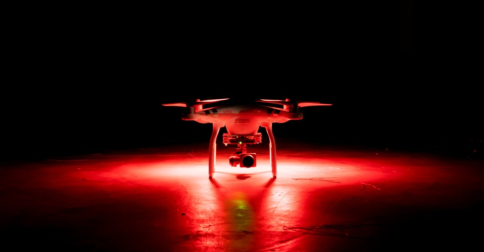

Part 107 can't fly at night, but hobbyist can or have to wait up to 90 days for approval?

So, how do you apply for this waiver? This here is another problem, as the waiver application and approval processes are very long and tedious. First, you need to file the waiver application through the FAA’s DroneZone portal. The waiver includes the names of the Person Responsible and the Remote Pilot, as well as a very detailed description of the operations. This description needs to include any potential risks that you have identified and the mitigating measures you intend to implement.

The basic rule of thumb when applying for a waiver is the more detailed the request, the better your chances of getting a waiver request approved. Most successful waiver applications state how long they intend to fly, where they will fly (with a map and coordinates, the capabilities of the drone and the drone pilot, and how the drone pilot intends to maintain visual contact with the drone despite the lack of daylight.

It is absolutely essential that you outfit your drone with anti-collision lights if you intend to fly at night. Although most modern drones come with their own lighting systems, it is still better to settle for after-market strobe lights since they are brighter. You also need to give some thought to how you will attach these strobe lights to your drone, ensuring that adhesives or connections are suitably durable and weather-proof. You may also consider investing in a lightweight GPS tracker that can help locate your drone, even in pitch dark, should you get into a crash.

Once you have filed your waiver request, the FAA may take up to 90 days for your request to be approved. This means that commercial drone pilots need to plan and prepare for their nighttime gigs way ahead of time. Although the concession of FAA for approving flying drones at night is well-appreciated, the long waiting time and tedious application process can feel very discouraging. It might not also be practical for many commercial drone pilots, many of whom cannot afford to stick to a 90-day lead time for potential jobs.

The stimulus that brought about this proposed change was the huge volume of waiver requests that the FAA have received regarding flying drones at night. Despite this volume, there was not a single recorded drone-related accident that happened under the conditions of a nighttime waiver. This has led the FAA to develop confidence in the skills of commercial drone pilots and in the benefit of using anti-collision lights that are visible within three statute miles.
 
3 ADVANTAGES, AND 3 DISADVANTAGES OF HAVING A PART 107 LICENSE

I don't understand what this post has to do with the thread at all. The article you linked to is outdated, misleading, and downright incorrect in some ways. Yes there are some limitations when flying a Part 107 mission but a 107 RPIC can always decide to fly a purely recreational flight.
 
Lycus Tech Mavic Air 3 Case

DJI Drone Deals

New Threads

Forum statistics

Threads
130,583
Messages
1,554,087
Members
159,586
Latest member
maniac2000