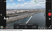
I have a DJI Mavic 3 Cine Premium Combo which has the DJI RC Pro controller. I want to do a particular hyperlapse.
The central subject is a building and behind it the sun will be rising. I want to start the drone off at some height -- perhaps 6' to make it what a person would see -- and then move left or right staying at the same altitude. The sequence will use all of the battery so roughly 30 minutes. The end result will be the sun rising behind the building (time lapse) with a movement of maybe 30 feet to the left to make the scene a little more interesting.
I have done a hyperlapse orbit before. That was 100% in the controller. I could have it orbit the building but just make the orbit super slow so that it goes only about 10º in the half hour of filming but I thought there might be a more direct way.
Any thoughts or suggestions?


