Los Alamos, New Mexico,
August 23, 2021
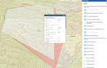
Since 2018 Los Alamos National Laboratory (LANL) [approximately 40 square miles in size], in collaboration with the National Nuclear Security Administration (NNSA) and the Federal Aviation Administration (FAA), has operated a system to counter all unauthorized unmanned aircraft systems (UAS) over its restricted airspace and an additional FAA designated “No Drone Zone.”
Recent unauthorized drone flights have been detected in this restricted airspace. The popularity of drones and technical advances of the industry have led to their increased use. The Laboratory utilizes its Counter Unmanned Aircraft Systems (CUAS) capability to intercept unauthorized flights violating established national airspace restrictions.
“The drone flying public should be reminded that all airspace over the Laboratory is protected against unauthorized drone or UAS flights,” said Unica Viramontes, Senior Director of Security at the Laboratory. “We can detect and track a UAS, and if it poses a threat, we have the ability to disrupt control of the system, seize or exercise control, confiscate, or use reasonable force to disable, damage or destroy the UAS.”
Under separate authority, the FAA has established “no drone zones” for sites with Category I Special Nuclear Materials. NNSA has also developed signage to advise UAS operators about specific airspace boundaries where they may not fly their aircraft and that violating the airspace will have severe consequences.
Los Alamos National Laboratory (LANL), a multidisciplinary research institution engaged in strategic science on behalf of national security, is managed by Triad, a public service oriented, national security science organization equally owned by its three founding members: Battelle Memorial Institute (Battelle), the Texas A&M University System (TAMUS), and the Regents of the University of California (UC) for the Department of Energy’s National Nuclear Security Administration.

August 23, 2021
Since 2018 Los Alamos National Laboratory (LANL) [approximately 40 square miles in size], in collaboration with the National Nuclear Security Administration (NNSA) and the Federal Aviation Administration (FAA), has operated a system to counter all unauthorized unmanned aircraft systems (UAS) over its restricted airspace and an additional FAA designated “No Drone Zone.”
Recent unauthorized drone flights have been detected in this restricted airspace. The popularity of drones and technical advances of the industry have led to their increased use. The Laboratory utilizes its Counter Unmanned Aircraft Systems (CUAS) capability to intercept unauthorized flights violating established national airspace restrictions.
“The drone flying public should be reminded that all airspace over the Laboratory is protected against unauthorized drone or UAS flights,” said Unica Viramontes, Senior Director of Security at the Laboratory. “We can detect and track a UAS, and if it poses a threat, we have the ability to disrupt control of the system, seize or exercise control, confiscate, or use reasonable force to disable, damage or destroy the UAS.”
- If you fly a drone over Los Alamos National Laboratory, in all likelihood you will lose your drone.
- Before you fly, it is a pilot’s responsibility to know the Laboratory’s airspace restrictions, maps are available from the Laboratory and the FAA.
- The Laboratory is authorized by Federal Law to detect and track UAS systems in our airspace.
- The Laboratory does not want to interfere with normal commercial or hobbyist drone flights, but will protect its assets from all unauthorized UAS flights that may pose a threat to the safety or security of assets and personnel. Though a very remote possibility, collateral interceptions could occur, so it is advisable for all drone pilots to stay well outside the Laboratory restricted airspace and additional FAA No Drone Zone.
Under separate authority, the FAA has established “no drone zones” for sites with Category I Special Nuclear Materials. NNSA has also developed signage to advise UAS operators about specific airspace boundaries where they may not fly their aircraft and that violating the airspace will have severe consequences.
Los Alamos National Laboratory (LANL), a multidisciplinary research institution engaged in strategic science on behalf of national security, is managed by Triad, a public service oriented, national security science organization equally owned by its three founding members: Battelle Memorial Institute (Battelle), the Texas A&M University System (TAMUS), and the Regents of the University of California (UC) for the Department of Energy’s National Nuclear Security Administration.
Unauthorized drone flights are prohibited in Laboratory restricted airspace, including additional No Drone Zone
Recent unauthorized drone flights have been detected in this restricted airspace.
discover.lanl.gov
Last edited: