DJI Mavic, Air and Mini Drones
Friendly, Helpful & Knowledgeable Community
Join Us Now

Lost Mavic on Isle of skye -please help.

Jambo83

New Member
Joined
Aug 13, 2020
Messages
4
Reactions
1
Age
40
Location
Uk
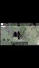
Hello, I was flying my Mavic mini up at the old man of storr and it disappeared. I flew it around the back, my phone stopped picking the Mavic signal up and I never heard the motor. 7 hours of searching, still no luck and find my drone and using the flashing/beeping feature never worked. The question I would like to ask is, if you look at the flight log, the drones course ends far from the storr, I would just like to know; because the path map stops does that mean that's where the drone came down or could it have kept flying but no longer recording the flight path? I have attached a link for all the data. I am convinced it didnt crash into the old man of storr and that it fell out of the sky.


Thank you
 

Attachments

  • Screenshot_2020-08-13-17-45-53-223.jpeg
    Screenshot_2020-08-13-17-45-53-223.jpeg
    457.1 KB · Views: 76
  • Screenshot_2020-08-13-08-59-34-371.jpeg
    Screenshot_2020-08-13-08-59-34-371.jpeg
    1.6 MB · Views: 78
  • Screenshot_2020-08-08-05-27-07-962.jpeg
    Screenshot_2020-08-08-05-27-07-962.jpeg
    874.1 KB · Views: 76
Last edited:
I believe your RTH height was 108m (above the takeoff point) and that when you lost signal you were around 120m above the takeoff point. If correct then I think the drone would return at that height of approximately 120m above the take off point and along the red line drawn on the attached.
At that height and on that path would it hit the Old Man of Storr?

Lets hope I got that correct, lol

The chart and menu thing come from running the .txt flight log from Airdata (and presumably your phone) through a piece of free software called CsvView
 

Attachments

  • Old Man of Storr.png
    Old Man of Storr.png
    1.8 MB · Views: 70
  • OMOS Skye 3.png
    OMOS Skye 3.png
    100.2 KB · Views: 67
  • OMOS Skye 3a.png
    OMOS Skye 3a.png
    24.3 KB · Views: 54
Last edited by a moderator:
I believe your RTH height was 108m (above the takeoff point) and that when you lost signal you were around 120m above the takeoff point. If correct then the drone would return at that height of approximately 120m above the take off point and along the red line drawn on the attached.
At that height and on that path would it hit the Old Man of Storr?

Lets hope I got that correct, lol
Thanks for getting back to me. I'm not an expert on drones lol. Why would the yellow line stop where it is? I don't think it would've hit that side, especially with the camera shot I have of it lying on the ground looking at a cliff that wouldn't have been seen if it crashed there
 
  • Like
Reactions: ven
Sorry I should have provided the following link
DJI Flight Log Viewer - PhantomHelp.com
it's ineractive, drag the various buttons through their movement ranges

You lost the signal at the end of the yellow line after which the controller recieved no more data from the drone.
Please bear in mind that this is my first attempt at prediction etc. so all that I have written NEEDS to be confirmed by one of the Gurus
 
  • Like
Reactions: Old Timer
You seem to have had the failsafe (loss of signal) response set to RTH.
If I am correct and it did lose signal through being behind the OMOS and if the rock face is in the return flight path then I think the only way you could have avoided the crash was to (before the loss of signal/connection) shove the maximum ceiling well up over 400ft, enough to clear the OMOS, and set the RTH height just slightly below that ceiling.
You can change the maximum ceiling and RTH height whilst in flight ( but at a guess not whilst actually RTH'ing).
Once you had cleared the OMOS you could have reduced the Mini's height etc etc
 
Last edited by a moderator:
Yes, this was most probably a too low set RTH height & lacking knowledge both regarding to how the failsafe functionality works & how severe the RC signal degrades by putting a big rock in between the RC & AC.

The log & the recording of the flight path ends immediately when the RC/AC connection is lost ... that's why the yellow Airdata path stops midair. With a lost connection the Mini will hover & initiate the failsafe action which was RTH after 11sec. If above the RTH height, which it was, the AC will go home at present height which was 119.8m.

Now, the GE altitudes isn't pin accurate but the height difference between the HP and bare ground up there is somewhat 58m ... then adding the rock height to that which says like 50m (quick Google search) for the old man of storr. That make 108m in total.

With all the uncertainty regarding the heights, those 108m is dangerous close to the AC height when the connection was lost. I would start the search near the cliff wall & walk towards the point where the signal was lost, paying extra attention to bushes & small trees along that route. GPS positions in the pic below.

1597349007776.png
 
  • Like
Reactions: Prismatic
Yes, this was most probably a too low set RTH height & lacking knowledge both regarding to how the failsafe functionality works & how severe the RC signal degrades by putting a big rock in between the RC & AC.

The log & the recording of the flight path ends immediately when the RC/AC connection is lost ... that's why the yellow Airdata path stops midair. With a lost connection the Mini will hover & initiate the failsafe action which was RTH after 11sec. If above the RTH height, which it was, the AC will go home at present height which was 119.8m.

Now, the GE altitudes isn't pin accurate but the height difference between the HP and bare ground up there is somewhat 58m ... then adding the rock height to that which says like 50m (quick Google search) for the old man of storr. That make 108m in total.

With all the uncertainty regarding the heights, those 108m is dangerous close to the AC height when the connection was lost. I would start the search near the cliff wall & walk towards the point where the signal was lost, paying extra attention to bushes & small trees along that route. GPS positions in the pic below.

View attachment 110536
Thank you for your help. So do you think it 100% hit the rock?
 
Thank you for your help. So do you think it 100% hit the rock?
Well, I wasn't there when it all happened ... but by knowing what happens when the RC lose connection to a AC with the failsafe set to RTH, operated in wind speeds below what a Mini can handle & a RTH flight path blocked by a huge rock on the same RTH height ... then let's say 98% ;)
 
If you look on Bing maps for the Old Man of Storr you can switch on or to an OS map with 10m contour lines.
If you can work out the positions of your home point and loss of signal points on that map you can then plot the RTH course on that OS map and see if it is above all the contour lines it crosses.
 
  • Like
Reactions: Old Timer
I lost and found my Mini recently, and in addition to the valuable help of members of this forum, I also got the video off my phone and watched the last few seconds for reference. Your phone should have a low-res video of the flight, if you were filming. Seeing what your camera saw last helped me find mine, it might help you.
 
Lycus Tech Mavic Air 3 Case

DJI Drone Deals

New Threads

Members online

Forum statistics

Threads
131,002
Messages
1,558,770
Members
159,985
Latest member
kclarke2929