DJI Mavic, Air and Mini Drones
Friendly, Helpful & Knowledgeable Community
Join Us Now

M3T - Pilot 2 for wind blades images with Waypoints

JCDiaz

Active Member
Joined
Jan 8, 2022
Messages
31
Reactions
30
Age
63
Location
Bogota, Colombia
Can a VERTICAL waypoint mission be done using Pilot 2 to inspect a turbine blade which is in a vertical position (12 o clock) and take images every x meters or y seconds?
Which are the main tips to do it? Clues?
 
Can a VERTICAL waypoint mission be done using Pilot 2 to inspect a turbine blade which is in a vertical position (12 o clock) and take images every x meters or y seconds?
Which are the main tips to do it? Clues?
I have a Litchi mission planner for wind turbine inspections. It can be used to create a flight path along each blade based on the geometry of the wind turbine. The resulting Litchi mission CSV file can be converted to a DJI KMZ file for the M3T. Litchi has the ability to take photos at given intervals of distance or time. The photo interval function would have to be set up using DJI Flight Hub 2 after the mission is converted.

Here is the wind turbine mission creator:
 
  • Like
Reactions: JCDiaz
Can a VERTICAL waypoint mission be done using Pilot 2 to inspect a turbine blade which is in a vertical position (12 o clock) and take images every x meters or y seconds?
Which are the main tips to do it? Clues?
What software are you processing in?

Agisoft Pro has a complex mission planner that does wonders.

DJ Wes, your Litchi solution looks pretty cool!
 
I have a Litchi mission planner for wind turbine inspections. It can be used to create a flight path along each blade based on the geometry of the wind turbine. The resulting Litchi mission CSV file can be converted to a DJI KMZ file for the M3T. Litchi has the ability to take photos at given intervals of distance or time. The photo interval function would have to be set up using DJI Flight Hub 2 after the mission is converted.

Here is the wind turbine mission creator:

Something I´m doing is not ok. At the moment I try to import the .kmz file created by your mission planner to the RC (Pilot 2) a "Task Type Error" appears. (I´m choosing ALT for the Altitude mode).
Appreciate your comments and help.
Regards
 
Last edited:
At the moment I try to import the .kmz file created by your mission planner to the RC (Pilot 2) a "Task Type Error" appears. (I´m chossing ALT for the Altitude mode).
I am not familiar with Pilot 2 and its requirements. All of my testing has been done in DJI Flight Hub 2:
Capture.PNG

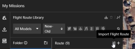
And the import function:
Capture.PNG

It needs to be a kml file.

Upload into Google Earth and then resave as a kml.
Don't confuse a DJI KMZ file with a Google Earth KMZ file. While they are both compressed archives, they contain different information.

If you wish to uncompress a DJI KMZ file, simply use either "unzip", or change the extension to ".zip" and use the built-in Windows uncompress command. A DJI KMZ file will contain two files: template.kml and waylines.wpml.
 
Last edited:
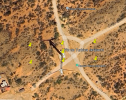
I´m getting to this point in Google Earth Pro after converting the csv to .kmz:
1749488984230.png

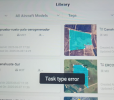
Then I save it as a .kml with Google Earth Pro. Try to import it as a "Waypoint Route" in Pilot 2 maintaining "Relative to TakeoffPoint (ALT)" and a "Task Type Error" appears:

1749489341556.png

Any ideas?
 
I´m getting to this point in Google Earth Pro after converting the csv to .kmz:
Take Google Earth out of the equation. It plays no part in this process. A DJI KMZ file is different from a Google Earth KMZ file. DJI recklessly used Google's KMZ extension confusing some people.

Then I save it as a .kml with Google Earth Pro. Try to import it as a "Waypoint Route" in Pilot 2 maintaining "Relative to TakeoffPoint (ALT)" and a "Task Type Error" appears:
That will not work. You should be importing the KMZ file directly from my conversion program if Pilot 2 supports importing KMZ files. Again, I can't help you with Pilot 2's capabilities. I have only imported KMZ files into DJI's Flight Hub 2.

Are you sure Pilot 2 supports importing the DJI KMZ format?
 
Take Google Earth out of the equation. It plays no part in this process. A DJI KMZ file is different from a Google Earth KMZ file. DJI recklessly used Google's KMZ extension confusing some people.


That will not work. You should be importing the KMZ file directly from my conversion program if Pilot 2 supports importing KMZ files. Again, I can't help you with Pilot 2's capabilities. I have only imported KMZ files into DJI's Flight Hub 2.

Are you sure Pilot 2 supports importing the DJI KMZ format?
Absolutely. Pilot 2 supports importing DJI KMZ format. I do it a lot with solar farm inspections.
I tried uploading the KMZ that your conversion program generated and the error continues.
Regards
 
Are you selecting the correct drone type in my Litchi to DJI converter?
Actually I just generate the .csv from your program, use an app from the web to convert .csv to .kml or .kmz and that´s what I try uploading in Pilot 2 and it´s where the error appears. I never get to select any drone type...
 
I can't help you if you do not provide factual information.

First you said:
I tried uploading the KMZ that your conversion program generated and the error continues.
Then you said:
Actually I just generate the .csv from your program, use an app from the web to convert .csv to .kml or .kmz and that´s what I try uploading in Pilot 2 and it´s where the error appears.

You must use my utilities for this to work. "An app from the web to convert..." doesn't tell me anything useful. What app from the web? A generic CSV to KML or KMZ converter is not going to produce anything useful. My utilities are made to work specifically on Litchi CSV files and DJI KMZ files.

Here are the steps:

1. Use my "Wind Turbine Inspection Mission" creator to create a Litchi CSV file.
2. Use my "Litchi Waypoints to DJI Fly or Pilot 2 Waypoints" converter to convert the mission for your specific drone. This is where you select the type of drone you have.
3. If Pilot 2 provides a function to upload a DJI KMZ file, upload it. I always use DJI Flight Hub 2 to upload a KMZ file into a new mission.
 

DJI Drone Deals

New Threads

Forum statistics

Threads
137,283
Messages
1,625,930
Members
165,882
Latest member
Per64
Want to Remove this Ad? Simply login or create a free account