I'm particularly interested in seeing the .DAT were you reported that the navHealth data couldn't be plotted. Both the .DATs you submitted didn't seem to have this problem.the zip file is the first battery flight. I think the first RTH was dead nuts on. Don't remember how many RTH I did. The DAT file is the last of the day. I had to zip the first (too big) so I don't know if that will mess with any data.
There were 7 or 8 landings in the two .DATs, most of them RTH landings. Except for the first landing in FLY098 they were normal. The RTH landings landed within .5 meter of the HP. There were 2 landings under pilot control that landed outside a .5 meter distance from the HP.
If you want to pursue investigating the problem you stated please provide a .DAT where it happened. If there are multiple landings then it will be necessary to know which landing.
There doesn't seem to be a problem with the GPS. DOP values are low and the navHealth values are either 4 or 5 indicating the FC has confidence in the lat/long values computed using the GPS and IMU data.
An RTH was commanded in the first landing in FLY098. The M2 moved directly over the HP (at time 358 secs) but then moved laterally (mostly south) as it first yawed to the launch orientation and then descended.
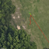
The straight red line is the return to the HP (yellow H symbol) and the squiggly red line is the movement to the south after arriving directly over the HP.

I'm guessing the PL system liked the spot where it landed better than the launch site.
I did consider the possibility that the GPS data was incorrect. That the M2 actually landed at the HP but the GPS data was showing that it landed south of the HP. But, from the accelerometer and gyro data it's apparent that you picked up the M2 and moved it back closer to the HP.


