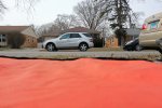
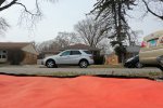
Here are some photos from the drone.
All the usual metadata are present, including GPS position data:
ExifTool Version Number : 12.36
File Name : DJI_0771.JPG
Directory : /Downloads
File Size : 7.2 MiB
File Modification Date/Time : 2022:03:20 21:20:59-06:00
File Access Date/Time : 2022:03:20 21:21:01-06:00
File Inode Change Date/Time : 2022:03:20 21:21:00-06:00
File Permissions : -rw-r--r--
File Type : JPEG
File Type Extension : jpg
MIME Type : image/jpeg
Exif Byte Order : Little-endian (Intel, II)
Image Description : default
Make : Hasselblad
Camera Model Name : L1D-20c
Orientation : Horizontal (normal)
Samples Per Pixel : 3
X Resolution : 72
Y Resolution : 72
Resolution Unit : inches
Software : 10.00.14.06
Modify Date : 2022:03:10 13:04:07
Y Cb Cr Positioning : Centered
Exposure Time : 1/500
F Number : 5.6
Exposure Program : Program AE
ISO : 100
Exif Version : 0230
Date/Time Original : 2022:03:10 13:04:07
Create Date : 2022:03:10 13:04:07
Components Configuration : Y, Cb, Cr, -
Exposure Compensation : +0.3
Max Aperture Value : 2.8
Metering Mode : Center-weighted average
Light Source : Daylight
Flash : No Flash
Focal Length : 10.3 mm
Warning : [minor] Bad MakerNotes directory
Flashpix Version : 0100
Color Space : sRGB
Exif Image Width : 5472
Exif Image Height : 3648
Interoperability Index : R98 - DCF basic file (sRGB)
Interoperability Version : 0100
File Source : Digital Camera
Scene Type : Directly photographed
Exposure Mode : Auto
White Balance : Auto
Digital Zoom Ratio : 1
Focal Length In 35mm Format : 28 mm
Scene Capture Type : Standard
Gain Control : None
Contrast : Normal
Saturation : Normal
Sharpness : Normal
Device Setting Description : (Binary data 4 bytes, use -b option to extract)
Serial Number : 0K8TFCT0024051
Lens Info : 28mm f/2.8-11
GPS Version ID : 2.3.0.0
GPS Latitude Ref : North
GPS Longitude Ref : West
GPS Altitude Ref : Above Sea Level
XP Comment : 0.9.142
XP Keywords : single
Compression : JPEG
Thumbnail Offset : 21142
Thumbnail Length : 19601
About : DJI Meta Data
Format : image/jpg
Absolute Altitude : +188.03
Relative Altitude : +0.00
Gimbal Roll Degree : +0.00
Gimbal Yaw Degree : -99.00
Gimbal Pitch Degree : -1.30
Flight Roll Degree : -0.70
Flight Yaw Degree : -96.50
Flight Pitch Degree : +2.10
Cam Reverse : 0
Gimbal Reverse : 0
Self Data : Self data
Version : 7.0
Has Settings : False
Has Crop : False
Already Applied : False
MPF Version : 0100
Number Of Images : 2
MP Image Flags : Dependent child image
MP Image Format : JPEG
MP Image Type : Large Thumbnail (VGA equivalent)
MP Image Length : 542258
MP Image Start : 7049600
Dependent Image 1 Entry Number : 0
Dependent Image 2 Entry Number : 0
Image UID List : (Binary data 66 bytes, use -b option to extract)
Total Frames : 1
Image Width : 5472
Image Height : 3648
Encoding Process : Baseline DCT, Huffman coding
Bits Per Sample : 8
Color Components : 3
Y Cb Cr Sub Sampling : YCbCr4:2:0 (2 2)
Aperture : 5.6
Image Size : 5472x3648
Megapixels : 20.0
Scale Factor To 35 mm Equivalent: 2.7
Shutter Speed : 1/500
Thumbnail Image : (Binary data 19601 bytes, use -b option to extract)
GPS Altitude : 188 m Above Sea Level
GPS Latitude : 42 deg 1' 43.76" N
GPS Longitude : 87 deg 44' 33.02" W
Preview Image : (Binary data 542258 bytes, use -b option to extract)
Circle Of Confusion : 0.011 mm
Field Of View : 65.5 deg
Focal Length : 10.3 mm (35 mm equivalent: 28.0 mm)
GPS Position : 42 deg 1' 43.76" N, 87 deg 44' 33.02" W
Hyperfocal Distance : 1.71 m
Light Value : 13.9


 Last Week's Most Popular Topics (February 7, 2026)