

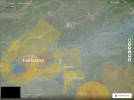
I am left confused. My reference was to what I see on the DJI Geo web site. I don't understand the comment about turning off ALL altitude layers. Where, what app, what web site...or where within the menu on the controller are you referring to? I don't know anything about turning off altitude layers so you'll have to school me on that and thanks ahead of time for that info...The only time I'm looking at that information is typically on the dji geo web site and that hasn't changed except now, when you designate the drone to be used, you see the 50km circles when you designate the use of a Mavic 3 series drone.Unless they have changed something from the original implementation, you have to turn off all Altitude layers to be able to view the map underneath the gray 500m altitude limit that exists everywhere else, within 50km of any airport. If you are within 50km of airports, there are also Altitude Zones coming off all the airport runways that you can no longer see when you need to turn off the Altitude layers to be able to see your otherwise obscured maps. What are you seeing that is different from that, in the areas within 50km of airports?

Max height increased to 1000m
- Thread starter Droning on and on...
- Start date

Similar threads


DJI Drone Deals
New Threads
-
 Air 3 Pebbly Beach - Mid North Coast, Black Head NSW, Ausralia.🦘🇦🇺
- Started by Squidinc
- Replies: 0
-

-

-
-
 Yx DJI Mini 3 Pro Mini 3 Mini 4 Pro Charger Hub with Color LCD Display
- Started by Dogpilot
- Replies: 0
Forum statistics
