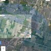
This is one of those events that has a number of abnormal elements to it, making it difficult to conclude exactly what happened. Firstly - the bits that make sense:
Signal loss is consistent with the terrain. If you compare the periods of signal loss with the computed viewshed then the results are as expected:

The VPS height measurement does a pretty good job of detecting the stands of trees that the aircraft passes over, and these are as shown in the GE 3D rendering. The viewshed from around the 260 second mark is the green shaded area, and it's apparent how the trees are blocking line of sight.

So that all makes reasonable sense. However, at the final point of signal loss, which should have triggered RTH, the aircraft was only 2140 m from the homepoint:

Extrapolating the battery down to the autoland level at the heigh the aircraft was flying shows the following:

In other words the aircraft had around 1100 seconds of flight left in the battery, which implies that it would have needed to make around 2 m/s (4.5 mph) into the wind to get back to the home point. Looking at the first graph above, it appears that the aircraft managed to hold position with a positive pitch of 10 - 13° at around 260 seconds - that should leave plenty of headroom for increasing pitch and making reasonable headway into the wind. For comparison, AirData's aerodynamic model suggests that the wind speed was 18 - 22 mph out of the NE for the latter part of this flight, which is also consistent.
But wait - there's more. Note from graphs 2 and 3 above that the smart battery level appears to stop decreasing after around 215 seconds. Looking at the actual cell voltages reveals an even more worrying feature:

The cell voltages stop updating just after the start of the flight. That suggests that there is some kind of issue with the smart battery. That's previously been seen as a precursor to FC failure, could indicate that the battery is not properly seated, but possibly also means, presumably, since the battery level is stuck at 84%, that it will never autoland, and just drop out of the sky when the battery falls too low to keep it flying.
Another possible issue is that the trees towards the end of the recorded flight were fairly tall compared to the height of the aircraft. GE suggests that there was a clearance of 7 or 8 meters, which is somewhat confirmed by the VPS height data, but given barometer altitude variations and errors in the GE DEM tree heights then it's not inconceivable that it might have hit a treetop.
And there's even more. The takeoff point is actually within a DJI restricted zone on an extended runway path:

If it did RTH then that would have caused it to land in the field on the left.
There's also the issue of the tall power lines:

On the way out the aircraft flew under them. On the way back they look tall enough to have been a problem if the aircraft had ignored the restricted zone.
I'd take a look around the last recorded location (43.187878 N, 79.930683 W), the intersection of the RTH path with the powerlines, and the intersection of the RTH path with the restricted zone, but without any good evidence for whether this aircraft crashed, blew away, or tried to return home but didn't make it, this is a bit of a needle in a haystack.


