DJI Mavic, Air and Mini Drones
Friendly, Helpful & Knowledgeable Community
Join Us Now

Never happened before

I'm out of my league. I don't know anything about getting files off the aircraft. I looked at the guide in your signature but it says that i need DJI assistant 2. I can't even find that.

Okay - well I think by inference at least the event is explainable - it was likely attempting to RTH as @eEridani suggested, but it was prevented from completing the maneuver by the rock obstacle. By the time you had re-acquired connection the battery was down to just a couple of percent, and so forced landing could not be canceled.
 
Your first TXT log ended at around 343sec with 64% battery ... your craft was then up on the max set height (200m) & the connection started to be sketchy (white vertical stripes in the chart=disconnected). All RC commands was nicely obeyed by the craft as shown in the data compiled in the chart.

Dotted graphs is the stick inputs ... Rudder (red) correlates to a yaw movement (blue), Elevator input (purple) correlates nicely to heading speed changes (black) ... and throttle commands (yellow) fits nicely to changes in the vertical Z-speed (light blue).

All was normal ...

View attachment 136291

... and your craft was here when the first log ended ... note at the big red arrow that the mobile device location is included in the data (explain further below...)

View attachment 136294

When the log recording continues (the second .TXT log) the timing is 1188sec & the battery is down at 1% & the craft is lowbattery auto landing. No stick inputs is made what so ever. & the connection is still sketchy (white vertical stripes in the chart=disconnected).

View attachment 136295

... and the craft is now here & are descending, the second log ends at 181,9m height relative the HP. Also note that during this short second log no mobile device position data is included anymore.

View attachment 136296

So what happened in between those 2 logs separated with 845sec & 63% battery ..?

My firm belief is that this was due to a disconnect between your RC & mobile device ... the craft obeyed all inputs it got according to the logs ... it had moved horizontally in between the 2 logs ... & in the first log the mobile device position was included in the data but not in the second.

So why didn't it make a low battery RTH ? I believe it actually did ... but either you canceled it unintentionally by pushing the RTH button on the RC, below from the manual... or it encountered an obstacle blocking it's way & the OD sensors stopped it.

View attachment 136298

The mobile device DAT log you included pretty much confirms my idea about the RC/mobile device disconnect ...

View attachment 136299

In order to know more about what happened in between those 2 log recording occasions the craft DAT log is needed.

It was an aircraft - RC disconnect, not an RC - device disconnect. The horizontal motion between the two logs was the RTH attempt as far as the obstacle.
 
I will keep working on the aircraft DAT files for you. Can you simplify that for me? BTW....i do recall getting a RTH notification before it landed. However i had already driven 1.5 miles away from the launch point AND my wife was standing under the aircraft. I cancelled RTH as i just wanted it to land where i knew i could retrieve it.
 
It was an aircraft - RC disconnect, not an RC - device disconnect. The horizontal motion between the two logs was the RTH attempt as far as the obstacle.
Could have been ... eventually at least, when the battery got low. But if it was a disconnect between AC/RC or mobile device/RC to begin with is without the craft DAT unknown at this stage. I'm puzzled by the heights there read out from GE ... if the craft was on 200m relative HP it should have been approx 50m above that rocky peak.

Well the craft DAT will reveal what happened 😁
 
I will keep working on the aircraft DAT files for you. Can you simplify that for me? BTW....i do recall getting a RTH notification before it landed. However i had already driven 1.5 miles away from the launch point AND my wife was standing under the aircraft. I cancelled RTH as i just wanted it to land where i knew i could retrieve it.

It was already in forced landing mode when you recovered the connection. It will have dropped out of failsafe RTH when the battery level fell below the smartBattery.landBattery value, which was 16% at that time.
 
Could have been ... eventually at least, when the battery got low. But if it was a disconnect between AC/RC or mobile device/RC to begin with is without the craft DAT unknown at this stage. I'm puzzled by the heights there read out from GE ... if the craft was on 200m relative HP it should have been approx 50m above that rocky peak.

Well the craft DAT will reveal what happened 😁

If you are working from the Google Earth DEM - it's not accurate for those rocks:

grab12.jpg
 
The aircraft files are downloaded to my laptop....now uploading to Dropbox. Will post once i can. I appreciate everyone's feedback. Thank you!
 
  • Like
Reactions: sar104
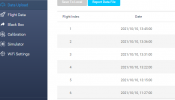
I downloaded the only file with yesterday's date, i thought. I'm looking at "data upload" on the DJI assistant 2. I'm looking now and i don't see any flights from yesterday. I only see today's dates listed
 
Last edited:
Nothing in the Flight Data folder?
 
I do not use DJI Assistant 2 Mavic. I go direct, and while I can't make any sense of the DJI file structures, in Windows - I just connect my drone as a USB device, the I'll use file manager to search for .DAT files on the drone, which usually shows up as internal memory and the drone SD card (Mavic Pro only has the SD card?). Then I copy what it finds that looks promising: usually somewhere in the DJI and flight app sub directories, DJI Fly for me, probably DJI Go or similar for you.

If you removed the SD card, taken off the videos and formatted it, I think the log files are lost.
 
Could it be that the older logs already have been overwritten ... don't know how large the memory for the craft DAT is really ... I mean considering that only 2 power up's (whats attached earlier) weigh over 400 meg. @sar104
My Mavic Pro is out on loan so I can't check the internal memory. I do remember that there was an issue with some aircraft where some of the DAT files were stored in a different location, for no apparent reason. @BudWalker discovered that quirk, and I think it applied to the Pro.
 
  • Like
Reactions: slup
Could it be that the older logs already have been overwritten ... don't know how large the memory for the craft DAT is really ... I mean considering that only 2 power up's (whats attached earlier) weigh over 400 meg. @sar104
This thread discusses the issue, although my recollection is that it turned out to be a bit more random as to which files showed up in the accessible SD card location:

 
  • Like
Reactions: slup

DJI Drone Deals

New Threads

Forum statistics

Threads
135,473
Messages
1,606,501
Members
163,917
Latest member
AirDove
Want to Remove this Ad? Simply login or create a free account