DJI Mavic, Air and Mini Drones
Friendly, Helpful & Knowledgeable Community
Join Us Now

New Pilot, new Member, New Drone!

ReDave

Member
Joined
Jan 30, 2021
Messages
11
Reactions
51
Age
63
Location
California
Hello, from the Sequoia foothills.
I have a question, [this kind of answers it but.... seems odd Height Ability in High places, like a mountain???]
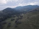
I live in next to a hill that climbs up 1500 feet or so that i've always wanted to check out.
I take off at 'zero' feet and head toward, and up that hill, with all the GPS and bottom sensors, my MA2 does not see the ground coming up as i ascend the hill.
So... I need to make calculations to raise the 400 ft limit as i head up the hill?

Thanks for your help, and for this great forum.

Brand new drone owner, I flew a glider a couple of times in the past, My new Mavic Air 2 is SO much easier. I love that when i let go of the sticks, it just hovers... so nice.

Capture.JPG
 
Welcome aboard! It's a great hobby. Your Mavic Air 2 will always show its altitude based on the 0' takeoff point, and this does become problematic when the area you are flying is not flat. For this flight, I would not go all the way to 400'. That is fairly high. I would go up to 200' and head toward the hill in question. Then, attempt to maintain the 200 or so feet via watching the camera view in your flight app. You will see when the copter begins getting closer to rising terrain, and you can climb. Remember however, that you are limited to 500 M above your takeoff point (or 1640'), and watch your battery levels as well, because it will take extra time to descend heading home. You will have to do this flight manually, as there are no apps for the MA2 currently that will allow for autonomous altitude hold in variable terrain.
 
Welcome to the forum.
I hope you will find our site helpful and look forward to any input , photo's/video's you might post .
Don't be shy and ask anything if you can't find it by searching . ?
 
Hi there & welcome to the forum ? :D

The MA2 have as you say Visual positioning sensors on the belly but they are mainly for keeping the AC hovering more stable near ground (effective up to 30m). They also report height to ground beneath to around 10-12m (only seen in the flight log for the DJI FLY app I believe, the DJI GO4 app had that value on the hud.) But in general the MA2 doesn't have "ground follow" so you need keep calculating. The barometric sensor only measures from the HP where it is reset at take off.
 
The App's 400ft thing is not a ceiling as such, you can climb through it, though you may get warnings about legal limits. Additionally the 400ft in the app relates to 400ft above the home point.
For the purposes of climbing the mountain you can ignore the App's 400ft thing.

However, you need to set the maximum permissable height to..... whatever. That is a ceiling the drone will not climb through. You could set it to 500m at the start of the flight or change it as the flight progresses, it makes no difference to the flight when it is changed.
I messed with this once and set 3 or 4 different maximum heights during the one flight then climbed up to them, I don't remember it I tried to set a maximum height that was below the current height.
 
Welcome to the forum and enjoy.

Please use one of the best forum search options.

Please share your pictures, videos and knowledge about your drones.
 
Welcome to Mavic Pilots! :) Enjoy the forum!Thumbswayup
 
Hi ReDave Welcome to Mavic Pilots.
New flyer advice,
Wide open space.
Slow & easy
Power-lines & trees are evil.
Don't expect RTH (Return To Home) to save you especially if you are under trees.
Don't forget to read the manual ;)
Download Air 2 manual HERE
You want an SD card that is U3 for 4K
Most of all have FUN
 
Welcome to the forum! :)
 
Lycus Tech Mavic Air 3 Case

DJI Drone Deals

New Threads

Forum statistics

Threads
130,994
Messages
1,558,710
Members
159,982
Latest member
PetefromNZ